Franklin Township near Weissport in Carbon County, Pennsylvania — The American Northeast (Mid-Atlantic)
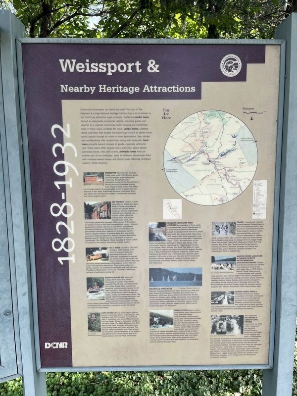
Weissport & Nearby Heritage Attractions
1828 - 1932
| — | Delaware & Lehigh National Heritage Corridor | — |
Photographed by Devry Becker Jones (CC0), July 20, 2024
1. Weissport & Nearby Heritage Attractions Marker
Community landscapes can reveal our past. This part of the Delaware & Lehigh National Heritage Corridor has a lot of stories to tell. You'll see distinctive types of towns. Traditional market towns formed as crossroads commercial centers, providing goods and services to a regional community. Some housing and commercial stock in these towns predates the canal. Lumber towns, oriented along waterways that floated harvested logs, served as places where goods passed through en route to other destinations. Saw, shingle and woodworking mills located here, along with boatyards. Canal towns primarily served shippers of goods, especially anthracite coal. These towns often located near canal locks, where people patronized stores, inns and taverns. Anthracite towns form yet another part of our landscape. Look for rhythmic streetscapes lined with company-owned houses and church spires reflecting immigrant workers' ethnic diversity.
Weissport flourished as a Lehigh Canal town until 1942. Diverse goods, coal and people moved along the waterway. Boatyards and a mercantile center in the Harry Rickert House anchored business activity here. Today, Lehigh Canal Park offers a 5-1/2 mile stretch of towpath tail, a river trail and restored sections of the canal. Positioned between the Lehigh River and Canal, the trail attracts walkers, recreational bicyclists and cross-country skiers.
Jim Thorpe, created in 1954 when Mauch Chunk and East Mauch Chunk consolidated, honors the famous Native American athlete respectfully interred here. Nestled into a narrow valley where the Lehigh River and Mauch Chunk Creek meet, this community dates from the early 19th century. It flourished as Carbon County's seat and transportation center — historic prosperity is clearly reflected in the town's magnificent Victorian architecture. Residents have reinvested in this picturesque community, making it a welcoming spot for visitors. Explore history, charming shops and inns in the downtown National Historical District; visit the Asa Packer Mansion and St. Mark's Church, both National Historic Landmarks. The Old Mauch Chunk Landing & Visitor Center is located in the historic downtown railroad station.
No. 9 Mine opened in 1851 and closed in 1972, making it the world's longest continually operating anthracite mine. Dedicated volunteers re-opened the tunnel, bucket-by-bucket. No. 9 now welcomes visitors deep into the earth where generations of immigrant miners labored under once-perilous conditions. Tours reveal muleways, shafts, tunnels, an underground hospital and coal deposits. The Mine's Wash Shanty serves as a museum, exhibiting artifacts of anthracite mining life.
Biking & Paddling along the Lehigh River and Canal attract thousands of outdoor enthusiasts annually. The 25-mile rail-trail through the Lehigh Gorge offers spectacular, primitive, uninterrupted scenery for off-road bicyclists. The trail runs adjacent to the Lehigh River, which serves up Class I, II and III whitewater rapids. The Lehigh Canal Towpath at Weissport and Walnutport provides gentle terrain along restored canal sections. The bed of the historic Switchback Railroad loops between Jim Thorpe and Summit Hill, providing a variety of terrain for biking and cross-country skiing.
Auto Tours offer an easy way to explore historic events and places in the region. The Audubon Auto Tour features the travels of John J. Audubon, who visited the Mauch Chunk and the Lehigh Gorge to document wildlife in the early 1800s. The Molly Maguire Auto Tour depicts the trials, mayhem and controversy surrounding these early labor activists. The Panther Valley Anthracite Auto Tour follows the discovery and development of the region's coal industry and communities. Stop in at local museums for tour maps and scripts.
Hickory Run State Park Complex is comprised of three parks administered by the PA Department of Conservation & Natural Resources. Lehigh Gorge State Park features a gorge that is 800 feet deep and 26 miles long with steep walls, thick vegetation, rock outcroppings and waterfalls. Experience Class I, II and III whitewater on the scenic Lehigh River, and explore hiking and biking trails. Learn about historic sites along the Upper Grand Division of the Lehigh Canal. Hickory Run State Park offers 40 miles of hiking trails, popular campgrounds and the striking Boulder Field, a National Natural Landmark, within its 15,500 acres. Nescopeck State Park, one of Pennsylvania's newest parks features 3,550 acres, a nine-acre lake and an Environmental Education Center. Experience camping, hunting, miles of trout streams, picnicking, hiking, cross-country skiing and swimming.
Beltzville State Park features unlimited horsepower motor boating on a 949-acres lake created from Pohopoco Creek by the Army Corps of Engineers. With easy access to I-476, Beltzville attracts visitors for fishing, water skiing, swimming, and picnicking. An Environmental Education Center enhances the learning experience. Hiking trails lead to waterfalls, mature forest, picturesque creeks, plentiful fossils and an 1842 covered bridge that spans the Pohopoco.
Snow Sports attract outdoor enthusiasts when temperatures drop. Downhill skiing, snowboarding, cross-country skiing and wintertime activities abound on northern Carbon County's Pocono Plateau and Blue Mountain near the Lehigh County border. With abundant natural and man-made snow, beginner or expert downhill skiers will find trails to their liking. More serene options include gliding on cross-country skis through backcountry woodland trails and over frozen canals. For a special treat, slide down groomed runs in oversized snow tubes or drive snowmobiles on designated trails in Hickory Run State Park.
Trails — Canals and railroads shipped eastern Pennsylvania's iron and anthracite coal to fuel America's Industrial Revolution. Today, historic canal towpaths and railroad lines welcome outdoor enthusiasts to explore them as trails. Walk, hike, mountain bike and cross-country ski on these routes along the Lehigh River at Lehigh Gorge State Park, Lehigh Canal Park, Walnutport Canal Park and Hickory Run State Park. Travel the bed of the historic Switchback Gravity Railroad between Jim Thorpe and Summit Hill, and on America's premier footpath, the Appalachian Trail, at Lehigh Gap.
Mauch Chunk Lake Park & Carbon County Environmental Education Center—Floods periodically ravaged Jim Thorpe until engineers created this man-made lake in 1972. Today, Mauch Chunk Lake anchors a county-owned park popular with residents and visitors. Explore an outdoor playground—swimming, non-motorized boating, mountain biking, camping, lakefront cabins, hiking, fishing, cross-country skiing and picnicking. At the western end of the park, stop in at the Environmental Education Center, noted for its raptor rescue program. The historic Switchback Trail is also located here.
Lehigh Canal Park at Weissport features an easily accessible 5-1/2 miles of towpath trail, a river trail and restored sections of the Lehigh Canal. Walkers, recreational bicyclists and cross-country skiers trek the trail, positioned between the Lehigh River and Canal. Fishing and ice skating (conditions permitting) are popular activities here.
The combined Delaware & Lehigh Canal System, constructed ca. 1818-1834, connected northeastern Pennsylvania's anthracite coal fields to the markets and ports of Philadelphia and beyond. Anthracite and associated industries located here played a pivotal role in America's Industrial Revolution. The historic canal system, preserved for educational and recreational purposes, operated until 1931 when the Delaware Canal became a state park. In contrast to the Delaware Canal's rural riverfront setting, the Lehigh Canal connected and fostered urban industrial communities from Easton to Wilkes-Barre. Lehigh Gorge State Park was created in the 1970s from remnants of the Lehigh Coal and Navigation Company's holdings.
Erected by Pennsylvania
this page online
Topics and series. This historical marker is listed in these topic lists: Industry & Commerce • Natural Resources • Settlements & Settlers • Waterways & Vessels. In addition, it is included in the Lehigh Canal series list. A significant historical year for this entry is 1942.
Location. 40° 49.899′ N, 75° 42.04′ W. Marker is near Weissport, Pennsylvania, in Carbon County. It is in Franklin Township. It is on D&L Trail - Lehigh Canal (North) 0.1 miles north of Bridge Street, on the left when traveling north. Touch for map. Marker is at or near this postal address: 103 Canal St, Lehighton PA 18235, United States of America. Touch for directions.

Regionally, this marker is in Anthracite Coal Region and in the Pocono Mountains. It is also in the American Northeast, in the Mid-Atlantic, in Appalachia, and specifically in Northern Appalachia. Globally, it is in North America, the Western Hemisphere, the Western World, and the Anglosphere. Historically, it finds itself in what was once the Haudenosaunee (Iroquois) Confederacy and also one of the original Thirteen Colonies.
Photographed by Devry Becker Jones (CC0), July 20, 2024
2. Weissport & Nearby Heritage Attractions Marker
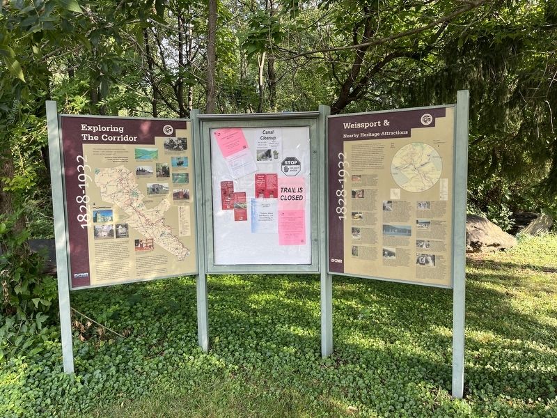
Other nearby markers. At least 8 other markers are within walking distance of this marker: Exploring the Corridor (a few steps from this marker); The Hub in it's Heyday (a few steps from this marker); From Mountain to Market (within shouting distance of this marker); Fort Allen (about 500 feet away, measured in a direct line); Jacob Weiss Memorial (about 700 feet away); National War Savings Campaign of 1918 (about 700 feet away); Franklin's Week in Weissport (approx. 0.2 miles away); a different marker also named Fort Allen (approx. 0.2 miles away). Touch for a list and map of all markers in Weissport.
Credits. This page was last revised on July 23, 2024. It was originally submitted on July 23, 2024, by Devry Becker Jones of Washington, District of Columbia. This page has been viewed 183 times since then and 26 times this year. Photos: 1, 2. submitted on July 23, 2024, by Devry Becker Jones of Washington, District of Columbia.
