Troy in Doniphan County, Kansas — The American Midwest (Upper Plains)
The Pony Express
America's early express mail delivery rides through the Glacial Hills
| — | Glacial Hills Scenic Byway | — |

Photographed by Mark Hilton, July 11, 2024
1. The Pony Express Marker
The Pony Express, the nation's first coast-to-coast express mail route, began as a publicity stunt for a million-dollar government contract by carrying mail from St. Joseph, Missouri to California in under 10 days. At the time, there were no railroads or telegraph lines west of St. Joseph, and stagecoaches could take months and were often unreliable. The company creating the Pony Express already had army contracts to deliver supplies, and the Pony Express was to be a similar contract for express mail.
The first successful Pony Express run from St. Joseph, Missouri to Sacramento, California started on April 3, 1860, when the route was inaugurated to much fanfare. Mail was carried the nearly 2,000 miles on the Oregon Trail to near the Great Salt Lake, where the path diverted west over the Sierra Nevada Mountains. Though dangerous, the trip over plains, deserts, and mountains, and through hostile territory and volatile weather could be made on horseback in as little as eight days. In the end, another company won the contract, despite the Pony Express carrying mail almost two weeks faster.
While the Pony Express was
this page online
Troy Station
Troy Station was the first relay stop after St. Joseph. The stop was located at the Smith Hotel, where a barn was built specifically for the enterprise. Today, the building still stands on the northeast corner of E. Myrtle and N. 1st Streets. Legend has it that the first donuts were also handed to passing riders near this stop. The route through Troy is commemorated by a marker near the courthouse.
How did they do it?
Everything
Photographed by Mark Hilton, July 11, 2024
2. The Pony Express Marker (on right of three)
Erected by Kansas Tourism, Kansas Department of Transportation.
Topics and series. This historical marker is listed in these topic lists: Communications • Roads & Vehicles. In addition, it is included in the Pony Express National Historic Trail series list. A significant historical date for this entry is April 3, 1860.
Location. 39° 47.101′ N, 95° 5.846′ W. Marker is in Troy, Kansas, in Doniphan County. It can be reached from Last Chance Road (Kansas Route 136) south of Doniphan Street, on the right when traveling south. Located at the Troy Community Center.

Photographed by Mark Hilton, July 11, 2024
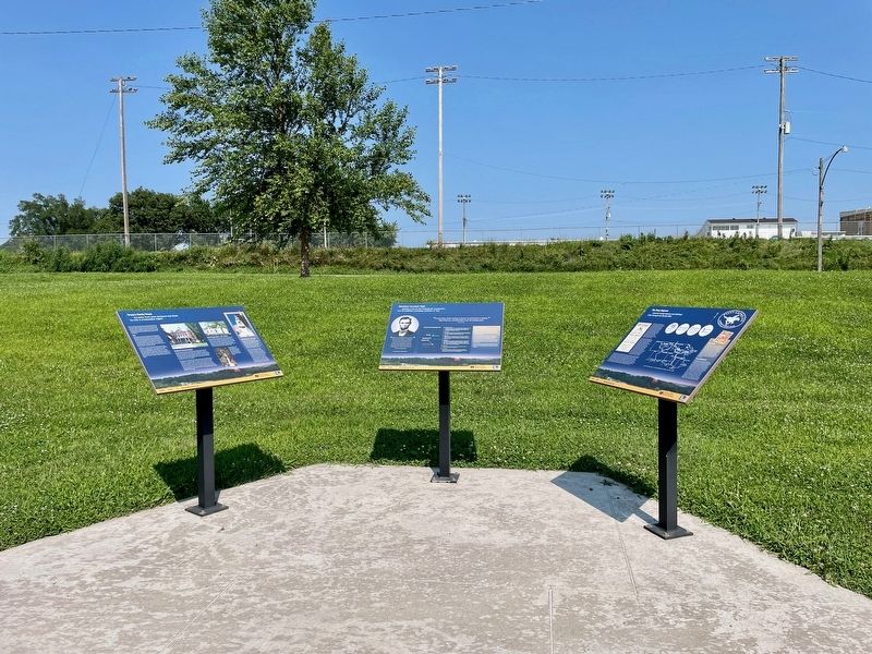
3. View from markers towards the Troy Community Center.

Regionally, this marker is in Eastern Kansas. It is also in the American Midwest, in the Lewis & Clark Corridor, in the Corn Belt, on the prairies, and on the Southern Plains. Globally, it is in North America, the Western Hemisphere, the Western World, and the Anglosphere. Historically, it finds itself in what was once the Louisiana Purchase.
Other nearby markers. At least 8 other markers are within walking distance of this marker: Abraham Lincoln's Visit (here, next to this marker); Troy's Early Days (here, next to this marker); Replica of the Statue of Liberty (approx. 0.4 miles away); Melvin L. Schmidt, J.D. (approx. 0.4 miles away); Doniphan County Courthouse (approx. half a mile away); "Tall Oak" (approx. half a mile away); Walter C. Worman and George Larson (approx. half a mile away); Abraham Lincoln (approx. half a mile away). Touch for a list and map of all markers in Troy.
Also see . . . Pony Express-Troy Station, Kansas (National Park Service). (Submitted on July 23, 2024, by Mark Hilton of Montgomery, Alabama.)
Credits. This page was last revised on July 23, 2024. It was originally submitted on July 23, 2024, by Mark Hilton of Montgomery, Alabama. This page has been viewed 338 times since then and 39 times this year. Photos: 1, 2, 3. submitted on July 23, 2024, by Mark Hilton of Montgomery, Alabama.
