Kansas City in Clay County, Missouri — The American Midwest (Upper Plains)
Old Western Border of the United States

Photographed by Duane and Tracy Marsteller, June 30, 2024
1. Old Western Border of the United States Marker
Platte Purchase Drive marks the site of the western border of the United States from 1821, when Missouri became a state, until 1837. Unlike today, the western border of Missouri was a straight line north from the confluence of the Missouri and Kansas rivers and along today's Platte Purchase Drive. On the west side was Indian Territory.
In 1830, President Andrew Jackson signed the Indian Removal Act, requiring all eastern tribes to move to new reserves west of Missouri. Six years later, the United States government acquired the land between the 1821 border and the Missouri River from the Iowa, Sac and Fox tribes through a controversial treaty known as The Platte Purchase.
The treaty was signed by Supt. of Indian Affairs William Clark, Iowa Chief Mo-hos-ca (a.k.a. White Cloud) and 26 other chiefs and warriors, becoming law in 1837. The three tribes were paid $7,500 and given provisions to help them move to reservations west of the Missouri River. Not only did the purchase force another tribal removal, but it angered abolitionists who saw it as a violation of the Missouri Compromise since it increased the area for
this page online
Before the purchase, Missouri was already the largest state in the Union. The acquisition of 3,149 square miles was as large as the states of Delaware and Rhode Island combined. Missouri is the only state to increase its land mass to this degree. The newly added northwestern corner of Missouri was divided into six additional counties: Andrew, Atchison, Buchanan, Holt, Nodaway, and Platte.
Today, Platte Purchase Drive where this marker stands continues to be the dividing line between the counties of Clay and Platte.
Erected 2018 by The Native Sons and Daughters of Greater Kansas City • Kansas City Parks and Recreation. (Marker Number 49.)
Topics. This historical marker is listed in these topic lists: Indigenous Peoples and Communities • Political Subdivisions. A significant historical year for this entry is 1821.
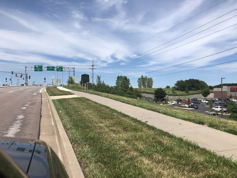
Location. 39° 15.277′ N, 94° 36.044′ W. Marker is in Kansas City, Missouri, in Clay County. It is on North Platte Purchase Drive 0.1 miles north of Northwest 88th Street, on the right when traveling north. Touch for map. Marker is at or near this postal address: 8955 N Platte Purchase Dr, Kansas
Photographed by Duane and Tracy Marsteller, June 30, 2024
2. Old Western Border of the United States Marker

Regionally, this marker is in the Missouri River Corridor. It is also in the American Midwest, in the Lewis & Clark Corridor, and in the Corn Belt. Globally, it is in North America, the Western Hemisphere, the Western World, and the Anglosphere. Historically, it finds itself in what was once the territory of the Mississippian Culture, the Louisiana Purchase, and the Antebellum South.
Other nearby markers. At least 8 other markers are within 6 miles of this marker, measured as the crow flies: Historic Linden, Missouri (approx. 2.9 miles away); Atkins-Johnson Farmhouse (approx. 4.7 miles away); Atkins-Johnson House (approx. 4.7 miles away); Atkins-Johnson Farm (approx. 4.7 miles away); Old Pike Road / Ferry Boat Operators at Kawsmouth (approx. 4.8 miles away); Renner Village Site (approx. 5½ miles away); Antioch Church (approx. 5.8 miles away); a different marker also named Antioch Church (approx. 5.8 miles away). Touch for a list and map of all markers in Kansas City.
Another marker is no longer nearby. The Town of Barry (was approx. 0.3 miles away but

Undetermined via Wiikipedia (Public Domain)
3. Map of Platte Purchase
The 3,149 square miles the federal government purchased for $7,500 is highlighted in red.
Also see . . .
1. How Was the Non-River State Line That Divides KCK and KCMO Selected? Your KC Q Answered. Despite achieving statehood in 1821, Missouri’s borders remained a little murky. Its western border at that time was described as “a meridian line passing through the middle of the mouth of the Kansas River, where the same empties into the Missouri River.” In 1823, surveyor Joseph C. Brown was dispatched with a team to put those words on the map. (Kansas City Public Library) (Submitted on July 24, 2024, by Duane and Tracy Marsteller of Murfreesboro, Tennessee.)
2. Platte Purchase. Wikipedia entry on the 1836 purchase that added 3,149 square miles to northwest Missouri. (Submitted on July 24, 2024, by Duane and Tracy Marsteller of Murfreesboro, Tennessee.)
Credits. This page was last revised on August 15, 2024. It was originally submitted on July 24, 2024, by Duane and Tracy Marsteller of Murfreesboro, Tennessee. This page has been viewed 947 times since then and 206 times this year. Photos: 1, 2, 3. submitted on July 24, 2024, by Duane and Tracy Marsteller of Murfreesboro, Tennessee.
