Jim Thorpe in Carbon County, Pennsylvania — The American Northeast (Mid-Atlantic)
Lock No. 1, Lehigh Canal Upper Division
1827 - 1931
| — | Delaware & Lehigh National Heritage Corridor | — |
Photographed by Devry Becker Jones (CC0), July 20, 2024
1. Lock No. 1, Lehigh Canal Upper Division Marker
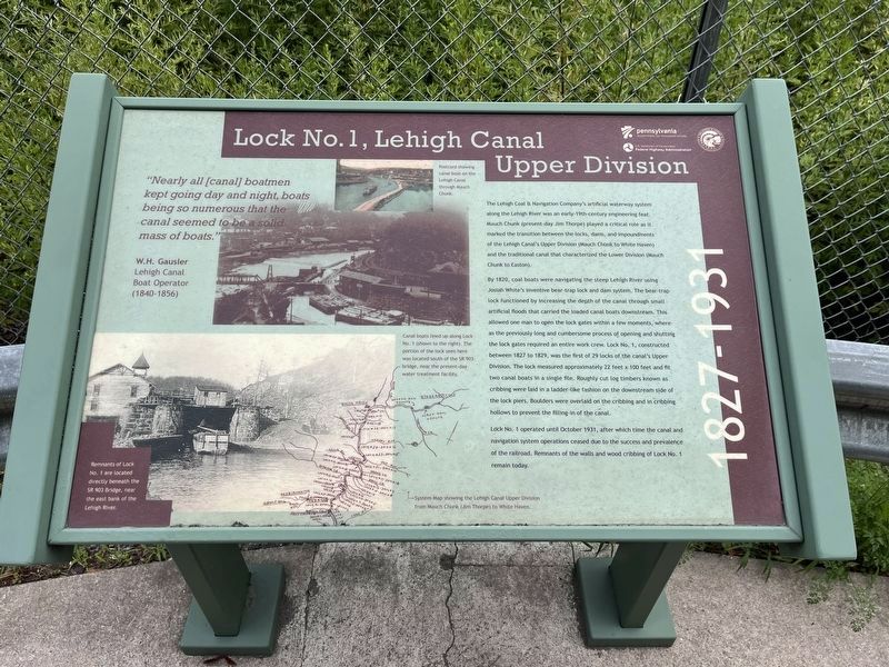
"Nearly all [canal] boatmen kept going day and night, boats being so numerous that the canal seemed to be a solid mass of boats."
W.H. Gausler
Lehigh Canal Boat Operator (1840-1856)
The Lehigh Coal & Navigation Company's artificial waterway system along the Lehigh River was an early-19th-century engineering feat. Mauch Chunk (present-day Jim Thorpe) played a critical role as it marked the transition between the locks, dams, and impoundments of the Lehigh Canal's Upper Division (Mauch Chunk to White Haven) and the traditional canal that characterized the Lower Division (Mauch Chunk to Easton).
By 1820, coal boats were navigating the steep Lehigh River using Josiah White's inventive bear-trap lock and dam system. The bear-trap lock functioned by increasing the depth of the canal through small artificial floods that carried the loaded canal boats downstream. This allowed one man to open the lock gates within a few moments, whereas the previously long and cumbersome process of opening and shutting the lock gates required an entire work crew. Lock No. 1, constructed between 1827 to 1829, was the first of 29 locks of
this page online
Lock No. 1 operated until October 1931, after which time the canal and navigation system operations ceased due to the success and prevalence of the railroad. Remnants of the walls and wood cribbing of Lock No. 1 remain today.
[Captions:]
Postcard showing canal boat on the Lehigh Canal through Mauch Chunk.
Canal boats lined up along Lock No. 1 (shown to the right). The portion of the lock seen here was located south of the SR 903 bridge, near the present-day bridge, near the present-day water treatment facility.
System Map showing the Lehigh Canal Upper Division from Mauch Chunk (Jim Thorpe) to White Haven.
Remnants of Lock No. 1 are located directly beneath the SR 903 Bridge, near the east bank of the Lehigh River.
Erected by Pennsylvania Department of Transportation; Federal
Photographed by Devry Becker Jones (CC0), July 20, 2024
2. Lock No. 1, Lehigh Canal Upper Division Marker
Topics and series. This historical marker is listed in these topic lists: Industry & Commerce • Waterways & Vessels. In addition, it is included in the Lehigh Canal series list. A significant historical month for this entry is October 1931.
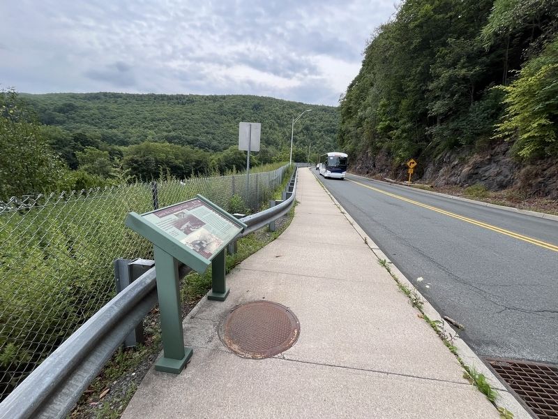
Location. 40° 52.042′ N, 75° 44.227′ W. Marker is in Jim Thorpe, Pennsylvania, in Carbon County. It is on Lehigh Avenue (U.S. 209) south of North Street (Pennsylvania Route 903), on the right when traveling north. Touch for map. Marker is in this post office area: Jim Thorpe PA 18229, United States of America. Touch for directions.

Regionally, this marker is in Anthracite Coal Region and in the Pocono Mountains. It is also in the American Northeast, in the Mid-Atlantic, in Appalachia, and specifically in Northern Appalachia. Globally, it is in North America, the Western Hemisphere, the Western World, and the Anglosphere. Historically, it finds itself in what was once the Haudenosaunee (Iroquois) Confederacy and also one of the original Thirteen Colonies.
Other nearby markers. At least 8 other markers are within walking distance of this marker: Exploring The Corridor (within shouting distance of this marker); From Rails to Trails (within shouting distance of this marker); All Aboard (about 300 feet away, measured in a direct line); Overcoming Geography (approx. 0.2 miles away); Asa Packer Mansion (approx. 0.2 miles away); View his Life from his Home (approx. 0.2 miles away); The Self Made Man (approx. 0.2 miles away); a different marker also named Asa Packer Mansion (approx. ¼ mile away). Touch for a list and map of all markers in Jim Thorpe.
Credits. This page was last revised on July 24, 2024. It was originally submitted on July 24, 2024, by Devry Becker Jones of Washington, District of Columbia. This page has been viewed 632 times since then and 72 times this year. Photos: 1, 2. submitted on July 24, 2024, by Devry Becker Jones of Washington, District of Columbia.
