Penrith in Westmorland and Furness, England, United Kingdom — Northwestern Europe (the British Isles)
The Water of Life
Photographed by Ray Gurganus, April 11, 2024
1. The Water of Life Marker
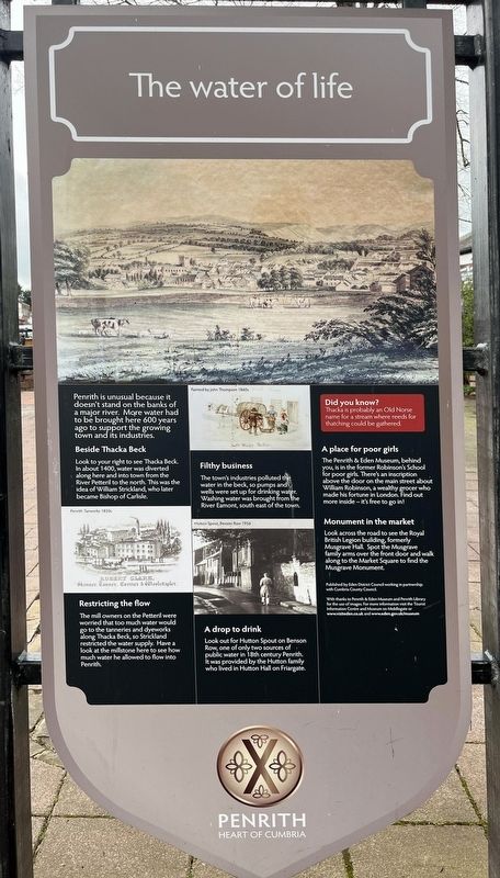
Beside Thacka Beck
Look to your right to see Thacka Beck. In about 1400, water was diverted along here and into town from the River Petteril to the north. This was the idea of William Strickland, who later became Bishop of Carlisle.
Filthy business
The town's industries polluted water in the beck, so pumps and wells were set up for drinking water. Washing water was brought from he River Eamont, south east of the town.
Did you know?
Thacka is probably and name for a stream where reeds for thatching could be gathered.
A place for poor girls
The Pen & Eden Mum, behind you, is in the former Robinson's School for poor girls. There's an inscription above the door on the main street about William Robinson, a wealthy grocer who made his fortune in London. Find out more inside-it's free to go in!
Monument in the market
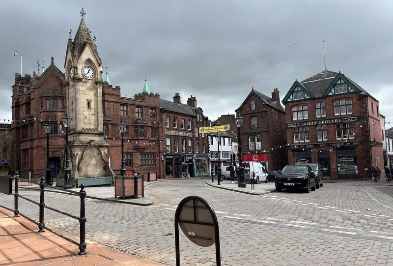
Look across the road to see the Royal British Legion building, formerly Musgrave Hall. Spot the Musgaeve family arms over the front door and walk along to the Market Square to find the Musgrave Monument.
Restricting the flow
The mill owners on the Petteril were worried that too much water would go to the tanneries and dyeworks along Thacka Beck, so Strickland restricted the water supply. Have a look at the millstone here to see how much water he allowed to flow into Penrith.
A drop to drink
Look out for Hutton Spout on Benson Row, one of only two sources of public water in 18th century Penrith. It was provided by the Hutton family who lived in Hutton Hall on Frigate.
Erected by Eden District Council.
Topics. This historical marker is listed in this topic list: Waterways & Vessels.
Location. 54° 39.949′ N,
this page online

Regionally, this marker is in North West England. Globally, it is on the Atlantic Ocean, in the North Atlantic Region, in Europe, in Atlantic Europe, on one of the British Isles, in the Western World, and in the Anglosphere. Historically, it finds itself in what was once the Roman Empire.
Other nearby markers. At least 8 other markers are within walking distance of this marker: Sign of the Times (about 120 meters away, measured in a direct line); A Long Tradition (approx. 0.3 kilometers away); St Andrew's Churchyard (approx. 0.3 kilometers away); A Bustling Market Town (approx. 0.3 kilometers away); The Board & Elbow (approx. 0.3 kilometers away); Great Dockray (approx. 0.3 kilometers away); Penrith Castle (approx. 0.4 kilometers away); Welcome to Penrith Castle (approx. 0.4 kilometers away). Touch for a list and map of all markers in Penrith.
Photographed by Ray Gurganus, April 11, 2024
2. Penrith
Credits. This page was last revised on July 25, 2024. It was originally submitted on July 24, 2024, by Ray Gurganus of Washington, District of Columbia. This page has been viewed 195 times since then and 17 times this year. Photos: 1, 2. submitted on July 24, 2024, by Ray Gurganus of Washington, District of Columbia. • Andrew Ruppenstein was the editor who published this page.
Editor’s want-list for this marker. photo of the marker within its surroundings • Can you help?
