Lexington in Lafayette County, Missouri — The American Midwest (Upper Plains)
General Price's Headquarters

Photographed by Duane and Tracy Marsteller, June 30, 2024
1. General Price's Headquarters Marker
Local legend holds that the cannon ball in the column of the court house was intended for this building.
Topics. This historical marker is listed in this topic list: War, US Civil. A significant historical date for this entry is September 18, 1861.
Location. 39° 11.137′ N, 93° 53.018′ W. Marker is in Lexington, Missouri, in Lafayette County. It is on Main Street (Missouri Route 224) west of North 10th Street, on the right when traveling west. Touch for map. Marker is at or near this postal address: 926 Main St, Lexington MO 64067, United States of America. Touch for directions.

Regionally, this marker is in the Missouri River Corridor. It is also in the American Midwest, in the Lewis & Clark Corridor, in the Corn Belt, and on the Santa Fe Trail Corridor. Globally, it is in North America, the Western Hemisphere, the Western World, and the Anglosphere.
this page online
Other nearby markers. At least 8 other markers are within walking distance of this marker: Original Site of Russell, Majors and Waddell Home Office (within shouting distance of this marker); Replica of the Statue of Liberty (within shouting distance of this marker); Wentworth World War Memorial (within shouting distance of this marker); Lafayette County Courthouse (about 300 feet away, measured in a direct line); Alexander Mitchell & Company Bank (about 300 feet away); Lexington (about 400 feet away); Fifth Branch Bank Building (about 500 feet away); Madonna of the Trail Monument (approx. 0.2 miles away). Touch for a list and map of all markers in Lexington.
Also see . . . First Battle of Lexington (or “Battle of the Hemp Bales”). In the short term, the victory boosted the spirits of Missouri secessionists, but the State Guard failed to leverage any long-term gains from the “Battle of the Hemp Bales,” so called because the MSG used hemp bales to encircle the federal position at
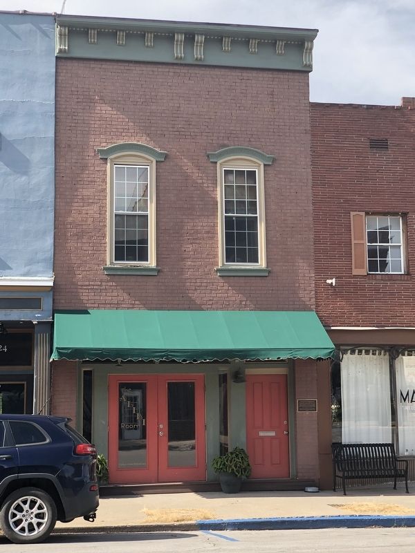
Photographed by Duane and Tracy Marsteller, June 30, 2024
2. General Price's Headquarters Marker
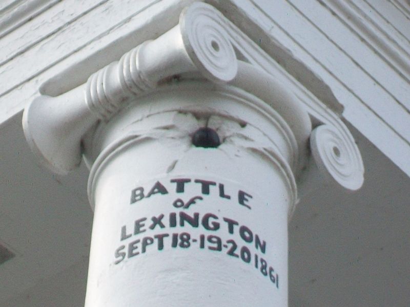
Photographed by William Fischer, Jr., November 11, 2015
3. Cannonball in Lafayette County Courthouse Column

Via Tennessee Virtual Archive (Public Domain), 1862/65
4. Maj. Gen. Sterling Price (1809-1867)
He later led a daring raid from Arkansas into Missouri in 1864, which ended in a retreat to Texas. Price also was the leader of the failed Confederate colony in Carlota, Veracruz.

from Harper's Weekly, Oct. 12, 1861; via Internet Archive (Public Domain)
5. The Battle of the Hemp Bales
An artist's rendition of the fighting.
Credits. This page was last revised on July 24, 2024. It was originally submitted on July 24, 2024, by Duane and Tracy Marsteller of Murfreesboro, Tennessee. This page has been viewed 370 times since then and 49 times this year. Photos: 1, 2. submitted on July 24, 2024, by Duane and Tracy Marsteller of Murfreesboro, Tennessee. 3. submitted on November 24, 2015, by William Fischer, Jr. of Reynoldsburg, Ohio. 4, 5. submitted on July 24, 2024, by Duane and Tracy Marsteller of Murfreesboro, Tennessee.
