Near Fort Peck in Valley County, Montana — The American West (Mountains)
Peculiar White Water Named the Milk River
Lewis and Clark at the Milk River

Photographed by Barry Swackhamer, February 1, 2011
1. Peculiar White Water Named the Milk River Marker
Caption: (upper left) Milk River entering the Missouri River.
"The water of this river possesses a peculiar whiteness, being about the colour of a cup of tea with the admixture of a tablespoonfull of milk. from the colour of it's water we called it Milk river...Capt Clark who walked this morning on the Lard. shore ascended a very highpoint opposite to the mouth of the river; he informed me that he had a perfect view of this river and the country through which it passed... –Captain M. Lewis, Wednesday May 8, 1805
Scientific Discovery: White Apple, (Psoralea esculenta) (Indian Bread Root)
"The white apple is found in great abundance in this neighbourhood... our epicures would admire this root very much, it would serve them in their ragouts and gravies in stead of the truffles morella."
this page online
Erected by Travel Montana, Dept. of Commerce, Montana's Missouri River Country, Galsgow Chamber of Commerce, Army Corps of Engineers.
Topics and series. This historical marker is listed in these topic lists: Exploration • Waterways & Vessels. In addition, it is included in the Lewis & Clark Expedition series list. A significant historical date for this entry is May 8, 1805.
Location. 48° 0.575′ N, 106° 23.361′ W. Marker is near Fort Peck, Montana, in Valley County. It is on Highway 24 near Yager Road, on the right when traveling east. This marker is located at the Lewis & Clark Overlook. Touch for map. Marker is at or near this postal address: 5473 Montana Highway 24, Fort Peck MT 59223, United States of America. Touch for directions.

Regionally, this marker is in Montana’s Missouri River Country. It is also in the American Mountain West, in the Lewis & Clark Corridor, on the prairies, on the Great Plains, and specifically on the Northern Plains. Globally, it is in North America, the Western Hemisphere, the Western World, and the Anglosphere. Historically, it finds itself

Photographed by Barry Swackhamer, February 1, 2011
2. Peculiar White Water Named the Milk River Marker
Other nearby markers. At least 8 other markers are within 2 miles of this marker, measured as the crow flies: With No Running Water, the Stream was called Big Dry River (a few steps from this marker); Summits of High Hills Were Covered with Pine (a few steps from this marker); Lewis & Clark in Missouri River Country (within shouting distance of this marker); The Slide of '38 (approx. half a mile away); Fort Peck Dam (approx. half a mile away); Built with Muscle and Muck (approx. half a mile away); In Memory (approx. half a mile away); Powerful Afterthoughts (approx. 1½ miles away). Touch for a list and map of all markers in Fort Peck.
June 21, 2026
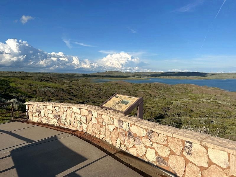
3. View off to the left from the marker
Signal Hill can be seen in the distant background, above the marker.
Credits. This page was last revised on August 20, 2026. It was originally submitted on July 26, 2024, by Barry Swackhamer of Brentwood, California. This page has been viewed 219 times since then and 70 times this year. Photos: 1, 2. submitted on July 26, 2024, by Barry Swackhamer of Brentwood, California. 3. submitted on August 13, 2026.
