Near Fort Peck in Valley County, Montana — The American West (Mountains)
With No Running Water, the Stream was called Big Dry River
Lewis and Clark at Big Dry River

Photographed by Barry Swackhamer, February 1, 2011
1. With No Running Water the Stream was called Big Dry River Marker
The Big Dry was so impressive, Lewis and Clark thought it extended possibly as far southeast as the Black Hills. Unlike streams they were familiar with in the East which flow all year, an intermittent stream like the Big Dry was a curiosity to Lewis and Clark.
"Today we passed the bed of the most extraordinary river that I ever beheld. It is as wide as the Missouri is at this place or ½ a mile wide and not containing a single drop of runing water; some small standing pools being all the water that could be percieved... This stream we called Big dry river." –Captain M. Lewis, Thursday May 9, 1805
"We saw a great quantity of game today particularly of Elk and Buffaloe, the latter are now so gentle that the men frequently throw sticks and stones at them in order to drive them out of the way. –Captain M. Lewis, Thursday May 9, 1805
Scientific Discovery: the Willet (Catoptrophorus semipalmatus)
this page online
"I killed four plover this evening of a different species from any I have yet seen... the notes of this bird are louder and more various than any other of this family..." –Captain M. Lewis, Thursday May 9, 1805
Erected by Travel Montana, Dept. of Commerce, Montana's Missouri River Country, Galsgow Chamber of Commerce, Army Corps of Engineers.
Topics and series. This historical marker is listed in these topic lists: Exploration • Waterways & Vessels. In addition, it is included in the Lewis & Clark Expedition series list. A significant historical date for this entry is May 9, 1805.
Location. 48° 0.57′ N, 106° 23.369′ W. Marker is near Fort Peck, Montana, in Valley County. It is on State Highway 24 near Yager Road, on the right when traveling east. This marker is located at the Lewis & Clark Overlook. Touch for map. Marker is at or near this postal address: 5473 Montana Highway 24, Fort Peck MT 59223, United States of America. Touch for directions.

Regionally, this marker is in Missouri River Country. It is also in the American Mountain West, in the Lewis & Clark Corridor, on the prairies, on the Great Plains, and specifically

Photographed by Barry Swackhamer, February 1, 2011
2. With No Running Water the Stream was called Big Dry River Marker
The marker is the second marker in.
Other nearby markers. At least 8 other markers are within 2 miles of this marker, measured as the crow flies: Summits of High Hills Were Covered with Pine (a few steps from this marker); Peculiar White Water Named the Milk River (a few steps from this marker); Lewis & Clark in Missouri River Country (within shouting distance of this marker); The Slide of '38 (approx. half a mile away); Fort Peck Dam (approx. half a mile away); Built with Muscle and Muck (approx. half a mile away); In Memory (approx. half a mile away); Powerful Afterthoughts (approx. 1½ miles away). Touch for a list and map of all markers in Fort Peck.
June 21, 2026
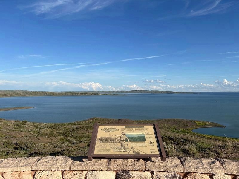
3. View from the marker
The Dry Arm can be seen in the distant background, on the far right side of the photo, continuing beyond the distant peninsula.
Credits. This page was last revised on August 20, 2026. It was originally submitted on July 26, 2024, by Barry Swackhamer of Brentwood, California. This page has been viewed 275 times since then and 66 times this year. Photos: 1, 2. submitted on July 26, 2024, by Barry Swackhamer of Brentwood, California. 3. submitted on August 13, 2026.
