Near Schuylerville in Saratoga County, New York — The American Northeast (Mid-Atlantic)
Saratoga Surrender Site

Photographed by Steve Stoessel, July 25, 2024
1. Saratoga Surrender Site Marker
Following the Surrender on October 17, 1777, the site remained in private ownership. In 2006, New York State Roy McDonald and New York State Assemblyman Steven Englebright, having taken notice that this historic location was for sale, sponsored efforts to obtain New York State funding to preserve this important site. With funding support from the State of New York, the conservation organization Open Space Institution purchased the property later that year.
Friends of the Saratoga Battlefield took the lead in developing a memorial park on the property in collaboration with the Historic Hudson-Hoosic Rivers Partnership. With a generous donation from the Alfred Z. Solomon Foundation, a bronze bas-relief of the John Trumball painting Surrender of General Burgoyne was commissioned. The Town of Saratoga and the New York State Natural Heritage Trust received a grant
this page online
Though the joint support of individuals, civic organizations, businesses, and government agencies, this location marking the turning point of the War for American Independence, will forever be preserved for future generations
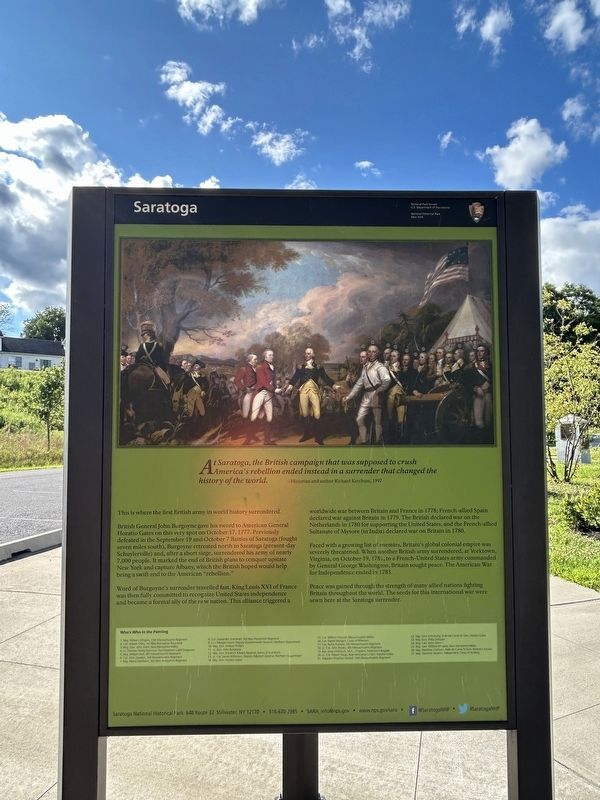
This is where the first British army in world history surrendered.
British General John Burgoyne gave his sword to American General Horatio Gates on this very spot on October 17, 1777. Previously defeated in the September 19 and October 7 Battles of Saratoga (fought seven miles south), Burgoyne retreated north to Saratoga (present-day Schuylerville) and, after a short siege, surrendered his army of nearly 7,000 people. It marked the end of British plans to conquer upstate New York and capture Albany, which the British hoped would help bring a swift end to the American "rebellion."
Word
Photographed by Steve Stoessel, July 25, 2024
2. Saratoga Surrender Site Marker
Faced with a growing list of enemies, Britain's global colonial empire was severely threatened. When another British army surrendered, at Yorktown, Virginia, on October 19, 1781, Lo a French-United States army commanded by General George Washington, Britain sought peace. The American War for Independence ended in 1783.
Peace was gained through the strength of many allied nations fighting Britain throughout the world. The seeds for this international war were sewn here at the Saratoga surrender.

Photographed by Steve Stoessel, July 25, 2024
3. Saratoga Surrender Site Marker
Native Americans
The resource-rich Saratoga area was frequently visited by indigenous peoples throughout history, and is considered homeland for several American Indian tribes. Archeological investigations have recorded evidence of peoples in this area during the Paleo-Indian, Archaic, and Woodland time periods. The Saratoga area is situated along the historical boundary of the Mohawk and the Mohican people, two American Indian groups with distinct sets of cultural and social traits.
The Mohawks, or Kanien'keha:ka - "people of the flint - settled in the Mohawk and upper Hudson valleys and were aligned with four other nations who identified themselves as the Haudenosaunee, or Iroquois Confederacy. Saratoga was known as "Ocseratonque" or "Ochsechrage" by the Mohawks; and known as "Amissohaendick" by Algonquian people, the Mahicans, or Mahikanak. Known today as the Mohicans, this tribe also inhabited the upper Hudson River Valley. Their name, translated to mean "The people of the waters that are never still," highlights the
Photographed by Steve Stoessel, July 25, 2024
4. Saratoga Surrender Site Marker
,br> The earliest Dutch settlers traded with both Mohicans and the Mohawks in the early 17th century. Friction over trading rights and lands led to war between the two native nations in 1624. The Mohawks came to dominate the area west of the river, pushing their rivals, the Mohicans, further east.
Pressure from encroaching European settlements led the Mohawks and Mohicans to sign land grants or patents to European communities. Even while tribes moved farther from their original lands, they were willing to help support the United States' fight for independence. Many Iroquoian and Algonquian nations supported the war effort and utilized their skills to ensure an American victory.
After the War for American Independence, many tribes were forced into diaspora and established communitics wherever they were able. Vibrant tribal communities today, including the Stockbridge-Munsee Community in Wisconsin, and the St. Regis Mohawk in northern New York, are still linked to their ancestral homelands and ensure the histories and stories are passed on to future generations.
Land Ownership
When Europeans first arrived in the Northeast, there already existed a robust indigenous trade network that extended back 1,500 years in the Saratoga area, This region of the upper Hudson River valley above Albany witnessed a long series of territorial wars involving various Indian tribes, Great Britain, and France. Forts were built along the Hudson River to protect claims on resources. By the late 17th century, the Mohicans sold the land that became the Saratoga Patent. The Patent divided the land among six prominent men, including two members of the Schuyler family. For generations, these families built northern plantations, purchased or inherited enslaved people to work the land, secured tenant farmers, and led efforts to build the Champlain Canal to increase trade and transportation in the area.
The Germain Family
Overlooking the Champlain Canal, Hudson Valley Railroad, and the Hudson River, the Germain family farmed this historic land for over 87 years. Income came from raising dairy cows pigs, chickens, and farming corn and squash. During canal operations, Ken and Ray Germain towed canal boats. Knowing that this was a special place for all Americans, the Germains cared for the land until it was sold to the Open Space Institute. Now the land that they cared for can be experienced by you and future generations.
Champlain Canal
As an advocate of inland navigation, Philip Schuyler was influential in the formation of the Northern Inland Lock Navigation Company in 1792. Construction of the subsequent Champlain Canal began in 1817 and was completed in 1823. Canal boats transported cargo along the 64 mile waterway from Cohoes, NY to Whitehall, NY. In 1915, it was replaced by the Champlain Barge Canal. Today, it is part of the Erie Canalway National Heritage Corridor Walk or bicycle on the towpath across the road and connect with the past.
Erected by Saratoga National Historical Park.
Topics. This historical marker is listed in these topic lists: Parks & Recreational Areas • War, US Revolutionary. A significant historical date for this entry is September 19, 1777.
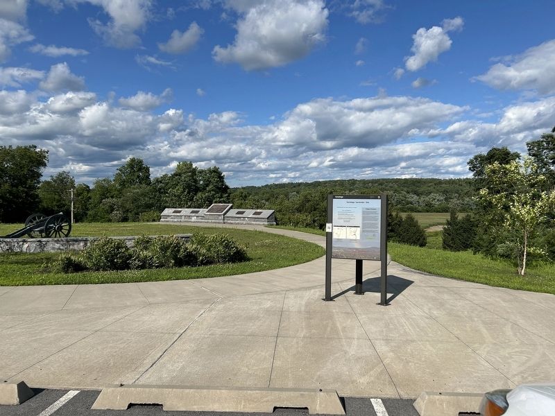
Location. 43° 5.205′ N, 73° 35.063′ W. Marker is near Schuylerville, New York, in Saratoga County. It can be reached from the intersection of Schuyler Street and Route 4. Marker is at the parking area for Saratoga Surrender Site. Touch for map. Marker is in this post office area: Schuylerville NY 12871, United States of America. Touch for directions.

Regionally, this marker is in Upstate New York, in the Capital District, and in the Albany Metropolitan Area. It is also in the American Northeast and in the Mid-Atlantic. Globally, it is in North America, the Great North Woods, the Western Hemisphere, the Western World, and the Anglosphere. Historically, it finds itself in what was once New Netherland and also one of the original Thirteen Colonies.
Other nearby markers. At least 8 other markers are within walking distance of this marker: Surrendered British Cannons (here, next to this marker); a different marker also named Saratoga Surrender Site (a few steps from this marker); Burgoyne Surrendered his Sword (within shouting distance of this marker); Champlain Canal (about 300 feet away, measured in a direct line); Fort Vrooman (about 300 feet away); Dutch Reformed Church (approx. ¼ mile away); Victory Woods (approx. half a mile away); Two Brothers Meet Again (approx. half a mile away). Touch for a list and map of all markers in Schuylerville.
Another marker is no longer nearby. Sword Surrender Site (was within shouting distance of this marker but has been permanently removed).
More about this marker. This is a three-sided marker. One side describes the site and presents the rules of the park. The second side discusses the surrender. The third side describes the history of the site.
Also see . . . Battles of Saratoga (Wikipedia). (Submitted on July 26, 2024, by Steve Stoessel of Niskayuna, New York.)
Credits. This page was last revised on July 27, 2024. It was originally submitted on July 26, 2024, by Steve Stoessel of Niskayuna, New York. This page has been viewed 445 times since then and 106 times this year. Photos: 1, 2, 3, 4. submitted on July 26, 2024, by Steve Stoessel of Niskayuna, New York.
