Tarpon Springs in Pinellas County, Florida — The American South (South Atlantic)
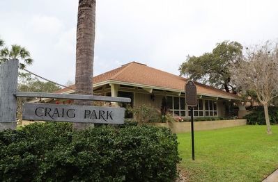
Craig Park
Photographed by Dave W, February 11, 2023
1. Craig Park Marker
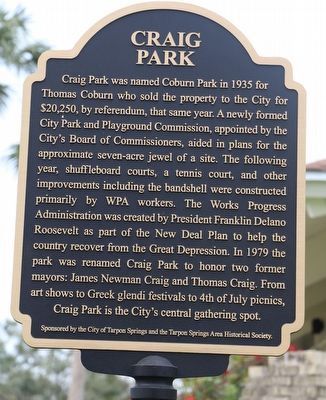
Craig Park was named Coburn Park in 1935 for Thomas Coburn who sold the property to the City for $20,250, by referendum, that same year. A newly formed City Park and Playground Commission, appointed by the City's Board of Commissioners, aided in plans for the approximate seven-acre jewel of a site. The following year, shuffleboard courts, a tennis court, and other improvements including the bandshell were constructed primarily by WPA workers. The Works Progress Administration was created by President Franklin Delano Roosevelt as part of the New Deal Plan to help the country recover from the Great Depression. In 1979 the park was renamed Craig Park to honor two former mayors: James Newman Craig and Thomas Craig. From art shows to Greek glendi festivals to 4th of July picnics, Craig Park is the City's central gathering spot.
Erected by The City of Tarpon Springs and the Tarpon Springs Area Historical Society.
Topics and series. This historical marker is listed in these topic lists: Charity & Public Work • Parks & Recreational Areas. In addition, it is included in the Works Progress Administration (WPA) projects
this page online
Location. 28° 8.755′ N, 82° 45.629′ W. Marker is in Tarpon Springs, Florida, in Pinellas County. It is at the intersection of Beekman Lane and South Spring Boulevard, on the left when traveling north on Beekman Lane. Touch for map. Marker is at or near this postal address: 6 Beekman Ln, Tarpon Springs FL 34689, United States of America. Touch for directions.

Regionally, this marker is on Florida’s Gulf Coast and on Tampa Bay. It is also in the American South and on the Gulf Coast. Globally, it is in the North Atlantic Region, North America, a Gulf of Mexico state, the Western Hemisphere, the Western World, and the Anglosphere. Historically, it finds itself in what was once New Spain, the territory of the Mississippian Culture, one of the Confederate States of America, and the Antebellum South.
Other nearby markers. At least 8 other markers are within walking distance of this marker: Craig Park War Memorial (about 400 feet away, measured in a direct line); Spring Bayou (about 600 feet away); Anson P.K. Safford House (approx. 0.2 miles away); Hennig House
Photographed by Dave W, February 11, 2023
2. Craig Park Marker
Credits. This page was last revised on July 27, 2024. It was originally submitted on February 17, 2023, by Dave W of Co, Colorado. This page has been viewed 637 times since then and 80 times this year. Last updated on July 27, 2024, by Quinton Spiaggi of Palm Harbor, Florida. Photos: 1, 2. submitted on February 17, 2023, by Dave W of Co, Colorado. • J. Makali Bruton was the editor who published this page.
