Near Sidney in Cheyenne County, Nebraska — The American Midwest (Upper Plains)
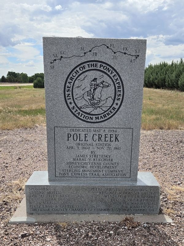
Pole Creek Original Station
| — | In Search of the Pony Express | — |
Photographed by Mark Parker, June 27, 2024
1. Pole Creek Original Station Marker
Pole Creek Original Station
Apr. 3, 1860 - Nov. 20, 1861.
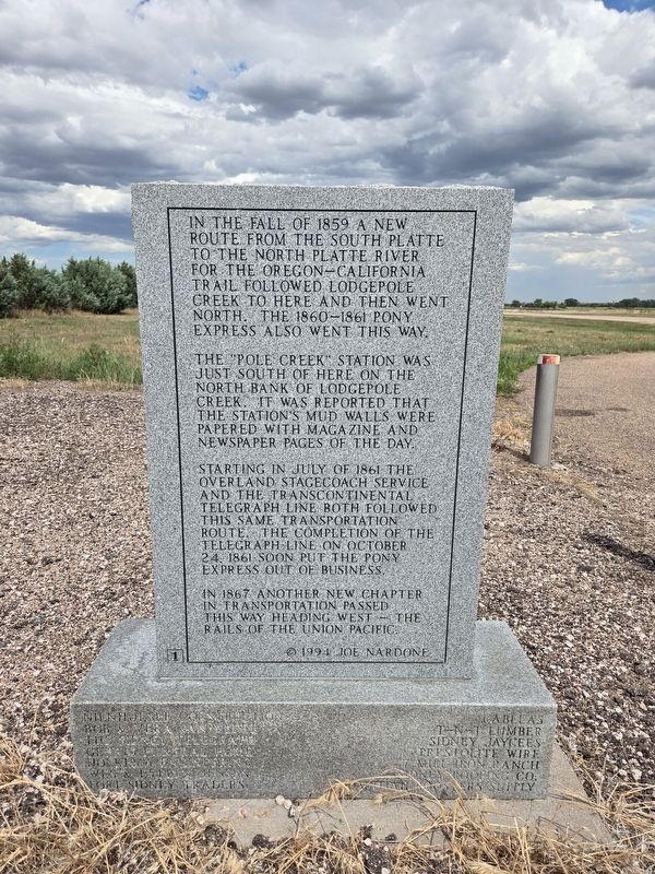
Reverse
In the fall of 1859 a new route from the South Platte to the North Platte River for the Oregon-California Trail followed Lodgepole Creek to here and then went north. The 1860-1861 Pony Express also went this way.
The "Pole Creek" station was just south of here on the north bank of Lodgepole Creek. It was reported that the station's mud walls were papered with magazine and newspaper pages of the day.
Starting in July of 1861 the Overland Stagecoach service and the Transcontinental Telegraph line both followed this same transportation route. The completion of the telegraph line on October 24, 1861 soon put the Pony Express out of business.
In 1867 another new chapter in transportation passed this way heading west - the rails of the Union Pacific.
©1994 Joe Nardone
Erected 1994 by Sidney / Cheyenne County Economic Development, Pony Express Trail Association.
Topics. This historical marker is listed in these topic lists: Communications • Exploration • Roads & Vehicles • Settlements & Settlers. A significant historical month for this entry is July 1861.
Location. 41° 8.979′ N,
this page online

Regionally, this marker is in the Nebraska Panhandle. It is also in the American Midwest, in the Corn Belt, on the prairies, on the Great Plains, and specifically on the High Plains. Globally, it is in North America, the Western Hemisphere, the Western World, and the Anglosphere. Historically, it finds itself in what was once the Louisiana Purchase.
Other nearby markers. At least 8 other markers are within 4 miles of this marker, measured as the crow flies: Cheyenne County (approx. 2.6 miles away); Purple Heart Trail (approx. 2.7 miles away); Sidney ~ Cheyenne County (approx. 2.7 miles away); Fort Sidney (approx. 3.3 miles away); Nebraska’s Earliest Documented Burial (approx. 3.4 miles away); 385 Gold Rush Byway (approx. 3½ miles away); National Pony Express Monument
Photographed by Mark Parker, June 27, 2024
2. Pole Creek Original Station Marker Reverse
Credits. This page was last revised on July 28, 2024. It was originally submitted on July 27, 2024, by Mark Parker of Hickory, North Carolina. This page has been viewed 322 times since then and 73 times this year. Photos: 1, 2. submitted on July 27, 2024, by Mark Parker of Hickory, North Carolina. • J. Makali Bruton was the editor who published this page.
