Fairfax, Virginia — The American South (Mid-Atlantic)
Mount Vineyard
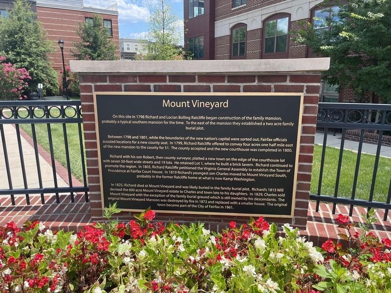
On this site in 1798 Richard and Locian Bolling Ratcliffe began construction of the family mansion, probably a typical southern mansion for the time. To the east of the mansion they established a two acre family burial plot.
Between 1798 and 1801, while the boundaries of the new nation's capital were sorted out, Fairfax officials scouted locations for a new county seat. In 1799, Richard Ratcliffe offered to convey four acres one half mile east of the new mansion to the county for $1. The county accepted and the new courthouse was completed in 1800.
Richard with his son Robert, then county surveyor, platted a new town on the edge of the courthouse lot with seven 50-foot wide streets and 19 lots. He returned Lot 1, where he built a brick tavern. Ricahrd continued to promote the region. In 1805, Richard Ratcliffe petitioned the Virginia General Assembly to establish the Town of Providence at Fairfax Court House. In 1819 Richard's youngest son Charles moved to Mount Vineyard South, probably in the former Ratcliffe home at what is now Kamp Washington.
In 1825, Richard died at Mount Vineyard and was likely buried in
this page online
Topics. This historical marker is listed in these topic lists: Government & Politics • Political Subdivisions • Settlements & Settlers. A significant historical year for this entry is 1798.
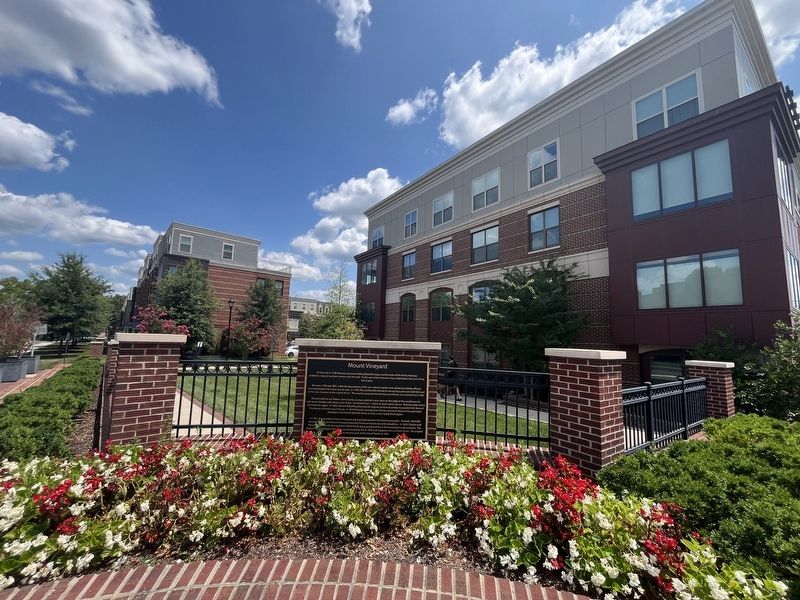
Location. 38° 51.014′ N, 77° 19.044′ W. Marker is in Fairfax, Virginia. It is at the intersection of Main Street (Virginia Route 236) and Oak Street, on the right when traveling west on Main Street. Touch for map. Marker is at or near this postal address: 10756 Main St, Fairfax VA 22030, United States of America. Touch for directions.

Regionally, this marker is in the Washington Metropolitan Area and in Northern Virginia. It is also in the American South, specifically in the Upper South, and in the Mid-Atlantic. Globally,
Other nearby markers. At least 8 other markers are within walking distance of this marker: A different marker also named Richard Ratcliffe's Mount Vineyard Plantation (within shouting distance of this marker); Ratcliffe Cemetery (approx. ¼ mile away); Arlington-Fairfax Electric Railway (approx. 0.3 miles away); Manassas Gap Railroad (approx. 0.3 miles away); Confederate Memorial (approx. 0.3 miles away); Confederate Dead (approx. 0.4 miles away); Old Fairfax High School (approx. 0.4 miles away); Mosby (approx. half a mile away). Touch for a list and map of all markers in Fairfax.
Other markers no longer nearby. Richard Ratcliffe’s Mount Vineyard Plantation (was a few steps from this marker but has been replaced with another marker now near it); Birthplace of the Confederate Battle Flag (was a few steps from this marker but has been permanently removed).
Credits. This page was last revised on July 27, 2024. It was originally submitted on July 27, 2024, by Devry Becker Jones of Washington, District of Columbia. This page has been viewed 279 times since then and 55 times this year. Photos: 1, 2. submitted on July 27, 2024, by Devry Becker Jones of Washington, District of Columbia.
