Notre Dame in St. Joseph County, Indiana — The American Midwest (Great Lakes)
St. Mary's Island

Photographed by Sean Flynn, July 27, 2024
1. St. Mary's Island Marker
This marker stands on the ground that was formerly called the "island".
Grom the early days the island was surrounded by the waters of St. Mary's Lake. These waters were lowered when a mill dam was destroyed to give free passage to the St. Joseph River, creating the two lakes...St. Mary's and St. Joseph's
In the wet weather, ponds of water form to indicate the areas of land fill.
Topics. This historical marker is listed in these topic lists: Education • Waterways & Vessels.
Location. 41° 42.232′ N, 86° 14.521′ W. Marker
this page online

Regionally, this marker is in Northern Indiana and in Greater South Bend. It is also in the American Midwest and in the Corn Belt. Globally, it is in North America, the Western Hemisphere, the Western World, and the Anglosphere.
Photographed by Sean Flynn, July 27, 2024
2. St. Mary's Island Marker
The marker is on the right side of the east entrance to the driveway up to Columba Hall on Notre Dame's campus.
Other nearby markers. At least 8 other markers are within walking distance of this marker: The Grotto of Our Lady of Lourdes (about 500 feet away, measured in a direct line); Thomas A. Dooley, M.D. '48 (about 600 feet away); Chaplain Corby of Gettysburg (about 700 feet away); From a Letter of The Rev. Edward Sorin, CSC (about 700 feet away); Old College (about 800 feet away); World War I Memorial (approx. 0.2 miles away); Rockne, Texas (approx. ¼ mile away); Edward Sorin

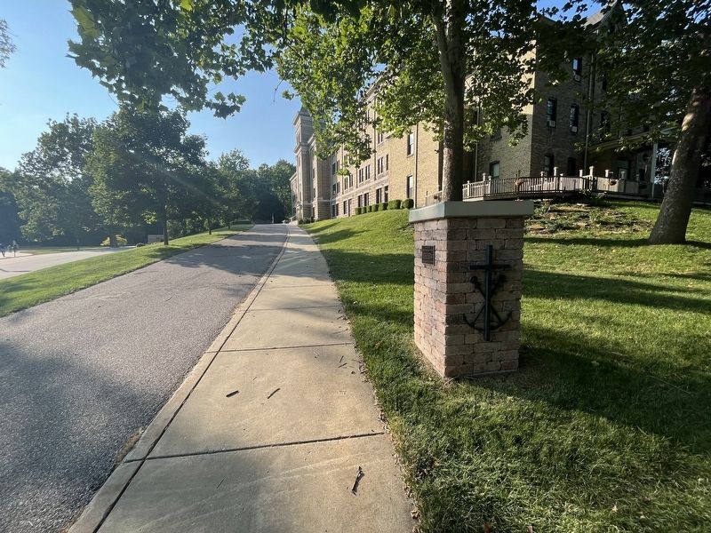
Photographed by Sean Flynn, July 27, 2024
3. St. Mary's Island Marker
Although obscured by trees in this southeast-facing photo, the Grotto of Our Lady of Lourdes, a one-seventh-size replica of the original in France, is about 500 feet away from this location. St. Mary's Lake, referenced on the plaque, is just off camera on the right.
Regarding St. Mary's Island. According to a 2000 history of Columba Hall, the residence hall for Brothers of the Holy Cross a short walk from this marker, the "Island" was originally a hill surrounded by swampland between the two lakes, which prior to their receding were considered a single lake. The Brothers have used this area as a residence since the mid-1840s, not long after they arrived in Northern Indiana around 1842. The current Columba Hall dates to around 1899, with many additions in the 125 years

Photographed by Sean Flynn, July 27, 2024
4. Columba Hall
The marker is on the far right.
Also see . . . The Chimney Swifts of Columba Hall. This article looks at a roost of chimney swifts that made their home in Columba Hall's chimney, and the biological sciences student who studied them.
Excerpt: "Columba Hall, home today to 26 Holy Cross brothers, is a rambling brick structure that dates to the 1890s but has had many additions. The rear chimney originally vented smoke from coal furnaces, but the hall today is heated by a circulating hot water system. The chimney hasn’t been used for years, making it a perfect home base for the swifts."(Submitted on July 29, 2024, by Sean P. Flynn of Oak Park, Illinois.)
Credits. This page was last revised on February 1, 2025. It was originally submitted on July 29, 2024, by Sean P. Flynn of Oak Park, Illinois. This page has been viewed 413 times since then and 35 times this year. Photos: 1, 2, 3, 4. submitted on July 29, 2024, by Sean P. Flynn of Oak Park, Illinois.
