Rocheport in Boone County, Missouri — The American Midwest (Upper Plains)
Rocheport to McBaine
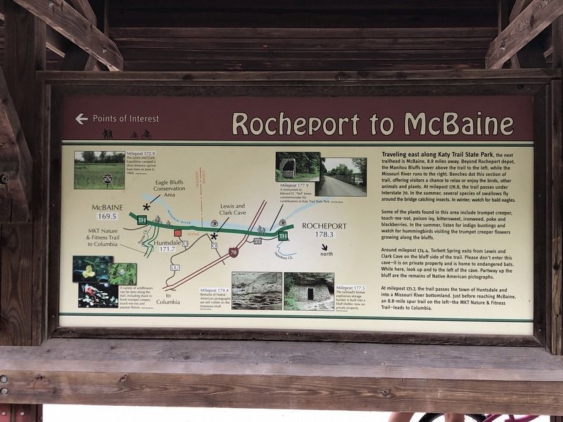
Photographed by Duane and Tracy Marsteller, July 1, 2024
1. Rocheport to McBaine Marker
Some of the plants found in this area include trumpet creeper, touch-me-not, poison ivy, bittersweet, ironweed, poke and blackberries. In the summer, listen for indigo buntings and watch for hummingbirds visiting the trumpet creeper flowers growing along the bluffs.
Around milepost 174.4. Torbett Spring exits from Lewis and Clark Cave on the bluff side of the trail. Please don't enter this cave – it is on private property and is home to endangered bats. While here, look up and to the left of the cave. Partway up the bluff are the remains of Native American pictographs.
At milepost 171.7, the trail passes
this page online
[Captions]
• A variety of wildflowers can be seen along the trail, including (back to front) trumpet creeper, touch-me-not and passion flower.
• Milepost 172.9 The Lewis and Clark Expedition camped a short distance upriver from here on June 6, 1804.
• Milepost 174.4 Remains of Native American pictographs are still visible on the limestone bluff.
• Milepost 177.5 The railroad's former explosives storage bunker is built into a bluff shelter, now on private property.
• Milepost 177.9 A monument to Edward D. “Ted” Jones commemorates his contributions to Katy Trail State Park.
Erected by Missouri State Parks.
Topics and series. This historical marker is listed in these topic lists: Exploration • Parks & Recreational Areas. In addition, it is included in the Katy Trail State Park series list. A significant historical date for this entry is June 6, 1804.
Location. 38° 58.65′ N, 92° 33.652′ W. Marker is in Rocheport, Missouri, in Boone County. It is on 1st
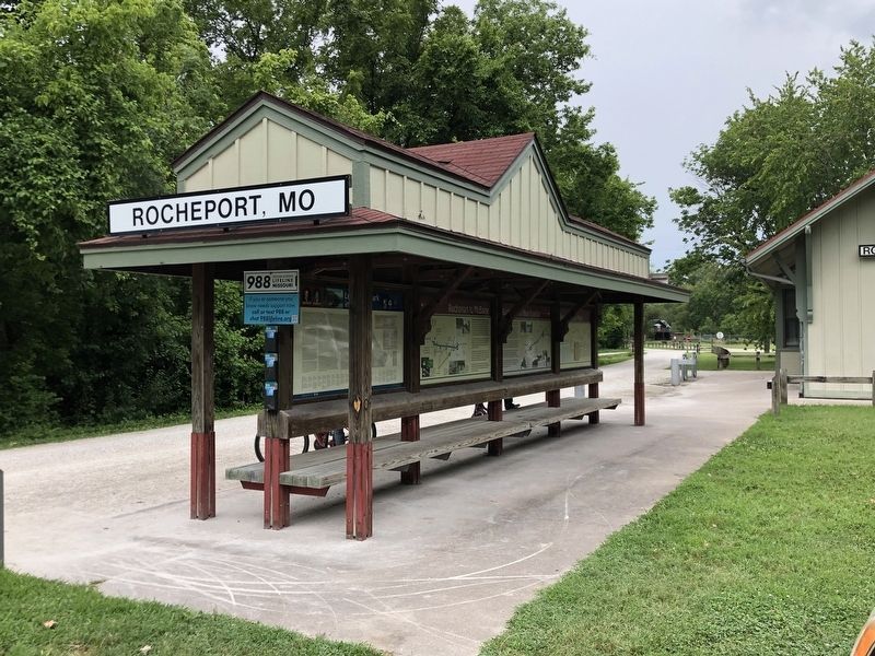
Photographed by Duane and Tracy Marsteller, July 1, 2024
2. Rocheport to McBaine Marker
This marker is the second one from the left.

Regionally, this marker is in Little Dixie and in the Missouri River Corridor. It is also in the American Midwest, in the Lewis & Clark Corridor, and in the Corn Belt. Globally, it is in North America, the Western Hemisphere, the Western World, and the Anglosphere. Historically, it finds itself in what was once the territory of the Mississippian Culture, the Louisiana Purchase, and the Antebellum South.
Other nearby markers. At least 8 other markers are within 4 miles of this marker, measured as the crow flies: Steamboating on the Missouri (here, next to this marker); Edward D. "Ted" and Pat Jones (here, next to this marker); History of Rocheport (here, next to this marker); Lewis and Clark in Missouri (here, next to this marker); Rocheport to New Franklin (here, next to this marker); 25th Anniversary (here, next to this marker); Edward D. (Ted) Jones (approx. 0.4 miles away); The Lewis and Clark Expedition Across Missouri (approx. 3.9 miles away). Touch for a list and map of all markers in Rocheport.
Another marker is no longer nearby. Katy Trail State Park 20th Anniversary (was here, next to this marker but has been confirmed missing).
Credits. This page was last revised on July 29, 2024. It was originally submitted on July 29, 2024, by Duane and Tracy Marsteller of Murfreesboro, Tennessee. This page has been viewed 483 times since then and 66 times this year. Photos: 1, 2. submitted on July 29, 2024, by Duane and Tracy Marsteller of Murfreesboro, Tennessee.
