Port Burwell in Elgin County, Ontario — Central Canada (North America)
Lieut.-Col. Mahlon Burwell
1783 - 1846
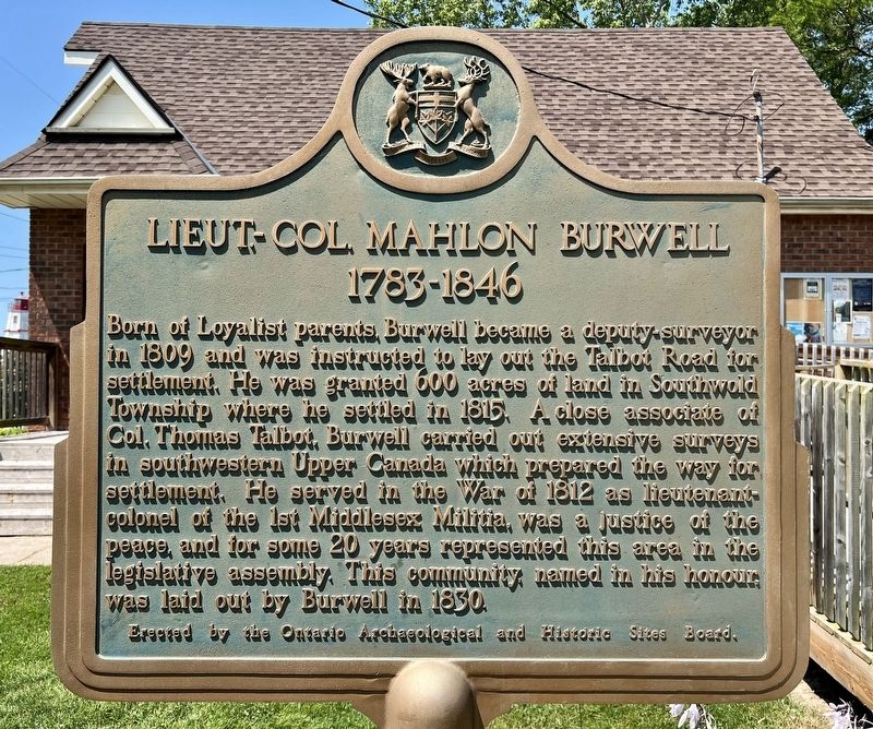
Photographed by Tim Boyd, July 27, 2024
1. Lieut.-Col. Mahlon Burwell Marker
Erected by Ontario Archaeological and Historic Sites Board.
Topics and series. This historical marker is listed in these topic lists: Colonial Era • Settlements & Settlers • War of 1812. In addition, it is included in the Canada, Ontario Heritage Trust series list. A significant historical year for this entry is 1809.
Location. 42° 38.751′ N, 80° 48.32′ W. Marker is in Port Burwell, Ontario, in Elgin County. It is on Erieus Street near Pitt Street, on the right when traveling south. Touch for map. Marker is at or near
this page online

Regionally, this marker is in the Southwest Ontario Area and in Southwestern Ontario. It is also in Central Canada. Globally, it is in North America, on the Great Lakes, in the Western Hemisphere, in the Western World, and in the Anglosphere. Historically, it finds itself in what was once a British colony, the Viceroyalty of New France, the Haudenosaunee (Iroquois) Confederacy, and Rupert’s Land.
Other nearby markers. At least 8 other markers are within 24 kilometers of this marker, measured as the crow flies: Port Burwell Lighthouse 1840 (about 150 meters away, measured in a direct line); Trinity Anglican Church 1836 (about 150 meters away); The Edison Homestead (approx. 3.6 kilometers away); Port Bruce Site of the Royal Salute (approx. 16.7 kilometers away); Aylmer Cenotaph (approx. 20.3 kilometers away); The Founding of Aylmer (approx. 20.4 kilometers away); The Founding of Springfield (approx. 23 kilometers away); Springfield Cenotaph (approx. 23.1 kilometers away). Touch for a list and map of all markers in Port Burwell.
Also see . . . Dictionary of Canadian Biography - Burwell, Mahlon.

Photographed by Tim Boyd, July 27, 2024
2. Lieut.-Col. Mahlon Burwell Marker
According to a newspaper account in 1833, Mahlon had not much more than 12 months of schooling, and when he decided to take up surveying, had little formal training in it. He failed to meet the provincial requirements for licensing as a surveyor in 1805 and had to extend his apprenticeship. Yet he acquired the minimal mathematical background necessary to use the instruments of the time: a circumferentor and a measuring chain. Despite the trying circumstances under which he worked, his field-notes, maps, and diaries are detailed and contain a remarkable amount of scientific information.(Submitted on July 29, 2024, by Tim Boyd of Hamilton, Ontario.)

circa 1830
3. Portrait and autograph of Lieut.-Col. Mahlon Burwell, ca 1830
Source: Library and Archives Canada (public domain)

1840
4. Sketch of Port Burwell harbour and village by Mahlon Burwell, 1840
Source: Wikipedia (public domain)
Credits. This page was last revised on July 29, 2024. It was originally submitted on July 29, 2024, by Tim Boyd of Hamilton, Ontario. This page has been viewed 194 times since then and 32 times this year. Photos: 1, 2, 3, 4. submitted on July 29, 2024, by Tim Boyd of Hamilton, Ontario. • Andrew Ruppenstein was the editor who published this page.
