Rostraver Township near Smithton in Westmoreland County, Pennsylvania — The American Northeast (Mid-Atlantic)
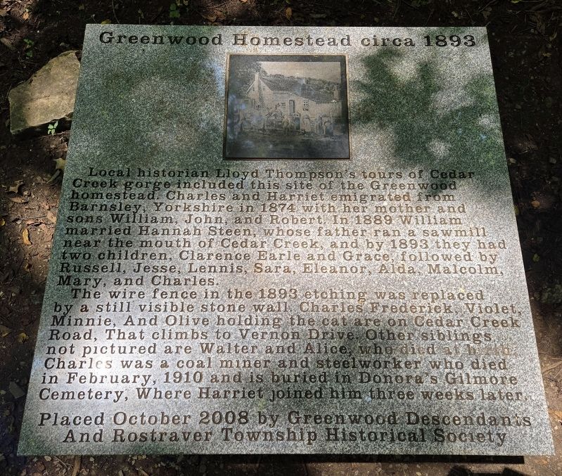
Greenwood Homestead circa 1893
Photographed by Bradley Owen, July 27, 2024
1. Greenwood Homestead circa 1893 Marker
Local historian Lloyd Thompson's tours of Cedar Creek gorge included this site of the Greenwood homestead. Charles and Harriet emigrated from Barnsley, Yorkshire in 1874 with her mother and sons William, John, and Robert. In 1889 William married Hannah Steen, whose father ran a sawmill near the mouth of Cedar Creek, and by 1893 they had two children, Clarence Earle and Grace, followed by Russell, Jesse, Lennis, Sara, Eleanor, Alda, Malcolm, Mary, and Charles.
The wire fence in the 1893 etching was replaced by a still visible stone wall. Charles Frederick, Violet, Minnie, and Olive holding the cat are on Cedar Creek Road, that climbs to Vernon Drive. Other siblings, not pictured are Walter and Alice, who died at birth. Charles was a coal miner and steelworker who died in February, 1910 and is buried in Donora's Gilmore Cemetery, where Harriet joined him three weeks later.
Erected 2008 by Greenwood Descendants And Rostraver Township Historical Society.
Topics. This historical marker is listed in these topic lists: Immigration • Industry & Commerce • Notable Places. A significant historical year for this entry is 1893.
Location. 40° 10.43′ N,
this page online

Regionally, this marker is in the Laurel Highlands and in Greater Pittsburgh. It is also in the American Northeast, in the Mid-Atlantic, in Appalachia, and specifically in Northern Appalachia. Globally, it is in North America, the Western Hemisphere, the Western World, and the Anglosphere. Historically, it finds itself in what was once the Viceroyalty of New France, the Haudenosaunee (Iroquois) Confederacy, and one of the original Thirteen Colonies.
Other nearby markers. At least 8 other markers are within 3 miles of this marker, measured as the crow flies: Cedar Creek Mill (approx. 0.2 miles away); Saw Mill (approx. 0.4 miles away); Rostraver Veterans Memorial (approx. 0.8 miles away); Col. George Crogan (Circa 1718 - 1782)

Photographed by Bradley Owen, July 27, 2024
2. Greenwood Homestead circa 1893 Marker
Credits. This page was last revised on July 30, 2024. It was originally submitted on July 30, 2024, by Bradley Owen of Morgantown, West Virginia. This page has been viewed 324 times since then and 39 times this year. Photos: 1, 2. submitted on July 30, 2024, by Bradley Owen of Morgantown, West Virginia.
