
Portland in Callaway County, Missouri — The American Midwest (Upper Plains)
Portland to McKittrick

Photographed by Duane and Tracy Marsteller, July 1, 2024
1. Portland to McKittrick Marker
Excellent views of the Missouri River continue at milepost 111.9, and half a mile beyond is another Lewis and Clark historical marker. After half a mile more, trail users reach Bluffton. The bluffs around Bluffton, rising 200 feet or more, are some of the highest on the trail. Grand Bluffs Conservation Area is located atop these bluffs.
At Rhineland, Katy Trail State Park briefly leaves the former railroad right of way. This area reminded German immigrants of their home country's Rhine River valley. Two picturesque churches are located near the trail here: Church of the Risen Savior and St. Marcus. Most of Rhineland was relocated to the hill above after the 1993 flood.
Approaching McKittrick around milepost 102, look across the river valley toward Hermann. Deutschheim State
this page online
[Map captiions]
• Milepost 113.7 Away from the river bottom, rolling pasture and woods make up the local landscape. DNR file photo
• Milepost 104.3 St. Marcus was built in 1891 by German immigrants. Rhineland was founded five years later, after the arrival of the Katy railroad. DNR file photo
• Milepost 101.9 Hermann, across the Missouri River, is just visible from the Katy Trail. DNR file photo
• [Remainder is damaged and unreadable]
Erected by Missouri State Parks.
Topics and series. This historical marker is listed in these topic lists: Environment • Settlements & Settlers. In addition, it is included in the Katy Trail State Park series list. A significant historical year for this entry is 1891.
Location. 38° 42.581′ N, 91° 42.995′ W. Marker is in Portland, Missouri, in Callaway County. It can be reached from the intersection of Market Street and Main Street, on the left when traveling south. Marker
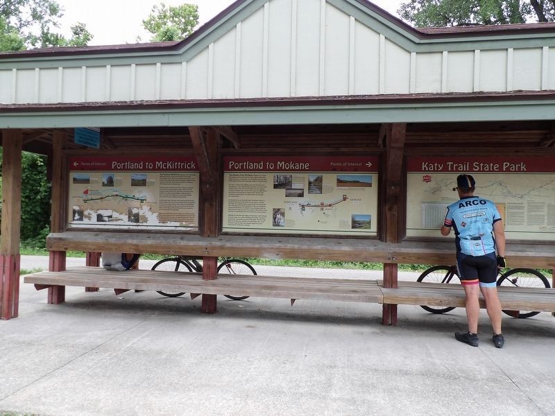
Photographed by Duane and Tracy Marsteller, July 1, 2024
2. Portland to McKittrick Marker
This marker is on the left.

Regionally, this marker is in Little Dixie and in the Missouri River Corridor. It is also in the American Midwest, in the Lewis & Clark Corridor, and in the Corn Belt. Globally, it is in North America, the Western Hemisphere, the Western World, and the Anglosphere. Historically, it finds itself in what was once the territory of the Mississippian Culture, the Louisiana Purchase, and the Antebellum South.
Other nearby markers. At least 8 other markers are within 9 miles of this marker, measured as the crow flies: Portland to Mokane (here, next to this marker); Old Jail - 1930 (approx. 3.8 miles away); The Lewis and Clark Expedition Across Missouri (approx. 4.4 miles away); Mysteries of Standing Rock (approx. 8.7 miles away); History of Mokane (approx. 8.7 miles away); Mokane to Portland (approx. 8.7 miles away); Mokane to Tebbetts (approx. 8.7 miles away); Katy Railroad (approx. 8.7 miles away).
Credits. This page was last revised on August 4, 2024. It was originally submitted on July 30, 2024, by Duane and Tracy Marsteller of Murfreesboro, Tennessee. This page has been viewed 155 times since then and 16 times this year. Photos: 1, 2. submitted on July 30, 2024, by Duane and Tracy Marsteller of Murfreesboro, Tennessee.
