Camden in Kershaw County, South Carolina — The American South (South Atlantic)
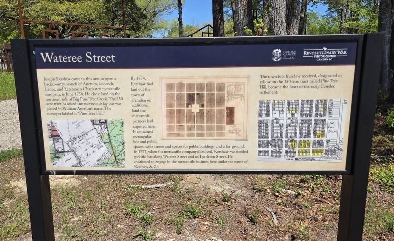
Wateree Street
Photographed by Mark Parker, April 7, 2024
1. Wateree Street Marker
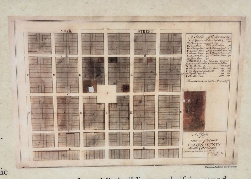
By 1774, Kershaw had laid out the town of Camden on additional land the mercantile partners had acquired here. The town lots Kershaw received, designated in yellow on the 150-acre tract called Pine Tree Hill, became the heart of the early Camden settlement. It contained rectangular lots and public spaces, wide streets and spaces for public buildings and a fair ground. In 1777, when the mercantile company dissolved, Kershaw was deeded specific lots along Wateree Street and on Lyttleton Street. He continued to engage in the mercantile business here under the name of Kershaw & Co.
The town lots Kershaw received, designated in yellow on the 150-acre tract called Pine Tree Hill, became the heart of the early Camden settlement.
Erected by Historic Camden Foundation / Revolutionary War
this page online
Topics. This historical marker is listed in these topic lists: Colonial Era • Industry & Commerce • Settlements & Settlers. A significant historical month for this entry is June 1758.
Location. 34° 13.959′ N, 80° 36.278′ W. Marker is in Camden, South Carolina, in Kershaw County. It can be reached from Broad Street (U.S. 521) 0.1 miles north of Ehreneclou Drive, on the right when traveling north. Located near the parking lot of the Revolutionary War Visitor Center. Touch for map. Marker is at or near this postal address: 212 Broad St, Camden SC 29020, United States of America. Touch for directions.

Regionally, this marker is in the Midlands and in the Olde English District. It is also in the American South and specifically in the Deep South. Globally, it is in North America, the Western Hemisphere, the Western World, and the Anglosphere. Historically, it finds itself in what was once the territory of the Mississippian Culture, one of the original Thirteen Colonies, one of the Confederate States of America, and the Antebellum South.
Other nearby markers. At least 8 other markers are within walking distance
Photographed by Mark Parker, April 7, 2024
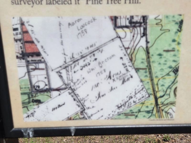
2. Closeup of original survey for William Ancrum of Pine Tree Hill
Located on lower left of the marker.
Courtesy of Camden Archives and Museum
Courtesy of Camden Archives and Museum
Also see . . .
1. Revolutionary War Visitor Center at Camden. (Submitted on July 31, 2024.)
2. Historic Camden Foundation. (Submitted on July 31, 2024.)
Photographed by Mark Parker, April 7, 2024
3. Closeup of Joseph Kershaw's layout of Camden in 1774
Upper center of marker.
Courtesy of Camden Archives and Museum

Photographed by Mark Parker, April 7, 2024
4. Closeup of Camden layout and location of Kershaw and Co. Mercantile
Location lower right of marker
Courtesy of Camden Archives and Museum
Courtesy of Camden Archives and Museum

Photographed by Mark Parker, April 7, 2024
5. Wide view Wateree Street Marker
Dirt path directly behind marker was Wateree Street. Parking lot to the north is off Historical Lane.
Credits. This page was last revised on July 31, 2024. It was originally submitted on July 31, 2024, by Mark Parker of Hickory, North Carolina. This page has been viewed 236 times since then and 41 times this year. Photos: 1, 2, 3, 4, 5. submitted on July 31, 2024, by Mark Parker of Hickory, North Carolina. • Bernard Fisher was the editor who published this page.
