Pasture Point in Hampton, Virginia — The American South (Mid-Atlantic)
Pasture Point
A Transitional Hampton Neighborhood

Photographed by Brandon D Cross
1. Pasture Point Marker
The area bordered on the east by Hampton River and on the north by Bright's Creek became known as "Pasture Track." It was a grazing area for cattle that also encompassed an orchard. During the Revolutionary War, it included several country homes, some of which may have been used as winter quarters for French officers after the British defeat at Yorktown in October 1781.
A reference to "Pasture Point" appears in 1849 deeds. When the Chesapeake & Ohio Railway built a station at the end of Washington Street in the 1880s, a number of distinctive homes began to appear. Hampton's seafood business was booming then, and roads between the port and station thronged with commerce. In the late 1880s, Jefferson Sinclair's Pasture Point Farm was subdivided into lots. Charles Taylor Holtzelaw, who built several Hampton
this page online
It was a typical "streetcar suburb," with a spur that extended from downtown along North King Street. The streetcars turned right on what is now Pembroke Avenue, rambled three blocks along the median, then turned north on Washington Street and ended at the C&O Station. Many of Hampton's most prominent families, blacks and whites, called Pasture Point home. Shopkeepers, ship captains, and others could hop the streetcar, walk, or ride carriages to downtown and the waterfront.
(captions)
The Holtzclaw home, located at 316 Marshall Street. Charles Taylor Holtzclaw built this home for himself. Courtesy of the Hampton History Museum
By the turn of the twentieth century, Pasture Point had become one of the most fashionable neighborhoods in Hampton. Here, young people pose in a "minuet" at the Booker home, on Marshall Street Courtesy of the Hampton History Museum
This streetcar is one of the many streetcars that traveled on the 40 plus miles of track laid out within the cities of Hampton and Newport News. Courtesy of the collection of Gregory Siegel
Erected by Explore
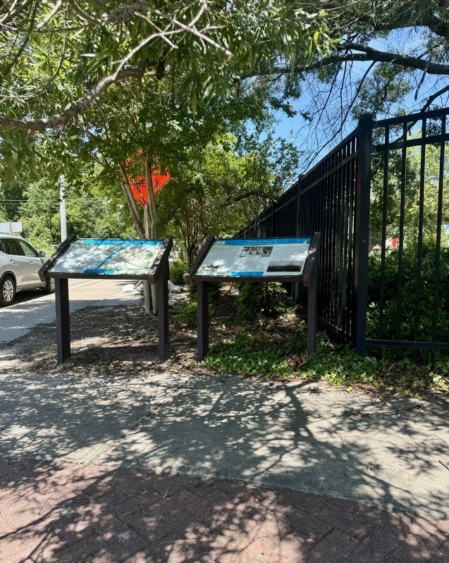
Photographed by Brandon D Cross
2. Pasture Point Marker (right)
Topics. This historical marker is listed in these topic lists: Architecture • Colonial Era • Industry & Commerce • Railroads & Streetcars. A significant historical year for this entry is 1667.
Location. 37° 1.901′ N, 76° 20.341′ W. Marker is in Hampton, Virginia. It is in Pasture Point. It is at the intersection of Park Street and East Pembroke Avenue, on the right when traveling north on Park Street. The marker is located at the entrance to River Park. Touch for map. Marker is in this post office area: Hampton VA 23669, United States of America. Touch for directions.

Regionally, this marker is on Virginia’s Peninsula and in Coastal Virginia. It is also in the American South, specifically in the Upper South, in the Tidewater, and on the Eastern Seaboard. Globally, it is in the North Atlantic Region, North America, the Western Hemisphere, the Western World, and the Anglosphere. Historically, it finds itself in what was once the territory of the Mississippian Culture, one of the original Thirteen Colonies, one of the Confederate States of America, and the Antebellum South.
Other nearby markers. At

Photographed by Brandon D Cross
3. River Street Park sign
Also see . . . Pasture Point Historic District. (Submitted on July 31, 2024, by Brandon D Cross of Flagler Beach, Florida.)
Credits. This page was last revised on July 31, 2024. It was originally submitted on July 31, 2024, by Brandon D Cross of Flagler Beach, Florida. This page has been viewed 349 times since then and 50 times this year. Photos: 1, 2, 3. submitted on July 31, 2024, by Brandon D Cross of Flagler Beach, Florida. • J. J. Prats was the editor who published this page.
