New Town in Mountrail County, North Dakota — The American Midwest (Upper Plains)
Crow Flies High
Mountrail County

Photographed by Barry Swackhamer
1. Crow Flies High Marker
Sunday, April 14, 1805
The expedition found reminders of the hard winter along those section of the Missouri. Clark killed a "meagre" buffalo bull, and near Indian Creek Lewis shot an elk "so poor that it was unfit for use. " But they also saw signs of Spring: "many gees" nesting in the trees, magpies, black-tailed prairie dogs, and at least two bears. Though game was "scarce and shy." Lewis collected "aromatic herbs," such as sage, hyssop, and wormwood. Water "about the color of strong lye" with the "taste of glauber salts and slightly of allumn" trickled from hillside springs. Near their campsite about 14 miles below Sanish townsite on the east bank, Lewis shot a great horned owl.
Tuesday, August 12, 1806
After a month of separation, the expedition re-united in this area of the Missouri. Clark's party, which had defended the Yellowstone River tarried while two men were sent to the previous evening's camp to retrieve a lost tomahawk. While they waited. hunter killed three elk and repaired a hole in a canoe with elk hide. When Lewis' party "hove into sight," Clark "was alarmed" to learn that his partner
this page online
Erected by North Dakota Parks & Recreation Department.
Topics and series. This historical marker is listed in these topic lists: Exploration • Waterways & Vessels. In addition, it is included in the Lewis & Clark Expedition series list. A significant historical date for this entry is August 12, 1806.
Location. 47° 58.931′ N, 102° 32.739′ W. Marker is in New Town, North Dakota, in Mountrail County. It can be reached from State Highway 23 near 2nd Street Northwest. The marker is located at Crow Flies High Historic Site. Touch for map. Marker is in this post office area: New Town ND 58763, United States of America. Touch for directions.

Regionally, this marker is in the Mandan, Hidatsa, and Arikara Nation, and in the Bakken Oil Patch. It is also in the American Lewis & Clark Corridor, on the prairies, and on the Northern Plains. Globally, it is in North America, the Western Hemisphere, the Western World, and the Anglosphere.

Photographed by Barry Swackhamer
2. Crow Flies High Marker Map
Map re-oriented with North at the top.
Other nearby markers. At least 5 other markers are within 14 miles of this marker, measured as the crow flies: The Best of the West (here, next to this marker); Pe-Ri-Tska-Wa-Ku-Re (here, next to this marker); Old Sanish Townsite (a few steps from this marker); White Earth Bay (approx. 13 miles away); Pouch Point Recreation Area (approx. 13.9 miles away in Montana).
More about this marker. Crow Flies High Historic Site is at the end of an unnamed, short road leading north from North Dakota Highway 23.
Photographed by Barry Swackhamer
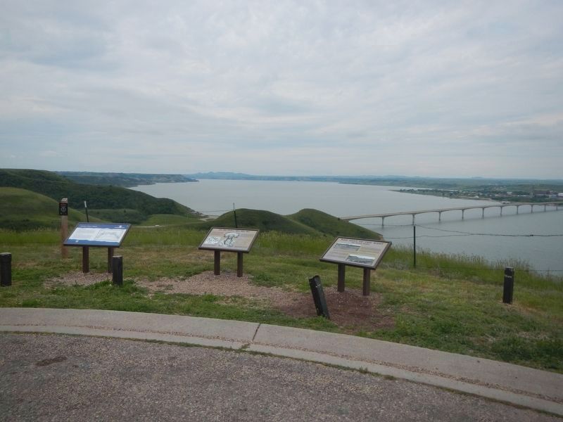
3. Crow Flies High Marker
Marker on the left.
Credits. This page was last revised on July 31, 2024. It was originally submitted on July 31, 2024, by Barry Swackhamer of Brentwood, California. This page has been viewed 163 times since then and 27 times this year. Photos: 1, 2, 3. submitted on July 31, 2024, by Barry Swackhamer of Brentwood, California.
