Near Pensacola in Escambia County, Florida — The American South (South Atlantic)
19th Century Well
Photographed by Connor Olson, July 28, 2024
1. 19th Century Well Marker
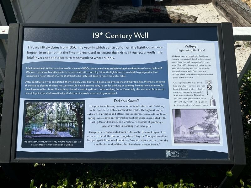
Mechanized well drilling was invented in the early 1800s, but our well was probably dug the old fashioned way - by hand! Workers used shovels and buckets to remove sand, dirt, and clay. Since the lighthouse is on a bluff (a geographic term indicating a rise in elevation), the shaft had to be forty feet deep to reach the water table.
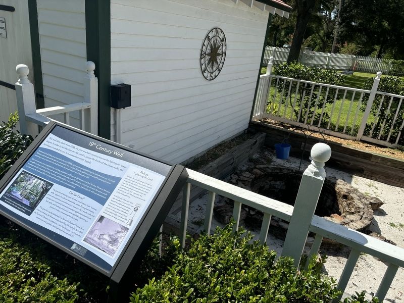
After construction was completed, the well likely would have still been used by keepers and their families. However, because the well is so close to the bay, the water would have been too salty to use for drinking or cooking. Instead, the water would have been used for chores like bathing, laundry, washing dishes, and scrubbing floors. Eventually, the well was abandoned, at which point the shaft was filled with dirt and the walls were cut to ground level.
Did You Know?
The practice of tossing coins, or other small tokens, into "wishing wells" appears in
this page online
This practice can be dated back as far as the Roman Empire. In a letter to a friend, the Roman magistrate Pliny the Younger described the Spring of Clitunno in Umbria as "so clear that you can count the be visited today in the Italian region of Umbria small coins and pebbles that have been thrown into it."
Pulleys: Lightening the Load
We know from archaeological evidence that the keepers and their families hauled water from this well using a bucket and a rope. The 1893 photograph below shows that a fixed pulley was used to draw the bucket from the well. Over time, the friction of the rope left deep grooves on the bricks of the well's rim.
A fixed pulley is the most basic type of pulley. It consists of a rope looped through a wheel which is mounted to an axle suspended from a secure beam. This allows you to use the gravitational force of
Photographed by Connor Olson, July 28, 2024
2. 19th Century Well and Marker
(caption) The Spring of Clitunno, referenced by Pliny the Younger, can still be visited today in the Italian region of Umbria
Erected by Florida Department of State; Florida Council on Arts and Culture.
Topics. This historical marker is listed in this topic list: Man-Made Features. A significant historical year for this entry is 1856.
Location. 30° 20.755′ N, 87° 18.508′ W. Marker is near Pensacola, Florida, in Escambia County. It can be reached from the intersection of Radford Boulevard and San Carlos Road, on the left when traveling west. Touch for map. Marker is at or near this postal address: 2081 Radford Blvd, Pensacola FL 32508, United States of America. Touch for directions.

Regionally, this marker is on the Florida Panhandle. It is also in the American South, specifically in the Deep South, and on the Gulf Coast. Globally, it is in the North Atlantic Region, North America, a Gulf of Mexico state, the Western Hemisphere, the Western World, and the Anglosphere. Historically, it finds itself in what was once New Spain, the territory of the Mississippian Culture, one of the Confederate States of America, and the Antebellum South.
Other nearby markers. At least 8 other markers are within walking distance of this marker: Pump House (here, next to this marker); Carriage House (a few steps from this marker); Keepers’ Quarters (within shouting distance of this marker); Pensacola Lighthouse (within shouting distance of this marker); Lighthouses and Range Markers (within shouting distance of this marker); The Privy (within shouting distance of this marker); Pelicans In Paradise (about 500 feet away, measured in a direct line); USS Antietam (CV-36) Anchor (approx. 0.3 miles away). Touch for a list and map of all markers in Pensacola.
Also see . . . Pensacola Lighthouse and Maritime Museum. (Submitted on July 31, 2024.)
Credits. This page was last revised on July 31, 2024. It was originally submitted on July 31, 2024, by Connor Olson of Menomonee Falls, Wisconsin. This page has been viewed 263 times since then and 38 times this year. Photos: 1, 2. submitted on July 31, 2024, by Connor Olson of Menomonee Falls, Wisconsin. • Bernard Fisher was the editor who published this page.
