
Cambridge in Furnas County, Nebraska — The American Midwest (Upper Plains)
Cambridge Millstone
Photographed by Mark Hilton, July 10, 2024
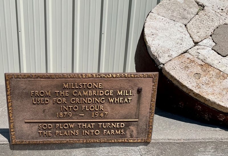
1. Cambridge Millstone Marker
Millstone,
from the Cambridge Mill.
Used for Grinding Wheat into Flour
1879 — 1947
Sod plow that turned the plains into farms.
Topics. This historical marker is listed in this topic list: Agriculture. A significant historical year for this entry is 1879.
Location. 40° 16.945′ N, 100° 10.045′ W. Marker is in Cambridge, Nebraska, in Furnas County. It is on Penn Street north of Nasby Street (U.S. 6), on the right when traveling north. Touch for map. Marker is at or near this postal address: 612 Penn St, Cambridge NE 69022, United States of America. Touch for directions.

Regionally, this marker is in Eastern Nebraska and in the Republican River Valley. It is also in the American Midwest, in the Corn Belt, and on the prairies. Globally, it is in North America, the Western Hemisphere, the Western World, and the Anglosphere. Historically, it finds itself in what was once the Louisiana Purchase.
Other nearby markers. At least 5 other markers are within 9 miles of this marker, measured as the crow flies: Historical Events (a few steps from this marker); In Memory of Pioneer Bohemians (approx. 5.3 miles away);
this page online
Photographed by Mark Hilton, July 10, 2024
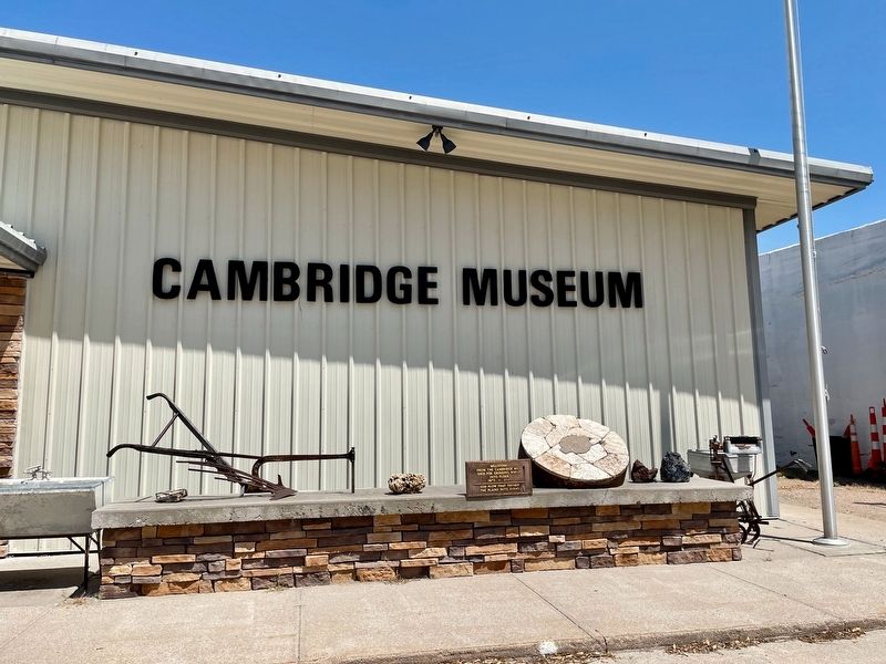
2. Millstone on right, plow on left.
Credits. This page was last revised on July 31, 2024. It was originally submitted on July 31, 2024, by Mark Hilton of Montgomery, Alabama. This page has been viewed 200 times since then and 26 times this year. Photos: 1, 2. submitted on July 31, 2024, by Mark Hilton of Montgomery, Alabama.
