Hampton, Virginia — The American South (Mid-Atlantic)
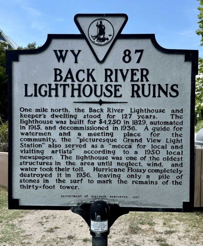
Back River Lighthouse Ruins
Photographed by Brandon D Cross
1. Back River Lighthouse Ruins Marker
Erected 1997 by Department of Historic Resources. (Marker Number WY-87.)
Topics and series. This historical marker is listed in this topic list: Waterways & Vessels. In addition, it is included in the Lighthouses series list. A significant historical year for this entry is 1829.
Location. 37° 4.604′ N, 76° 16.555′ W. Marker is in Hampton, Virginia. It is at the intersection of Beach Road and Lighthouse Drive, on the right when traveling east on Beach Road. Located near the shoreline at the end of Beach Road. Touch for map.
this page online

Regionally, this marker is on Virginia’s Peninsula and in Coastal Virginia. It is also in the American South, specifically in the Upper South, in the Tidewater, and on the Eastern Seaboard. Globally, it is in the North Atlantic Region, North America, the Western Hemisphere, the Western World, and the Anglosphere. Historically, it finds itself in what was once the territory of the Mississippian Culture, one of the original Thirteen Colonies, one of the Confederate States of America, and the Antebellum South.
Other nearby markers. At least 8 other markers are within 3 miles of this marker, measured as the crow flies: Fox Hill (approx. 0.2 miles away); a different marker also named Fox Hill (approx. 0.2 miles away); a different marker also named Fox Hill (approx. 0.2 miles away); a different marker also named Fox Hill (approx. 0.2 miles away); a different marker also named Fox Hill (approx. ¼ mile away); Buckroe Beach (approx. 2.6 miles away); Buckroe (approx. 2.6 miles away); a different marker also named Buckroe Beach
Photographed by Brandon D Cross
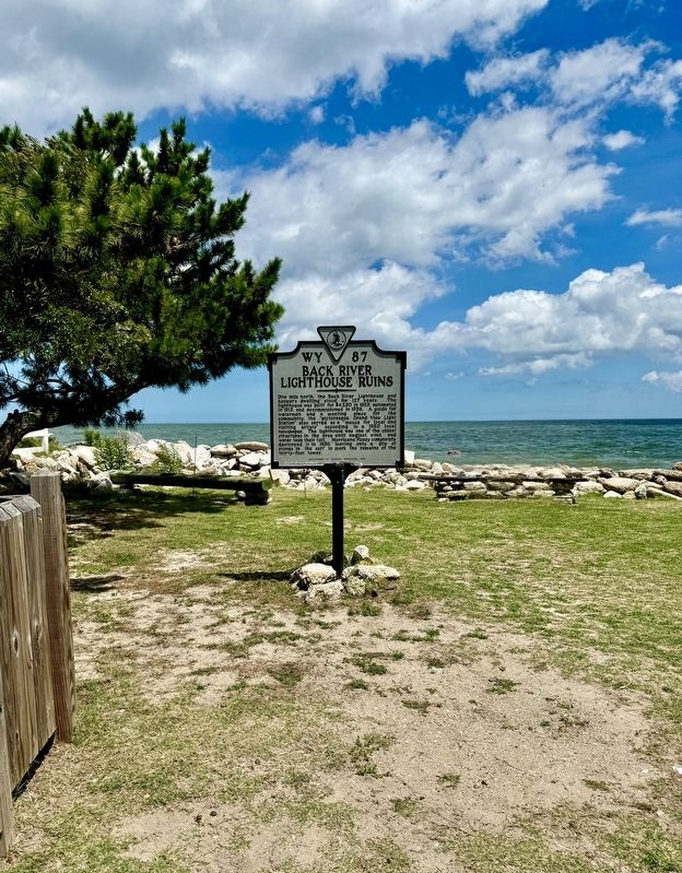
2. Back River Lighthouse Ruins Marker
Also see . . . Back River Light. Wikipedia (Submitted on August 1, 2024.)
Credits. This page was last revised on August 1, 2024. It was originally submitted on July 31, 2024, by Brandon D Cross of Flagler Beach, Florida. This page has been viewed 670 times since then and 139 times this year. Photos: 1, 2. submitted on July 31, 2024, by Brandon D Cross of Flagler Beach, Florida. • Bernard Fisher was the editor who published this page.
