Circle in McCone County, Montana — The American West (Mountains)
McCone County
Photographed by Cosmos Mariner, July 2, 2024
1. McCone County Marker
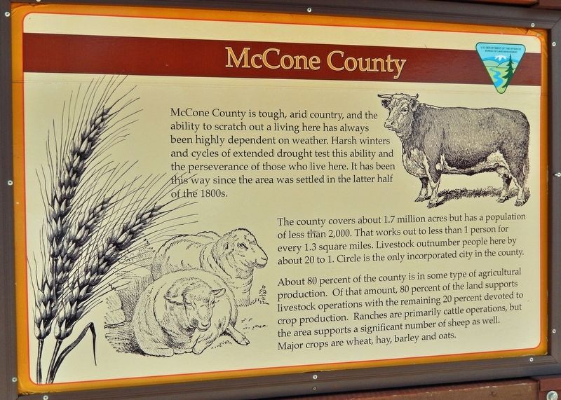
McCone County is tough, arid country, and the ability to scratch out a living here has always been highly dependent on weather. Harsh winters and cycles of extended drought test this ability and the perseverance of those who live here. It has been this way since the area was settled in the latter half of the 1800s.
The county covers about 1.7 million acres but has a population of less than 2,000. That works out to less than 1 person for every 1.3 square miles. Livestock outnumber people here by about 20 to 1. Circle is the only incorporated city in the county.
About 80 percent of the county is in some type of agricultural production. Of that amount, 80 percent of the land supports livestock operations with the remaining 20 percent devoted to crop production. Ranches are primarily cattle operations, but the area supports a significant number of sheep as well. Major crops are wheat, hay, barley, and oats.
Erected by U.S. Department of the Interior, Bureau of Land Management.
Topics. This historical marker is listed in these topic lists: Agriculture • Animals • Settlements & Settlers.
Location. 47° 24.65′ N,
this page online

Regionally, this marker is in the American Mountain West, in the Lewis & Clark Corridor, on the prairies, on the Great Plains, and specifically on the Northern Plains. Globally, it is in North America, the Western Hemisphere, the Western World, and the Anglosphere. Historically, it finds itself in what was once Rupert’s Land and also the Louisiana Purchase.
Other nearby markers. At least 4 other markers are within 12 miles of this marker, measured as the crow flies: McCone County Veterans Memorial (a few steps from this marker); Circle (within shouting distance of this marker); Northern Pacific Railroad in Redwater Valley (within shouting distance of this marker); Brockway, Montana (approx. 11.1 miles away).
Also see . . . History of Circle and McCone County (by Polly Wischmann).
Photographed by Cosmos Mariner, July 2, 2024
2. McCone County Marker
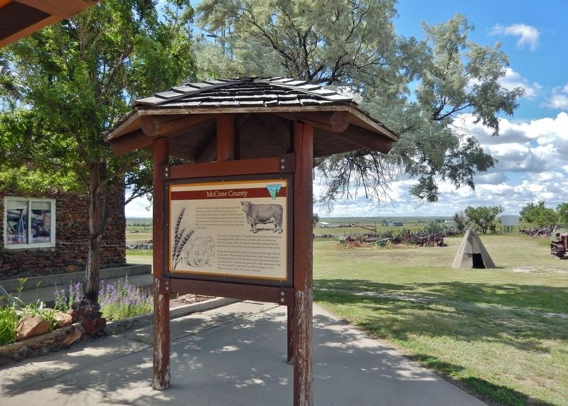
The marker is mounted on this kiosk in front of the McCone County Museum.
In 1882 the Texas longhorn appeared on the scene. Capital Syndicate (XIT), who owned 10 counties in Texas, ran cattle around the Redwater River until 1915. The Homestead Law in 1862 gave the "squatters" right to file claim on the land which they occupied. "Dry-farming" became an important factor after 1900. Thousands of people of every class, color and creed came filed on homesteads. The peak of this movement was reached in 1910 and they settled in tarpaper shacks, sod houses, dugouts, etc. Many of the early settlers were the same cowboys who once rode and worked for the big ranches. Circle moved to its present location when the Great Northern platted this as a townsite in 1914. In 1919 this county was created and named after George McCone, who was senator of Dawson County. In 1928, there was another influx of settlers who came when the Northern Pacific built a branch line to Brockway. In the 1950's oil was discovered in the county and there has been activity in that field since.(Submitted on August 1, 2024, by Cosmos Mariner of Cape Canaveral, Florida.)
Credits. This page was last revised on August 1, 2024. It was originally submitted on August 1, 2024, by Cosmos Mariner of Cape Canaveral, Florida. This page has been viewed 289 times since then and 19 times this year. Photos: 1, 2. submitted on August 1, 2024, by Cosmos Mariner of Cape Canaveral, Florida.
