Amity Township near Douglassville in Berks County, Pennsylvania — The American Northeast (Mid-Atlantic)
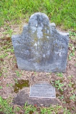
James Warren
Photographed by William Fischer, Jr., July 4, 2009
1. James Warren Marker
April 7, 1776
Early settler and
builder
Village once known
as Warrensburg
Topics. This historical marker is listed in these topic lists: Cemeteries & Burial Sites • Religion & Religious Structures • Settlements & Settlers. A significant historical month for this entry is April 1888.
Location. 40° 15.417′ N, 75° 43.777′ W. Marker is near Douglassville, Pennsylvania, in Berks County. It is in Amity Township. It can be reached from Benjamin Franklin Highway. Marker is at his gravesite, next to that of his maternal grandfather, Anthony Sadowski, near the southwest (rear) boundary of St. Gabriel Church cemetery, 1188 Benjamin Franklin Highway (US Route 422). Touch for map. Marker is in this post office area: Douglassville PA 19518, United States of America. Touch for directions.

Regionally, this marker is in Southeast Pennsylvania and specifically in Pennsylvania Dutch Country. It is also in the American Northeast and in the Mid-Atlantic. Globally, it is in North America, the Western Hemisphere, the Western World, and the Anglosphere. Historically, it finds itself in what was once the Haudenosaunee (Iroquois) Confederacy and also one of the original Thirteen Colonies.
Other nearby markers. At least 8 other markers are within walking distance of this marker: Anthony Sadowski (here, next to this marker); William Bird, Esq. (within shouting distance of this marker); The Douglass Family (within shouting distance of this marker); St. Gabriels (about 300 feet away, measured in a direct line); a different marker also named Anthony Sadowski (about 300 feet away); Feuding Railroads (approx. 0.2 miles away); Mouns Jones House (approx. ¼ mile away); Riverside Settlement and the Covered Bridge (approx. ¼ mile away). Touch for a list and map of all markers in Douglassville.
Also see . . . Mention of James Warren in Sadowski Biography.
this page online
Photographed by William Fischer, Jr., July 4, 2009
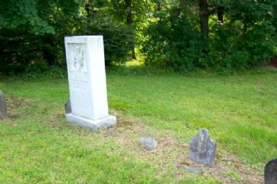
2. James Warren Marker
On ground at right; large marker to left is for his grandfather, Anthony Sadowski.
Photographed by William Fischer, Jr., July 4, 2009
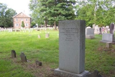
3. James Warren Marker
View from marker toward St. Gabriel's Church (c.1801), which front US Route 422.
Credits. This page was last revised on February 7, 2023. It was originally submitted on December 8, 2009, by William Fischer, Jr. of Reynoldsburg, Ohio. This page has been viewed 1,023 times since then and 22 times this year. Photos: 1, 2, 3. submitted on December 8, 2009, by William Fischer, Jr. of Reynoldsburg, Ohio.
