Hanover in Washington County, Kansas — The American Midwest (Upper Plains)
Transportation
Photographed by Jeremy Snow, July 19, 2024
1. Transportation Marker
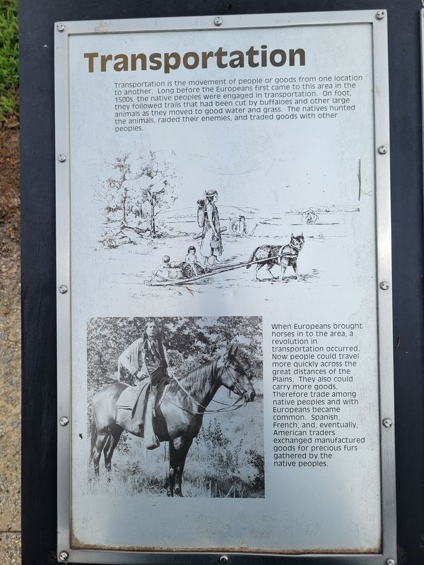
Transportation is the movement of people or goods from one location to another. Long before the Europeans first came to this area in the 1500s, the native peoples were engaged in transportation. On foot they followed trails that had been cut by buffaloes and other large animals as they moved to good water and grass. The natives hunted the animals, raided their enemies, and traded goods with other peoples.
When Europeans brought horses in to the area, a revolution in transportation occurred. Now people could travel more quickly across the great distances of the Plains. They also could carry more goods. Therefore trade among native peoples and with Europeans became common. Spanish, French, and, eventually, American traders exchanged manufactured goods for precious furs gathered by the native peoples.
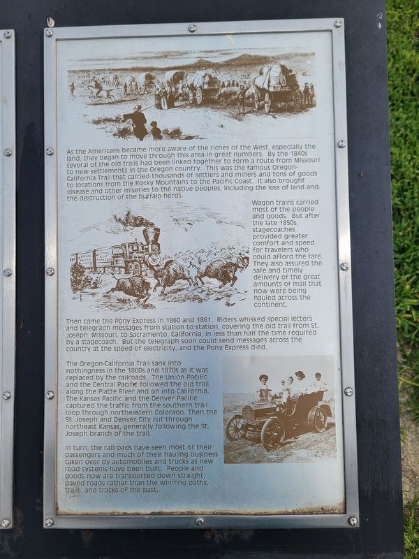
As the Americans became more aware of the riches of the West, especially the land, they began to move through this area in great numbers. By the 1840s several of the old trails had been linked together to form a route from Missouri to new settlements in the Oregon country. This was the famous Oregon- California Trail
this page online
Wagon trains carried most of the people and goods. But after the late 1850s, stagecoaches provided greater comfort and speed for travelers who could afford the fare. They also assured the safe and timely delivery of the great amounts of mail that now were being hauled across the continent.
Then came the Pony Express in 1860 and 1861. Riders whisked special letters and telegraph messages from station to station, covering the old trail from St. Joseph, Missouri, to Sacramento, California, in less than half the time required by a stagecoach. But the telegraph soon could send messages across the country at the speed of electricity, and the Pony Express died.
The Oregon-California Trail sank into nothingness in the 1860s and 1870s as it was replaced by the railroads. The Union Pacific and the Central Pacific followed the old trail along the Platte River and on into California.
Photographed by Jeremy Snow, July 19, 2024
2. Transportation Marker
In turn, the railroads have seen most of their passengers and much of their hauling business taken over by automobiles and trucks as new road systems have been built. People and goods now are transported down straight, paved roads rather than the winding paths, trails, and tracks of the past.
Topics and series. This historical marker is listed in this topic list: Roads & Vehicles. In addition, it is included in the California Trail, and the Pony Express National Historic Trail series lists.
Location. 39° 54.049′ N, 96° 50.643′ W. Marker is in Hanover, Kansas, in Washington County. It can be reached from Big Bear Road. Touch for map. Marker is at or near this postal address: 2307 Big Bear Rd, Hanover KS 66945, United States of America. Touch for directions.

Regionally, this marker is in Eastern Kansas. It is also in the American Midwest,
Photographed by Jeremy Snow, July 19, 2024
3. Transportation Marker
Other nearby markers. At least 8 other markers are within 5 miles of this marker, measured as the crow flies: Points of Interest (here, next to this marker); Hollenberg Station and Transportation (here, next to this marker); Hollenberg Ranch Pony Express Station (within shouting distance of this marker); Camping Along the Trail (about 300 feet away, measured in a direct line); Hollenberg Pony Express Station (about 800 feet away); Trail Junction (approx. 2.9 miles away); Wagons Merge on the Prairie (approx. 2.9 miles away); Hollenberg Ranch and the Pony Express (approx. 4.1 miles away). Touch for a list and map of all markers in Hanover.
Credits. This page was last revised on August 3, 2024. It was originally submitted on August 2, 2024, by Jeremy Snow of Cedar City, Utah. This page has been viewed 172 times since then and 23 times this year. Photos: 1, 2, 3. submitted on August 2, 2024, by Jeremy Snow of Cedar City, Utah. • J. Makali Bruton was the editor who published this page.
