Near Pensacola in Escambia County, Florida — The American South (South Atlantic)
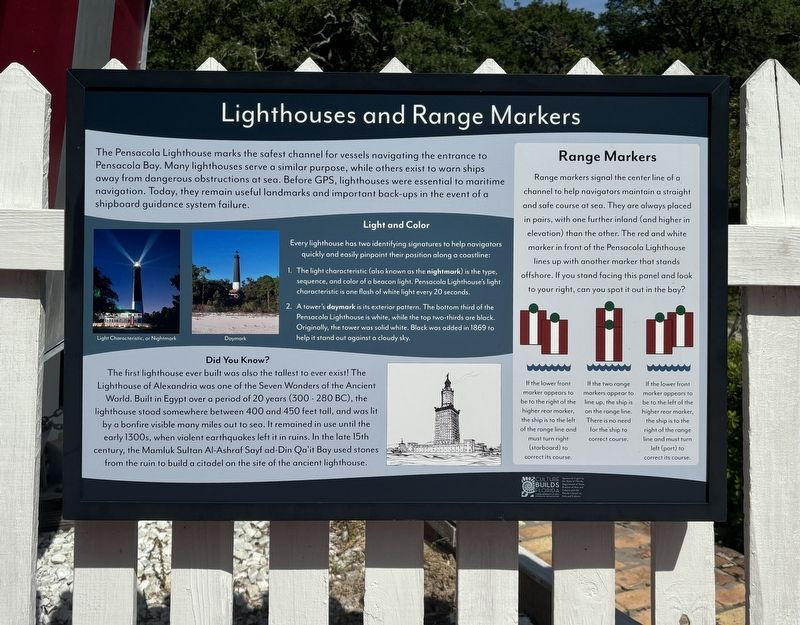
Lighthouses and Range Markers
Photographed by Connor Olson, July 28, 2024
1. Lighthouses and Range Lights Marker
Light and Color
Every lighthouse has two identifying signatures to help navigators quickly and easily pinpoint their position along a coastline:
1. The light characteristic (also known as the nightmark) is the type, sequence, and color of a beacon light. Pensacola Lighthouse's light characteristic is one flash of white light every 20 seconds.
2. A tower's daymark is its exterior pattern. The bottom third of the Pensacola Lighthouse is white, while the top two-thirds are black. Originally, the tower was solid white. Black was added in 1869 to help it stand out against a cloudy sky.
Did You Know?
The first lighthouse ever built was also the tallest to ever exist! The Lighthouse of Alexandria was one of the Seven Wonders of
this page online
Range Markers
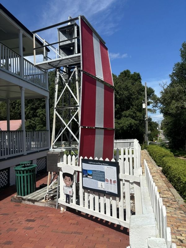
Range markers signal the center line of a channel to help navigators maintain a straight and safe course at sea. They are always placed in pairs, with one further inland (and higher in elevation than the other. The red and white marker in front of the Pensacola Lighthouse lines up with another marker that stands offshore. If you stand facing this panel and look to your right, can you spot it out in the bay?
(captions)
If the lower front marker appears to be to the right of the higher rear marker, the ship is to the left of the range line and must turn right (starboard) to correct its course.
If the two range markers appear to line up, the ship is on the range line. There is no need for the ship to correct course.
If the lower front marker appears to be to the left of the higher rear marker, the ship is to the right of the range line and must turn left (port) to correct its course.
Erected by Florida
Photographed by Connor Olson, July 28, 2024
2. Range Markers and marker
Topics and series. This historical marker is listed in these topic lists: Communications • Waterways & Vessels. In addition, it is included in the Lighthouses series list.
Location. 30° 20.754′ N, 87° 18.486′ W. Marker is near Pensacola, Florida, in Escambia County. It can be reached from the intersection of Radford Boulevard and San Carlos Road, on the left when traveling west. Touch for map. Marker is at or near this postal address: 2081 Radford Blvd, Pensacola FL 32508, United States of America. Touch for directions.

Regionally, this marker is on the Florida Panhandle. It is also in the American South, specifically in the Deep South, and on the Gulf Coast. Globally, it is in the North Atlantic Region, North America, a Gulf of Mexico state, the Western Hemisphere, the Western World, and the Anglosphere. Historically, it finds itself in what was once New Spain, the territory of the Mississippian Culture, one of the Confederate States of America, and the Antebellum South.
Other nearby markers. At least 8 other markers are within walking distance of this marker: Keepers’ Quarters (a few steps from this marker); Pensacola Lighthouse (a few steps from this marker); 19th Century Well (within shouting distance of this marker); The Privy (within shouting distance of this marker); Pump House (within shouting distance of this marker); Carriage House (within shouting distance of this marker); Pelicans In Paradise (about 500 feet away, measured in a direct line); USS Antietam (CV-36) Anchor (approx. 0.3 miles away). Touch for a list and map of all markers in Pensacola.
Also see . . . Pensacola Lighthouse and Maritime Museum. (Submitted on August 4, 2024.)
Credits. This page was last revised on August 4, 2024. It was originally submitted on August 3, 2024, by Connor Olson of Menomonee Falls, Wisconsin. This page has been viewed 210 times since then and 41 times this year. Photos: 1, 2. submitted on August 3, 2024, by Connor Olson of Menomonee Falls, Wisconsin. • Bernard Fisher was the editor who published this page.
