Clarksburg in Harrison County, West Virginia — The American South (Appalachia)
Clarksburg Defenses
Protecting the Town and Railroad
| — | Jones-Imboden Raid | — |
Photographed by Don Morfe, August 1, 2012
1. Clarksburg Defenses Marker
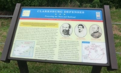
The trenches here and on Pinnicinick Hill were constructed for the protection of Clarksburg and the vital North Western Virginia Railroad. The line ran west from Grafton, where it joined the Baltimore and Ohio Railroad, through Clarksburg to Parkersburg. On May 30, 1861, three companies of the 14th Ohio Infantry arrived in Clarksburg by train from Ohio, the first Union troops to do so. The 8th Indiana Infantry soon arrived and on Jun 19 began to help build fortifications on Lowndes and Pinnicinick Hills. The soldiers did not live in the
this page online
When in April 1863 Confederate Gen. William E. “Grumble” Jones and Gen. John D. Imboden raided present-day West Virginia, Jones approached Clarksburg from the north and Imboden from the east. Approximately 5,000 Union troops in the area retreated to the relative safety of Clarksburg’s fortifications. The commanding general, Benjamin S. Roberts, sent out a cavalry company on a reconnaissance but otherwise made no effort to attack the Confederates. Jones, finding the defenses of Clarksburg too strong, moved on to Bridgeport, where his men burned two railroad bridges and destroyed a locomotive.
(captions)
West Virginia Railroads and Turnpike
Gen. William E. Jones Courtesy West Virginia State Archives
Gen. John D. Imboden Courtesy Library of Congress
Gen. Benjamin S. Roberts Courtesy Library of Congress
Jones-Imboden Raid
Erected by West Virginia Civil War Trails.
Topics and series. This historical marker is listed in this topic list: War, US Civil. In
Photographed by Bradley Owen, November 6, 2025
2. Clarksburg Defenses Marker
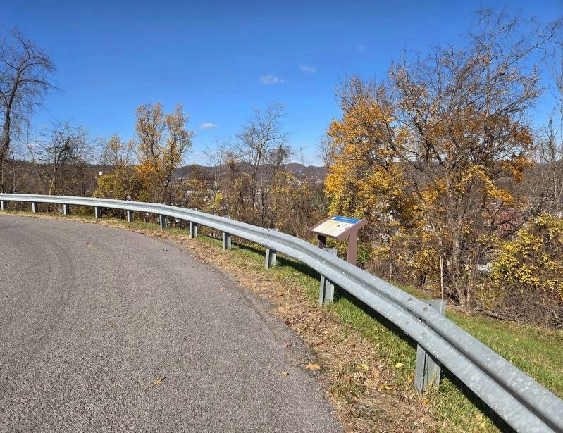
Location. 39° 16.502′ N, 80° 20.417′ W. Marker is in Clarksburg, West Virginia, in Harrison County. It is on Kiwanis Drive 0.2 miles north of South 2nd Street, on the left when traveling east. The marker is located in Lowndes Park. Touch for map. Marker is in this post office area: Clarksburg WV 26301, United States of America. Touch for directions.

Regionally, this marker is in the Little Kanawha Valley. It is also in the American South, specifically in the Upper South, in Appalachia, and specifically in Northern Appalachia. Globally, it is in North America, the Western Hemisphere, the Western World, and the Anglosphere. Historically, it finds itself in what was once the territory of the Mississippian Culture.
Other nearby markers. At least 8 other markers are within walking distance of this marker: John W. Davis (approx. ¼ mile away); Kelly Miller School (approx. ¼ mile away); Ethel L. Hart (approx. ¼ mile away); Kelly Miller (approx. ¼ mile away); The Immigrants (approx. 0.3 miles away); Veterans Memorial
Photographed by Don Morfe, August 1, 2012
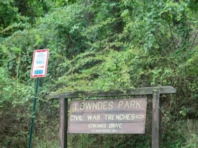
3. Park Entrance Sign
Another marker is no longer nearby. U.S.S. West Virginia Bow Flag Staff (was approx. ¼ mile away but has been permanently removed).
Credits. This page was last revised on November 8, 2025. It was originally submitted on August 24, 2012, by Don Morfe of Baltimore, Maryland. This page has been viewed 1,819 times since then and 77 times this year. Last updated on August 4, 2024, by Carl Gordon Moore Jr. of North East, Maryland. Photos: 1. submitted on August 24, 2012, by Don Morfe of Baltimore, Maryland. 2. submitted on November 8, 2025, by Bradley Owen of Morgantown, West Virginia. 3. submitted on September 1, 2012, by Don Morfe of Baltimore, Maryland. • Bernard Fisher was the editor who published this page.
