Monroe in Fairfield County, Connecticut — The American Northeast (New England)
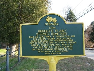
Birdsey’s Plain / Stepney Cemetery
1794
Birdsey’s Plain /
Stepney Cemetery
Erected by Monroe Rotary Club.
Topics and series. This historical marker is listed in this topic list: Cemeteries & Burial Sites. In addition, it is included in the Rotary International series list. A significant historical year for this entry is 1794.
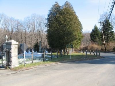
Location. 41° 19.305′ N, 73° 15.793′ W. Marker is in Monroe, Connecticut, in Fairfield County. Marker is at the intersection of Pepper Street and Green Street, on the right when traveling north on Pepper Street. Located next to the Stepney Green. Touch for map. Marker is in this post office area: Monroe CT 06468, United States of America. Touch for directions.
Other nearby markers. At least 8 other markers are within 2 miles of this marker, measured as the crow flies. Birdsey’s Plain Methodist Church (within shouting distance of this marker); Birdsey’s Plain Stepney Baptist Church (about 300 feet away, measured in a direct line); Original Bell of Stepney Baptist Church (about 300 feet away); Monroe World War I Memorial (about 400 feet away); Burr Hawley & Burritt General Store (about 600 feet away); Bridgeport / Newtown Turnpike (approx. 0.4 miles away); Stepney Schoolhouse (approx. 1.3 miles away); Stepney Fire House #1 (approx. 1.6 miles away). Touch for a list and map of all markers in Monroe.
Also see . . . Birdsey’s Plain / Stepney Cemetery. (Submitted on December 10, 2009, by Michael Herrick of Southbury, Connecticut.)
Additional commentary.
1. Stepney Marker
The Birdsley's Plain/Stepney Cemetery Marker was funded by the Monroe Rotary Club. This is one of 18 markers located throughout the village of Stepney, CT which is part of the Town of Monroe, CT. The markers collectively make up the Stepney Heritage Trail, which was researched and designed by the Save Our Stepney Task Force, organize in May of 2001 dedicated to the preservation and beautification of the village of Stepney. For a full list of sites go to www.stepneyct.org. Note To Editor only visible by Contributor and editor
— Submitted April 20, 2012, by Joel Leneker of Stepney, Connecticut.
Credits. This page was last revised on June 16, 2016. It was originally submitted on December 10, 2009, by Michael Herrick of Southbury, Connecticut. This page has been viewed 1,328 times since then and 16 times this year. Photos: 1, 2. submitted on December 10, 2009, by Michael Herrick of Southbury, Connecticut. • Bill Pfingsten was the editor who published this page.

