Jumping Branch in Summers County, West Virginia — The American South (Appalachia)
Camp Green Meadows
⎯⎯⎯
The Burning of Jumping Branch

Photographed by Dave W, August 4, 2024
1. Camp Green Meadows side of marker
Camp Green Meadows
Near here, July 13 ~ August 15, 1862, was encampment of the 23rd Ohio Volunteer Infantry under future US President Rutherford B. Hayes. The camp's strategic location near the Bluestone and New rivers enabled the 23rd Ohio to mount a successful defense of Pack's Ferry from 900 attacking Confederates on August 6, as well as launch a raid on the Mercer Salt Works on August 10.
The Burning of Jumping Branch
On February 8, 1862, Confederate troops abandoned their camp at Jumping Branch as elements of the 23rd Ohio Infantry advanced on the position. After a skirmish at the mouth of the Bluestone, the rebels managed to escape across the New River. Returning to the village of Jumping Branch, the Union troops burned the church, houses, and many other surrounding structures.
Erected 2022 by Summers County Historical Society; West Virginia Archives & History.
Topics. This historical marker is listed in this topic list: War, US Civil. A significant historical date for this entry is February 8, 1862.
Location. 37° 38.956′ N, 80° 57.967′ W. Marker is in Jumping Branch, West Virginia, in Summers County. It is on Beech
this page online

Regionally, this marker is in the Southern Coalfields. It is also in the American South, specifically in the Upper South, in Appalachia, and specifically in Southern Appalachia. Globally, it is in North America, the Western Hemisphere, the Western World, and the Anglosphere. Historically, it finds itself in what was once the territory of the Mississippian Culture.
Other nearby markers. At least 8 other markers are within 5 miles of this marker, measured as the crow flies: Giles, Fayette & Kanawha Turnpike (approx. 2.8 miles away); Raleigh County / Summers County (approx. 2.9 miles away); Lilly (approx. 3.6 miles away); Follow the River to Freedom (approx. 3.6 miles away); Lilly Bridge (approx. 3.7 miles away); Pack's Ferry (approx. 3.8 miles away); Status of Construction (approx. 4.3 miles away); Summers County (approx. 4.4 miles away).

Photographed by Dave W, August 4, 2024
2. The Burning of Jumping Branch side of marker
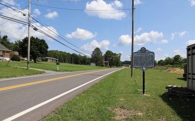
Photographed by Dave W, August 4, 2024
3. Camp Green Meadows / The Burning of Jumping Branch Marker
Credits. This page was last revised on August 22, 2024. It was originally submitted on August 5, 2024, by Dave W of Co, Colorado. This page has been viewed 824 times since then and 119 times this year. Photos: 1, 2, 3. submitted on August 5, 2024, by Dave W of Co, Colorado. • Bernard Fisher was the editor who published this page.
