Near Union in Monroe County, West Virginia — The American South (Appalachia)
Confederate Postal Service
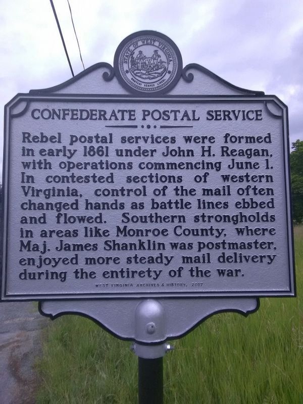
Photographed by Roger Miller, June 11, 2018
1. Confederate Postal Service Marker
Erected 2017 by West Virginia Archives & History.
Topics and series. This historical marker is listed in these topic lists: Communications • War, US Civil. In addition, it is included in the Postal Mail and Philately, and the West Virginia Archives and History series lists. A significant historical date for this entry is June 1, 1861.
Location. 37° 34.241′ N, 80° 34.292′ W. Marker is near Union, West Virginia, in Monroe County. It is on Seneca Trail South (U.S. 219) south of Kountz Road, on the right when traveling south. Touch for map. Marker is at or near this postal address: 22023 Seneca Trail S, Union WV 24983, United States of America. Touch for directions.

Regionally, this marker is in the Southern Coalfields. It is also in the American South,
this page online
Other nearby markers. At least 8 other markers are within 2 miles of this marker, measured as the crow flies: Big Lime (approx. 1.2 miles away); Early History of the Area (approx. 1.7 miles away); Lord Dunmore's War (approx. 1.7 miles away); Seneca Trail or Warriors Path (approx. 1.7 miles away); Chapman House (approx. 2 miles away); Monroe Garden Club (approx. 2.1 miles away); William Porcher Miles (approx. 2.1 miles away); General John Echols (approx. 2.1 miles away). Touch for a list and map of all markers in Union.
Another marker is no longer nearby. Salt Sulphur (was within shouting distance of this marker but has been confirmed missing).
More about this marker. The marker has been moved 3.5 miles south of its original location (37.60016N, -80.54036).
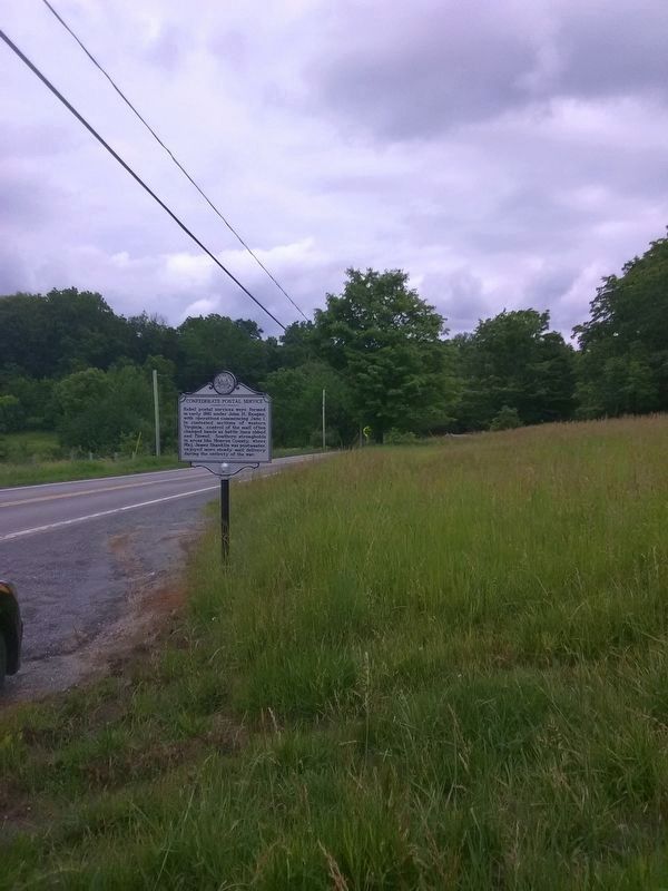
Photographed by Roger Miller, June 11, 2018
2. Confederate Postal Service Marker (original location)
Credits. This page was last revised on August 5, 2024. It was originally submitted on June 11, 2018, by Roger Miller of Pulaski, Virginia. This page has been viewed 816 times since then and 54 times this year. Last updated on August 5, 2024, by Dave W of Co, Colorado. Photos: 1, 2. submitted on June 11, 2018, by Roger Miller of Pulaski, Virginia. • Bernard Fisher was the editor who published this page.
