Near Union in Monroe County, West Virginia — The American South (Appalachia)
Salt Sulphur
Photographed by Don Morfe, August 6, 2012
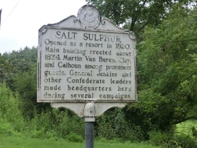
1. Salt Sulphur Marker
Inscription. Opened as a resort in 1820. Main building erected about 1823. Martin Van Buren, Clay, and Calhoun among prominent guests. General Jenkins and other Confederate leaders made headquarters here during several campaign.
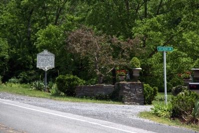
Location. Marker has been reported missing. It was located near 37° 34.26′ N, 80° 34.26′ W. Marker was near Union, West Virginia, in Monroe County. It was at the intersection of Koontz Road (U.S. 219) and County Route 10/5, on the left when traveling south on Koontz Road. Touch for map. Marker was at or near this postal address: 22049 Seneca Trail S, Union WV 24983, United States of America. Touch for directions.
Regionally, this marker was in the Southern Coalfields. It was also in the American South, specifically in the Upper South, in Appalachia, and
Click or scan to see this page online
specifically in Southern Appalachia. Globally, it was in North America, the Western Hemisphere, the Western World, and the Anglosphere. Historically, it found itself in what was once the territory of the Mississippian Culture.
War, Salt Sulphur regained some of its
former popularity after 1882. The book on West Virginia published by
the West Virginia Commission of the Louisiana Purchase Exposition in 1904 gives the following account of Salt Sulphur:
“ ‘The Salt Sulphur Springs on Indian creek,
near the town of Union in Monroe County, have
been for many years a favorite resort. They are
surrounded by beautiful mountain scenery and are
reached by driving over a splendid road fourteen
miles from Fort Spring Station on the Chesapeake
and Ohio Railway. In addition to the Salt Sulphur
Springs, there is an Iodine Spring, a Sweet Sulphur
Spring, and a Chalybeate Spring; thus affording an
opportunity for a variety of treatment, but it is
not so much a resort for invalids as for those who
desire rest and recreation.
“ ‘The “Old Salt” is like a hospitable manor of
the old regime; with its beautiful park through
which, under magnificent forest trees, a clear
stream flows. On the wide porches of its spacious,
comfortable, and substantial buildings, the days
are always cool.
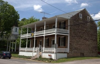
“ ‘The hotel and cottages are built of stone, and
contain roomy and
Photographed by Don Morfe, August 6, 2012
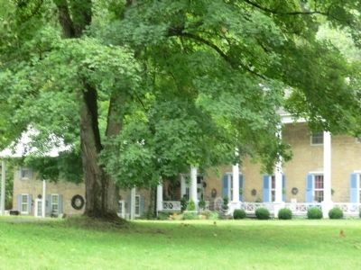
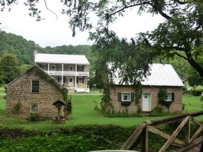
3. Old Salt Sulphur Spring Resort, now a private residence
comfortable apartments, nicely
furnished and easy of access. The wide and lofty
ball room, with its splendid floor, is a superb
place for dancing. A neat little stage, with
several sets of scenery and a large assortment of
costumes, is always ready for amateur theatricals...
Adjoining it, are eleven acres of most beautiful
lawn. The elevation is two thousand feet above
sea level.’ ” (Submitted on June 3, 2015.)
Photographed by Don Morfe, August 6, 2012
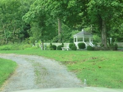
4. The Former Salt Sulphur Spring Resort
Photographed by Don Morfe, August 6, 2012
5. The Former Salt Sulphur Spring Resort
Photographed by J. J. Prats, May 30, 2015
6. Stone Store Building (1820) hides the adjacent Stone Church (c. 1836)
Credits. This page was last revised on August 6, 2024. It was originally submitted on September 7, 2012, by Don Morfe of Baltimore, Maryland. This page has been viewed 1,246 times since then and 27 times this year. Last updated on August 5, 2024, by Dave W of Co, Colorado. Photos:1. submitted on September 7, 2012, by Don Morfe of Baltimore, Maryland. 2. submitted on June 3, 2015, by J. J. Prats of Powell, Ohio. 3, 4, 5. submitted on September 7, 2012, by Don Morfe of Baltimore, Maryland. 6. submitted on June 3, 2015, by J. J. Prats of Powell, Ohio. • Devry Becker Jones was the editor who published this page.