Medical Mile in Grand Rapids in Kent County, Michigan — The American Midwest (Great Lakes)
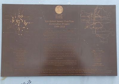
Combined Sewer Overflow Elimination Project
1989-2015
Photographed by Joel Seewald, April 5, 2024
1. Combined Sewer Overflow Elimination Project Marker
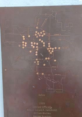
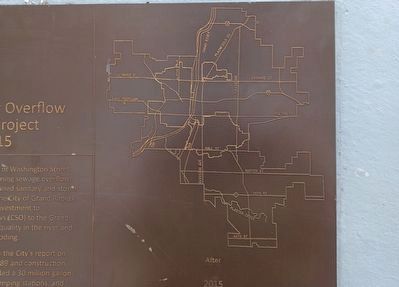
On July 13, 2015, at the intersection of Washington Street and Lafayette Avenue, the last remaining sewage overflow point in an antiquated system of combined sanitary and storm sewers was sealed. With this action, the City of Grand Rapids completed a $400 million investment to eliminate combined sewage overflows (CSO) to the Grand River, while also improving the water quality in the river and reducing localized flooding.
The CSO project was first outlined in the City's report on Combined Sewer System Study in 1989 and construction began in 1991. The investments included a 30 million gallon retention basin, two stormwater pumping stations, and approximately 120 miles of pipelines, constructed over a six square mile area of the City. Green infrastructure was also extensively implemented and complete neighborhoods were rebuilt. Overflows to the Grand River averaged 10 billion gallons each year prior to the start of this program and are now 0 gallons.
This plaque commemorates the commitment of City leaders, our residents, rate payers, and City staff, which led to completion of this investment in the water quality of
this page online
Elected Officials
Mayor Gerald R. Helmholdt
William Blickley
George Bowman
James Kozak
Lewis A. Meriweather
Linda Samuelson
Sharon Worst
City Manager
Kurt F. Kimball
2015
Elected Officials
Mayor George Heartwell
Rosalynn Bliss
Walt Gutowski
Ruth E. Kelly
Senita Lenear
Elias Lumpkins, Jr.
Dave Shaffer
City Manager
Gregory A. Sundstron
Contributing Elected Officials: Mayor John H. Logie, Eric Williams, Roy Schmidt, M. Scott Bowen, David LaGrand, Richard Tormala, James Jendrasiak, Lynn Rabaut, Robert Dean, and James White.
Contributing City Staff: Tiiu Arrak, John Brom, Judy Bouma, Chris Barfuss, Bill Cole, P.E., Mark DeClercq, P.E., Eric DeLong, Rick DeVries, P.E., Thomas Ecklund, Randall Fisher, Bernard Gumbis, John Hayes, Dianette Hight, Jack Hornbach, P.E., Tracy Hover, Wayne Jernberg, P.E., Karl Koster, P.E., Mike Lunn, Jeff McCaul, P.E., Charles Schroeder, P.E., Darryl Smith, Robert Spry, P.E., Joellen Thompson, P.E., Vaughn Umphrey, Robert White
Plaque donated by CSO consultant team of Black & Veatch, Fishbeck Thompson Carr & Huber, and Materials
Photographed by Joel Seewald, April 5, 2024
2. Combined Sewer Overflow Elimination Project Marker - top left image (Before)
Erected by City of Grand Rapids.
Topics. This historical marker is listed in these topic lists: Charity & Public Work • Environment. A significant historical date for this entry is July 13, 2015.
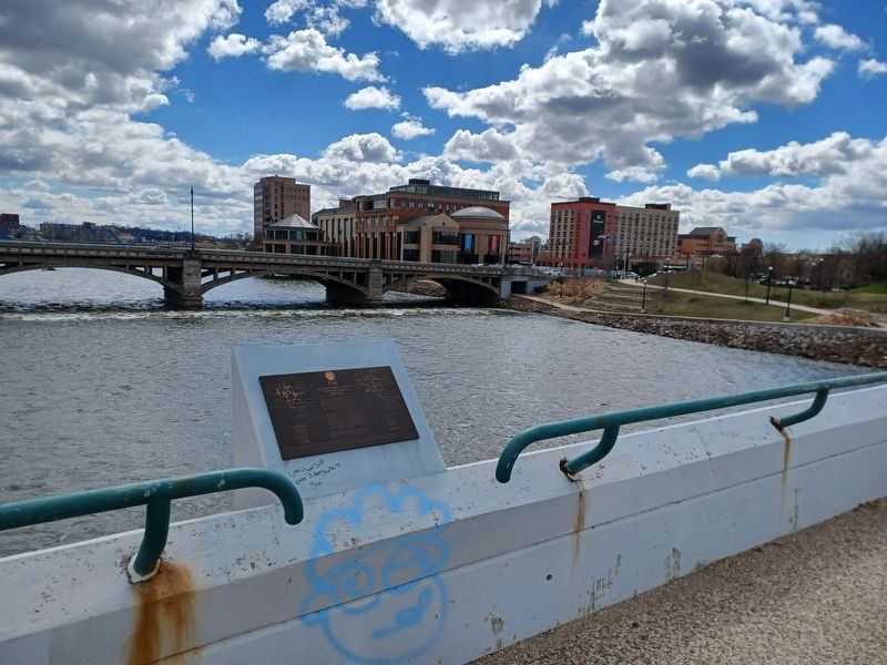
Location. 42° 58.051′ N, 85° 40.514′ W. Marker is in Grand Rapids, Michigan, in Kent County. It is in Medical Mile. It can be reached from Lyon Street Northwest 0.2 miles west of Monroe Avenue Northwest. Marker is located at the center of the Richard M. Gillett Bridge, overlooking the Grand River. Touch for map. Marker is in this post office area: Grand Rapids MI 49503, United States of America. Touch for directions.

Regionally, this marker is in West Michigan. It is also in the American Midwest. Globally, it is in North America, the Western Hemisphere, the Western World, and the Anglosphere. Historically, it finds itself in what was once the Northwest Territory.
Other nearby markers. At least 8 other markers are within walking distance of this marker: Grand River Bridges (a few steps from this marker); Grand Legacy (within shouting distance of this marker); a different marker also named Grand Legacy (within shouting
Photographed by Joel Seewald, April 5, 2024
3. Combined Sewer Overflow Elimination Project Marker — right image (After)
Photographed by Joel Seewald, April 5, 2024
4. Combined Sewer Overflow Elimination Project Marker
Credits. This page was last revised on August 5, 2024. It was originally submitted on August 5, 2024, by Joel Seewald of Madison Heights, Michigan. This page has been viewed 309 times since then and 35 times this year. Photos: 1, 2, 3, 4. submitted on August 5, 2024, by Joel Seewald of Madison Heights, Michigan.
