Penn Township near Hanover in York County, Pennsylvania — The American Northeast (Mid-Atlantic)
Battle of Hanover
Confederates Invade Free Soil
| — | Gettysburg Campaign | — |
Photographed by Shane Oliver, August 28, 2021
1. Battle of Hanover Marker
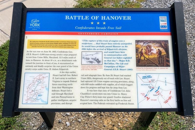
After a stunning victory at Chancellorsville in May 1863, Confederate Gen. Robert E. Lee led the Army of Northern Virginia through Maryland into Pennsylvania, marching east to threaten Harrisburg, Philadelphia, Baltimore, and Washington D.C. The Army of the Potomac marched north from the nation’s capital, searching for Lee. On July 1-3, the armies collided at Gettysburg in one of the pivotal battles of the Civil War. Three days later, after a bloody defeat, the Confederates began retreating to Virginia.
As the sun rose on June 30, 1863, Confederate Gen. J.E.B. Stuart’s 5,000-man-strong cavalry corps prepared to trot from Union Mills, Maryland, 12.5 miles south of here, to Hanover. At about 10 A.M., as a detachment rode towards the junction in front of you, it encountered an untimely and deadly surprise: the rear guard of the Union cavalry corps under Gens. H. Judson Kilpatrick.
A few days earlier, Stuart had left Gen. Robert E. Lee’s army in northern Virginia to impede Federal forces marching north from their Washington defenses. Stuart led a raid through Maryland and into Pennsylvania to gather intelligence, acquire
this page online
It was here that sixty of Confederate Col. John Chambliss’s cavalrymen ran into Union Lt. Henry Clay Potter’s forty-man rear guard. Gunfire shattered Hanover’s morning calm as the first battle on free soil erupted here. The Federals retreated up Frederick Street.
“[T]he capture of this train of wagons was a misfortune. …Had Stuart been entirely unimpeded, he would probably have passed Hanover on the 30th before the arrival of Kilpatrick’s division, and would have been in communication with General Lee before nightfall on that day.”—Major H.B. McClellan, The Life and Campaigns of Major General J.E.B. Stuart 1885
Erected by Pennsylvania Civil War Trails & York County.
Topics and series. This historical marker is listed in this topic list: War, US Civil. In addition, it is included in the Pennsylvania Civil War Trails series
Photographed by Shane Oliver, August 28, 2021
2. Battle of Hanover Marker
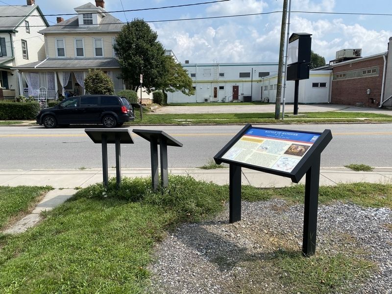
The “Consequences on the Battle of Gettysburg” and “Custer at Hanover” markers can be seen next to this marker.
Location. 39° 47.599′ N, 76° 59.499′ W. Marker is near Hanover, Pennsylvania, in York County. It is in Penn Township. It is at the intersection of Frederick Street (Pennsylvania Route 194) and Stuart Avenue, on the left when traveling north on Frederick Street. Touch for map. Marker is at or near this postal address: 513 Frederick St, Hanover PA 17331, United States of America. Touch for directions.

Regionally, this marker is in South-Central Pennsylvania, specifically in Pennsylvania Dutch Country, in the Susquehanna Valley, and in Greater Harrisburg. It is also in the American Northeast and in the Mid-Atlantic. Globally, it is in North America, the Western Hemisphere, the Western World, and the Anglosphere. Historically, it finds itself in what was once the Haudenosaunee (Iroquois) Confederacy and also one of the original Thirteen Colonies.
Other nearby markers. At least 8 other markers are within walking distance of this marker: Stuart's Fruitless Odyssey (here, next to this marker); The Confederates Invade Pennsylvania (a few steps from this marker); Gettysburg Campaign (within shouting distance of this marker); J.E.B. Stuart's Jump (within shouting distance of this marker); Hanover (about 600 feet away, measured in a direct line); Heroics of the Union Cavalry (approx. ¼ mile away); The Center of the Storm (approx. ¼ mile away); Profiles in Union Cavalry Courage (approx. 0.3 miles away). Touch for a list and map of all markers in Hanover.
Other markers no longer nearby. Consequences on the Battle of Gettysburg (was here, next to this marker but has been replaced with another marker now near it); Custer at Hanover (was here, next to this marker but has been replaced with another marker now near it); The Forney Farms (was approx. ¼ mile away but has been permanently removed); The Winebrenner Tannery (was approx. ¼ mile away but has been replaced with another marker now near it).
Credits. This page was last revised on August 6, 2024. It was originally submitted on September 8, 2021, by Shane Oliver of Richmond, Virginia. This page has been viewed 753 times since then and 42 times this year. Last updated on August 5, 2024, by Carl Gordon Moore Jr. of North East, Maryland. Photos: 1, 2. submitted on September 8, 2021, by Shane Oliver of Richmond, Virginia. • Devry Becker Jones was the editor who published this page.
