Near Bartow in Pocahontas County, West Virginia — The American South (Appalachia)
The Great Raid
Path of Destruction
| — | Jones-Imboden Raid | — |
Photographed by Bernard Fisher, August 8, 2012
1. The Great Raid CWT Marker
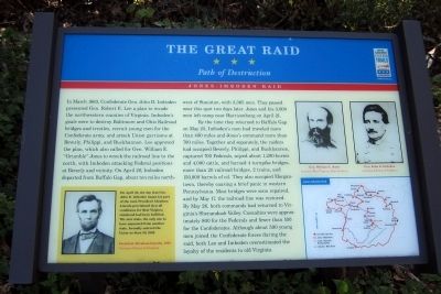
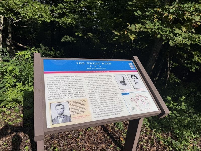
In March 1863, Confederate Gen. John D. Imboden presented Gen. Robert E. Lee a plan to invade the northwestern counties of Virginia. Imboden’s goals were to destroy Baltimore and Ohio Railroad bridges and trestles, recruit young men for the Confederate army, and attack Union garrisons at Beverly, Philippi, and Buckhannon. Lee approved the plan, which also called for Gen. William E. “Grumble” Jones to wreck the railroad line to the north, with Imboden attacking Federal positions at Beverly and vicinity. On April 20, Imboden departed from Buffalo Gap, about ten miles northwest of Staunton, with 3,365 men. They passed near this spot two days later. Jones and his 3,000 men left camp near Harrisonburg on April 21.
By the time they returned to Buffalo Gap on May 25, Imboden’s men had traveled more than 400 miles and Jones’s command more than 700 miles. Together and separately, the raiders had occupied Beverly, Philippi, and Buckhannon, captured 700 Federals, seized about 1,200 horses and 4,000 cattle, and burned 4 turnpike bridges, more than 20 railroad bridges, 2 trains, and 150,000 barrels of oil. They also occupied Morgantown,
this page online
[Sidebar:]
On April 20, the day that Gen, John D. Imboden began his part of the raid, President Abraham Lincoln proclaimed that all conditions for West Virginia statehood had been fulfilled. The new state, the only one to have separated from another state, formally entered the Union on June 20, 1863.
Erected by West Virginia Civil War Trails.
Topics and series. This historical marker is listed in this topic list: War, US Civil. In addition, it is included in the Former U.S. Presidents: #16 Abraham Lincoln, and the West Virginia Civil War Trails series lists. A significant historical date for this entry is April 20, 1863.
Location. 38° 28.532′ N, 79° 41.952′ W. Marker is near Bartow, West Virginia,
Photographed by Devry Becker Jones (CC0), August 8, 2026
2. The Great Raid Marker
The marker has weathered somewhat but remains generally legible.

Regionally, this marker is in the Potomac Highlands. It is also in the American South, specifically in the Upper South, in Appalachia, and specifically in Southern Appalachia. Globally, it is in North America, the Western Hemisphere, the Western World, and the Anglosphere. Historically, it finds itself in what was once the territory of the Mississippian Culture.
Other nearby markers. At least 8 other markers are within 6 miles of this marker, measured as the crow flies: Camp Allegheny (a few steps from this marker); West Virginia / Virginia (a few steps from this marker); Highland County / West Virginia (within shouting distance of this marker); a different marker also named Camp Allegheny (approx. 0.7 miles away in Virginia); Battle for the High Ground (approx. 1.3 miles away); Spirited Artillery Duel (approx. 5.8 miles away); Camp Bartow (approx.
Photographed by Bernard Fisher
3. West Virginia CWT Markers
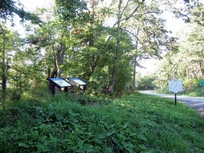
Other markers no longer nearby. War In West Virginia (was here, next to this marker but has been permanently removed); Staunton-Parkersburg Turnpike (was here, next to this marker but has been replaced with another marker now near it); The First Campaign (was a few steps from this marker but has been replaced with another marker now near it); Camp Allegheny 1861-1862 (was approx. 1.3 miles away but has been replaced with another marker now near it); a different marker also named Camp Allegheny (was approx. 1.3 miles away but has been replaced with another marker now near it).
More about this marker. On the upper right are portraits of Gen. William E. Jones Courtesy West Virginia State Archives and Gen. John D. Imboden Courtesy Library of Congress
On the lower left is a portrait of President Abraham Lincoln, 1863 Courtesy Library of Congress
On the lower right is a map of the Jones-Imboden Raid
Credits. This page was last revised on August 9, 2026. It was originally submitted on August 11, 2012, by Bernard Fisher of Richmond, Virginia. This page has been viewed 1,447 times since then and 102 times this year. Last updated on August 6, 2024, by Carl Gordon Moore Jr. of North East, Maryland. Photos: 1. submitted on August 11, 2012, by Bernard Fisher of Richmond, Virginia. 2. submitted on August 9, 2026, by Devry Becker Jones of Washington, District of Columbia. 3. submitted on August 11, 2012, by Bernard Fisher of Richmond, Virginia. • Devry Becker Jones was the editor who published this page.
