Ayr Township near McConnellsburg in Fulton County, Pennsylvania — The American Northeast (Mid-Atlantic)
Gettysburg Campaign
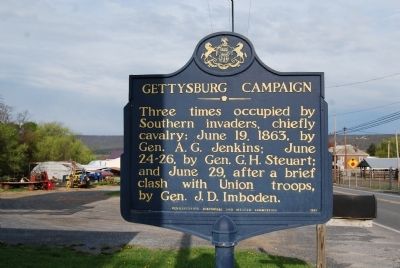
Photographed by Mike Wintermantel, April 30, 2015
1. Gettysburg Campaign Marker
Erected 1947 by Pennsylvania Historical and Museum Commission.
Topics and series. This historical marker is listed in this topic list: War, US Civil. In addition, it is included in the Pennsylvania Historical and Museum Commission (PHMC) series list. A significant historical date for this entry is June 19, 1863.
Location. 39° 55.725′ N, 77° 59.08′ W. Marker is near McConnellsburg, Pennsylvania, in Fulton County. It is in Ayr Township. It is at the intersection of Lincoln Way West and Horton Drive, on the right when traveling east on Lincoln Way West. Touch for map. Marker is at or near this postal address: 888 Lincoln Way W, Mc Connellsburg PA 17233, United States of America. Touch for directions.

Regionally, this marker is in South-Central Pennsylvania. It is also in the American Northeast, in the Mid-Atlantic, in Appalachia, and specifically in Northern Appalachia. Globally, it is in North America, the Western Hemisphere,
this page online
Other nearby markers. At least 8 other markers are within walking distance of this marker: Pleasures of Roadside Dining (approx. 0.3 miles away); Confederate Soldiers (approx. 0.3 miles away); a different marker also named Gettysburg Campaign (approx. 0.3 miles away); Veterans Memorial (approx. 0.7 miles away); a different marker also named Veterans Memorial (approx. 0.7 miles away); Changing Main Street (approx. ¾ mile away); 209 Lincoln Way East (approx. ¾ mile away); 205 Lincoln Way East (approx. ¾ mile away). Touch for a list and map of all markers in McConnellsburg.
Another marker is no longer nearby. Confederate Dead (was approx. 0.3 miles away but has been replaced with another marker now near it).
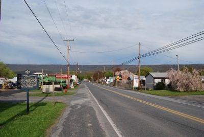
Photographed by Mike Wintermantel, April 30, 2015
2. Gettysburg Campaign Marker
Credits. This page was last revised on August 7, 2024. It was originally submitted on April 30, 2015, by Mike Wintermantel of Pittsburgh, Pennsylvania. This page has been viewed 1,055 times since then and 25 times this year. Last updated on August 6, 2024, by Carl Gordon Moore Jr. of North East, Maryland. Photos: 1, 2. submitted on April 30, 2015, by Mike Wintermantel of Pittsburgh, Pennsylvania. • Devry Becker Jones was the editor who published this page.
