Bedford in Bedford County, Pennsylvania — The American Northeast (Mid-Atlantic)
Fill 'Er Up
Lincoln Highway Heritage Corridor

Photographed by William Fischer, Jr., August 4, 2024
1. Fill 'Er Up Marker
During the early years of the Lincoln Highway, gas and snacks were not nearly as easy to find as they are today. Individual gas pumps were located in front of stores on the sidewalks.
Early travelers were warned to fill their tank every time they stopped because they never knew when they would find another station. As automobile traffic increased in the 1920s and 1930s, so did the number of service stations.
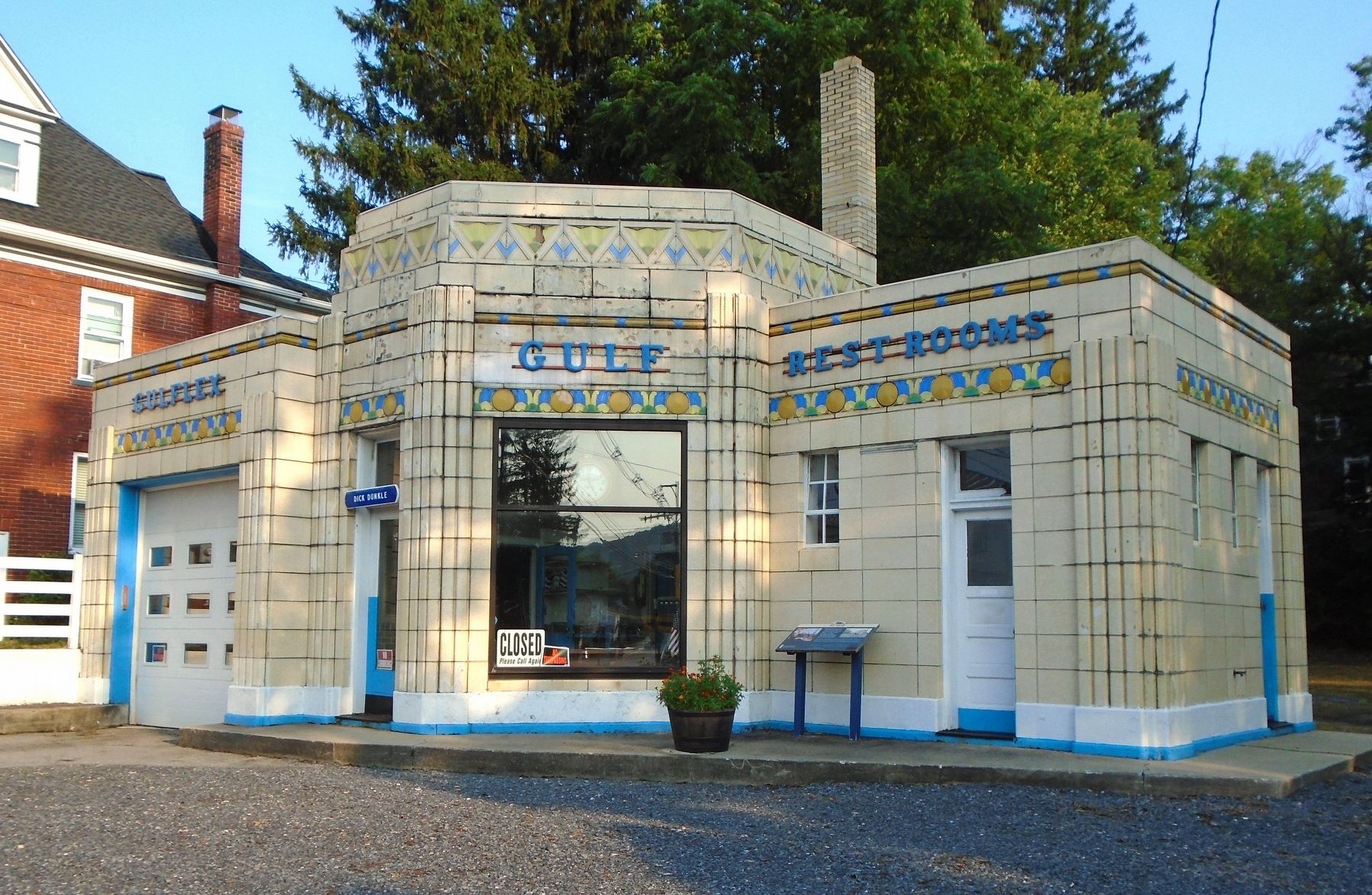
Dunkle's Gulf, an Art Deco terra-cotta structure, opened in 1933 by Dick Dunkle. The station is still open today and offers full-service repairs and gasoline. Its unique style is among the few that still exist from the Lincoln Highway-era.
[Photo caption reads]
A rare Lincoln Highway period photo of Dunkle's Gulf, Bedford. PA.
Erected by Lincoln Highway Heritage Corridor and the Eads Group.
Topics and series. This historical marker is listed in these topic lists: Industry & Commerce • Roads & Vehicles. In addition, it is included in the Lincoln Highway series list. A significant historical year for this entry is 1933.
Location. 40° 1.117′ N, 78° 30.452′ W. Marker is in Bedford, Pennsylvania, in Bedford
this page online

Regionally, this marker is in South-Central Pennsylvania and in the Laurel Highlands. It is also in the American Northeast, in the Mid-Atlantic, in Appalachia, and specifically in Northern Appalachia. Globally, it is in North America, the Western Hemisphere, the Western World, and the Anglosphere. Historically, it finds itself in what was once the Haudenosaunee (Iroquois) Confederacy and also one of the original Thirteen Colonies.
Other nearby markers. At least 8 other markers are within walking distance of this marker: NW Boundary Original Survey of Bedford (within shouting distance of this marker); First Court House and Prison Built in 1774 (approx. 0.2 miles away); Forbes Road (approx. 0.2 miles away); SW Boundary Original Survey of Bedford (approx. 0.2 miles away); Fort Bedford (approx. 0.2 miles away); Bedford County Civil War Monument (approx. 0.2 miles away); Grist Millstone
Photographed by William Fischer, Jr., August 4, 2024
2. Dunkle's Gulf and Fill 'Er Up Marker
Regarding Fill 'Er Up. Dunkle's is no longer an active gas station as the pumps have been removed.
Related markers. Click here for a list of markers that are related to this marker.
Credits. This page was last revised on August 7, 2024. It was originally submitted on August 7, 2024, by William Fischer, Jr. of Reynoldsburg, Ohio. This page has been viewed 306 times since then and 42 times this year. Photos: 1, 2. submitted on August 7, 2024, by William Fischer, Jr. of Reynoldsburg, Ohio.
