Near Gettysburg in Adams County, Pennsylvania — The American Northeast (Mid-Atlantic)
Army of Northern Virginia
July 5, 1863
Photographed by Craig Swain, August 16, 2008
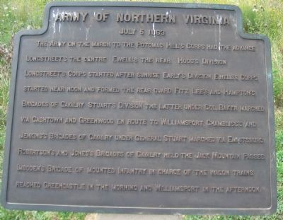
1. Army of Northern Virginia Tablet - July 5, 1863
The Army on the march to the Potomac. Hill's Corps had the advance. Longstreet's the centre. Ewell's the rear. Hood's Division Longstreet's Corps started after sunrise. Early's Division Ewell's Corps started near noon and formed the rear guard. Fitz Lee's and Hampton's Brigades of Cavalry Stuart's Division the later under Col. Baker marched via Cashtown and Greenwood en route to Williamsport. Chambliss's and Jenkins's Brigades of Cavalry under General Stuart marched via Emmitsburg. Robertson's and Jones's Brigade of Cavalry held the Jack Mountain Passes. Imboden's Brigade of mounted infantry in charge of the wagon trains reached Greencastle in the morning and Williamsport in the afternoon.
Erected by Gettysburg National Military Park Commission.
Topics and series. This historical marker is listed in this topic list: War, US Civil. In addition, it is included in the Gettysburg National Military Park Commission series list. A significant historical date for this entry is July 5, 1863.
Location. 39° 49.631′ N, 77° 14.687′ W. Marker is near Gettysburg, Pennsylvania, in Adams County. It is on Southwest Confederate Avenue 0.2 miles
this page online

Regionally, this marker is in South-Central Pennsylvania. It is also in the American Northeast, in the Mid-Atlantic, in Appalachia, and specifically in Northern Appalachia. Globally, it is in North America, the Western Hemisphere, the Western World, and the Anglosphere. Historically, it finds itself in what was once the Haudenosaunee (Iroquois) Confederacy and also one of the original Thirteen Colonies.
Other nearby markers. At least 8 other markers are within walking distance of this marker: A different marker also named Army of Northern Virginia (here, next to this marker); a different marker also named Army of Northern Virginia (here, next to this marker); a different marker also named Army of Northern Virginia (here, next to this marker); a different marker also
Photographed by Craig Swain
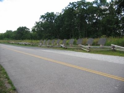
2. Army of Northern Virginia Itinerary Tablets
Ten tablets cover the movements of the Confederate army from June 26 to July 5, 1863.
More about this marker. The tablet is one of ten placed originally by the Battlefield Commission around the turn of the century. These were restored and placed on Seminary Ridge in 2007.
Credits. This page was last revised on August 7, 2024. It was originally submitted on September 27, 2008, by Craig Swain of Leesburg, Virginia. This page has been viewed 1,359 times since then and 28 times this year. Last updated on August 7, 2024, by Carl Gordon Moore Jr. of North East, Maryland. Photos: 1, 2. submitted on September 27, 2008, by Craig Swain of Leesburg, Virginia. • Devry Becker Jones was the editor who published this page.
