Near Richmond in Henrico County, Virginia — The American South (Mid-Atlantic)
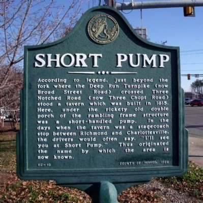
Short Pump
Erected 1998 by County of Henrico. (Marker Number HC-10.)
Topics. This historical marker is listed in these topic lists: Roads & Vehicles • Settlements & Settlers. A significant historical year for this entry is 1815.
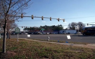
Location. 37° 39.098′ N, 77° 36.724′ W. Marker is near Richmond, Virginia, in Henrico County. Marker is at the intersection of West Broad Street and Pouncey Tract Road, on the right when traveling west on West Broad Street. Touch for map. Marker is at or near this postal address: 11500 W Broad St, Henrico VA 23233, United States of America. Touch for directions.
Other nearby markers. At least 8 other markers are within 3 miles of this marker, measured as the crow flies. Deep Run School (approx. 0.2 miles away); "Right arm to partner & Reel" (approx. 0.4 miles away); Chief Powhatan (approx. 0.4 miles away); Springfield School (approx. 1.2 miles away); Shady Grove United Methodist Church (approx. 1.4 miles away); Deep Run Baptist Church (approx. 1.7 miles away); Goochland County / Henrico County (approx. 2.1 miles away); Old Coal Pit Railroad Bed (approx. 2.3 miles away).
Also see . . . It Truly Was a Short Pump. Richmond.com (Submitted on December 11, 2009, by Bernard Fisher of Richmond, Virginia.)
Credits. This page was last revised on July 7, 2021. It was originally submitted on December 11, 2009, by Bernard Fisher of Richmond, Virginia. This page has been viewed 1,655 times since then and 76 times this year. Photos: 1, 2. submitted on December 11, 2009, by Bernard Fisher of Richmond, Virginia.

