
Stanton in Mercer County, North Dakota — The American Midwest (Upper Plains)
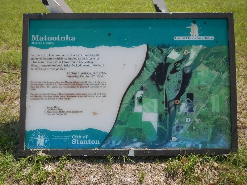
Matootnha
Mercer County
Photographed by Barry Swackhamer, circa July 2024
1. Matootnha Marker
Click on image to enlarge.
"a fine worm Day we met with a french man by the name of Jassame which we employ as an interpreter This man has a wife & Chindren in the Village - Great numbers of both Sides flocked down to the bank to views us as wee passed." Captain Clark's journal entry, Saturday October 27, 1804
On this site is the location of the first Mandan Village visited by Lewis & Clark. On the morning of October 27th, 1804 Lewis and Clark stopped briefly and smoked with Chief Big White. The original site was destroyed by gravel pit operations in the 1950's
This site was also the home of Rene Jusseaume, a free trader who had lived with the Mandans for about fifteen years. Jusseaume acted and (sic) an interpreter and accompanied Lewis & Clark to another village.
1. Your are Here
2. Big White Village
3. Approximate Historic Fort Mandan Site
4. Campsite October 26th
Erected by City of Stanton.
Topics and series. This historical marker is listed in these topic lists: Exploration • Indigenous Peoples and Communities • Settlements & Settlers. In addition, it is included in the Lewis & Clark Expedition series
this page online
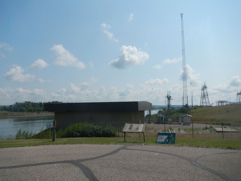
Location. 47° 17.238′ N, 101° 20.238′ W. Marker is in Stanton, North Dakota, in Mercer County. It can be reached from Alternate State Highway 200 near 40th Avenue Southwest. The marker is located near the boat ramp just north of Leyland Otis Power Plant. Touch for map. Marker is in this post office area: Stanton ND 58571, United States of America. Touch for directions.

Regionally, this marker is in North Dakota’s Mandan, Hidatsa, and Arikara Nation, in the Standing Rock Sioux Tribe, and on the Missouri Plateau. It is also in the American Lewis & Clark Corridor, on the prairies, and on the Northern Plains. Globally, it is in North America, the Western Hemisphere, the Western World, and the Anglosphere. Historically, it finds itself in what was once Rupert’s Land and also the Louisiana Purchase.
Other nearby markers. At least 8 other markers are within 4 miles of this marker, measured as the crow flies: Sheheke-Shote's Return (about 400 feet away, measured in a direct line); Lewis and Clark Expedition (approx. 2½ miles away); Fort Mandan Historic Site (approx. 2½
Photographed by Barry Swackhamer, circa July 2024
2. Matootnha Marker
Credits. This page was last revised on August 8, 2024. It was originally submitted on August 8, 2024, by Barry Swackhamer of Brentwood, California. This page has been viewed 212 times since then and 21 times this year. Photos: 1, 2. submitted on August 8, 2024, by Barry Swackhamer of Brentwood, California.
