Near Terry in Prairie County, Montana — The American West (Mountains)
Military Camp
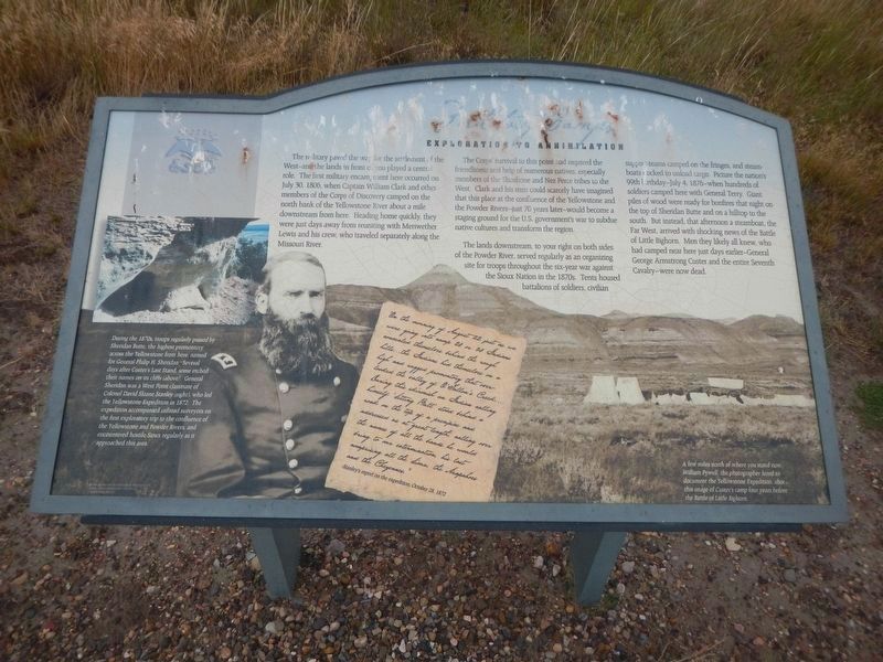
Exploration to Annihilation
Photographed by Barry Swackhamer, February 5, 2011
1. Military Camp Marker
Captions: (lower left) During the 1870s, troops regularly passed by Sheridan Butte, the highest promontory across the Yellowstone from here, named for General Philip H. Sheridan.Several days after Custer's Last Stand, some etched their names on its cliffs (above). General Sheridan was a West Point classmate of Colonel David Sloane Stanley (right), who led the Yellowstone Expedition in 1872. The expedition accompanied railroad surveyors on the first exploratory trip to the confluence of the Yellowstone and Powder Rivers, and encountered hostile Sioux regularly as it approached this area.; (lower right) A few miles north of where you stand now, William Pywell, the photographer hired to document the Yellowstone Expedition, shot this image of Custer's Camp four years before the Battle of Little Bighorn.
The Corps' survival to this point had required the friendliness and help of numerous native tribes to the West. Clark and his men could scarcely have imagined that this place at the confluence of the Yellowstone and the Powder Rivers-just 70 years later-would become a staging ground for the U.S. governments war to subdue native cultures and transform the region.
The land downstream, to your right on both sides of the Powder River, served regularly as an organizing site for troops throughout the six-year war against the Sioux Nation in the 1870s. Tents housed battalions of soldiers, civilian support-teams camped on the fringes and steamboat docked to
this page online
script letter at the bottom center:
On the morning of August 22 just as we were going into camp 20 or 30 Indians concealed themselves behind the rough hills...the Indianas hid themselves on a high and rugged promontory that over looked the valley of O'Fallon's Creek...During this skirmish an Indian calling himself 'Sitting Bull' stood behind a rock on the top of a precipice and addressed us at great length calling over the names of all the bands he would bring to our extermination, his list comprising all the Sioux, the Arapahoes and the Cheyennes. Stanley's report on the expedition, October 28, 1872
Erected by Undaunted Stewedship.
Photographed by Barry Swackhamer, February 5, 2011
2. Military Camp Marker
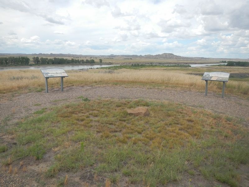
Marker on the right.
Topics. This historical marker is listed in these topic lists: Exploration • Wars, US Indian. A significant historical date for this entry is July 30, 1805.
Location. 46° 43.838′ N, 105° 26.105′ W. Marker is near Terry, Montana, in Prairie County. It is on Old Highway 10 near Powder River Road, on the right when traveling west. Touch for map. Marker is in this post office area: Terry MT 59349, United States of America. Touch for directions.

Regionally, this marker is in andspecifically outheast Montana in Custer Country. It is also in the American Mountain West, in the Lewis & Clark Corridor, on the prairies, on the Great Plains, and specifically on the Northern Plains. Globally, it is in North America, the Western Hemisphere, the Western World, and the Anglosphere. Historically, it finds itself in what was once Rupert’s Land and also the Louisiana Purchase.
Other nearby markers. At least 8 other markers are within 8 miles of this marker, measured as the crow flies: Here Come the Immigrants! (here, next to this marker); Welcome to Prairie County (within shouting distance of this marker); Buffalo Hunters (within shouting distance of this marker); Father DeSmet - Sitting Bull Council (within shouting distance of this marker); The Powder River (approx. ¾ mile away); Milwaukee Railroad (approx. 5 miles away); C. W. "Prof" Grandey School (approx. 7.3 miles away); Prairie County (approx. 7.6 miles away). Touch for a list and map of all markers in Terry.
Credits. This page was last revised on August 9, 2024. It was originally submitted on August 8, 2024, by Barry Swackhamer of Brentwood, California. This page has been viewed 194 times since then and 33 times this year. Photos: 1, 2. submitted on August 8, 2024, by Barry Swackhamer of Brentwood, California.
