
Aldie in Loudoun County, Virginia — The American South (Mid-Atlantic)
Mother of Stonewall Jackson
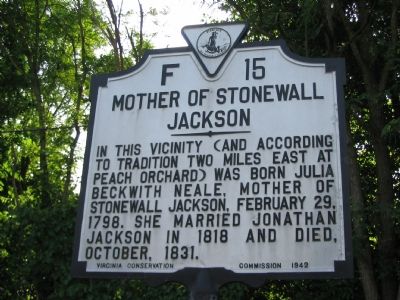
Photographed by Craig Swain, June 22, 2007
1. Mother of Stonewall Jackson Marker
Erected 1942 by Virginia Conservation Commission. (Marker Number F-15.)
Topics and series. This historical marker is listed in this topic list: Women. In addition, it is included in the Virginia Department of Historic Resources (DHR) series list. A significant historical year for this entry is 1798.
Location. 38° 58.311′ N, 77° 37.361′ W. Marker is in Aldie, Virginia, in Loudoun County. It is at the intersection of James Monroe Highway (U.S. 15) and John Mosby Highway (U.S. 50), on the right when traveling north on James Monroe Highway. Touch for map. Marker is in this post office area: Aldie VA 20105, United States of America. Touch for directions.

Regionally, this marker is in the Washington Metropolitan Area and in Northern Virginia. It is also in the American South, specifically in the Upper South, and in the Mid-Atlantic. Globally, it is in North America, the Western Hemisphere, the Western
this page online
Other nearby markers. At least 8 other markers are within walking distance of this marker: President Monroe’s Home (approx. ¼ mile away); Welcome to Gilbert's Corner Regional Park (approx. 0.8 miles away); Neighbor Against Neighbor (approx. 0.8 miles away); This is Gilbert's Corner! (approx. 0.8 miles away); Plain Path…Shenandoah Hunting Path…Carolina Road…Rogue’s Road… (approx. 0.9 miles away); Mt. Zion Old School Baptist Church (approx. 0.9 miles away); Mt. Zion Cemetery (approx. 0.9 miles away); Mt. Zion Church (approx. 0.9 miles away). Touch for a list and map of all markers in Aldie.
More about this marker. This marker was originally erected about a mile south of here (“0.9 miles south of Gilbert’s Corner,” says the 1985 edition of Margaret Peters’ A Guidebook to Virginia’s Historical Markers ). This means that the legendary peach orchard is a little bit further away now. —Ed.
Related markers.
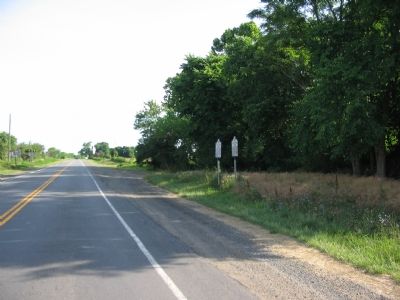
Photographed by Craig Swain, June 22, 2007
2. Two Markers North of Gilbert's Corner, VA
Additional commentary.
1. Duplicate Number F-15s
Margaret Peters listed two markers with the number F-15 in her book. The other was associated with Mount Pony, just south of Culpeper, VA and was also along U.S. Highway 15. That marker has since been replaced by a new marker, with the number F-34 (HMDB number 4442).
— Submitted December 31, 2007, by Craig Swain of Leesburg, Virginia.
Credits. This page was last revised on August 10, 2024. It was originally submitted on June 28, 2007, by Craig Swain of Leesburg, Virginia. This page has been viewed 2,932 times since then and 51 times this year. Last updated on August 9, 2024, by Karine Gendron of Laval, Quebec. Photos: 1, 2. submitted on June 28, 2007, by Craig Swain of Leesburg, Virginia. • Bernard Fisher was the editor who published this page.
