Waverly in Pike County, Ohio — The American Midwest (Great Lakes)
Ohio and Erie Canal
Photographed by William Fischer, Jr., November 9, 2009
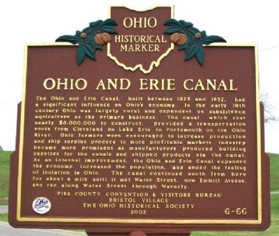
1. Ohio and Erie Canal Marker
The Ohio and Erie Canal, built between 1825 and 1832, had a significant influence on Ohio's economy. In the early 19th century Ohio was largely rural and dependent on subsistence agriculture as the primary business. The canal, which cost nearly $8,000,000 to construct, provided a transportation route from Cleveland on Lake Erie to Portsmouth on the Ohio River. Ohio farmers were encouraged to increase production and ship surplus produce to more profitable markets. Industry became more prominent as manufacturers produced building supplies for the canals and shipped products via the canal. As an internal improvement, the Ohio and Erie Canal expanded the economy, increased the population, and ended the feeling of isolation in Ohio. The canal continued south from here for about a mile until it met Water Street, now Emmitt Avenue, and ran along Water Street through Waverly.
Erected 2002 by Pike County Convention & Visitors Bureau, Bristol Village, and The Ohio Historical Society. (Marker Number 6-66.)
Topics and series. This historical marker is listed in these topic lists: Industry & Commerce • Settlements & Settlers
this page online
Location. 39° 8.123′ N, 82° 58.194′ W. Marker is in Waverly, Ohio, in Pike County. It is at the intersection of Wendy Lane and 2nd Street (Ohio Route 335), on the right when traveling south on Wendy Lane. Marker is in the Bristol Village retirement community on the northeast edge of town. Touch for map. Marker is in this post office area: Waverly OH 45690, United States of America. Touch for directions.

Regionally, this marker is in the Scioto Valley and in Southern Ohio Hill Country. It is also in the American Midwest, in Appalachia, and specifically in Northern Appalachia. Globally, it is in North America, the Western Hemisphere, the Western World, and the Anglosphere. Historically, it finds itself in what was once the Haudenosaunee (Iroquois) Confederacy, the territory of the Mississippian Culture, and the Northwest Territory.
Other nearby markers. At least 8 other markers are within walking distance of this marker: Ohio & Erie Canal Historical Markers
Photographed by William Fischer, Jr., November 9, 2009
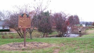
2. Ohio and Erie Canal Marker
Also see . . .
1. Connecting the State and the Nation: Ohio Canal History. Ohio Memory website entry (Submitted on October 16, 2024, by Larry Gertner of New York, New York.)
2. Map of Ohio Canal System. Library of Congress website entry (Submitted on December 11, 2009, by William Fischer, Jr. of Reynoldsburg, Ohio.)
Photographed by William Fischer, Jr., November 9, 2009
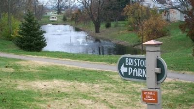
3. Ohio and Erie Canal Remnant
Looking east from marker.
Credits. This page was last revised on November 13, 2024. It was originally submitted on December 11, 2009, by William Fischer, Jr. of Reynoldsburg, Ohio. This page has been viewed 2,163 times since then and 65 times this year. Photos: 1, 2, 3. submitted on December 11, 2009, by William Fischer, Jr. of Reynoldsburg, Ohio.
