Terry in Prairie County, Montana — The American West (Mountains)
Here Come the Immigrants!
Railroads, Boats & Wagon Trains
Photographed by Barry Swackhamer, February 5, 2011
1. Here Come the Immigrants! Marker
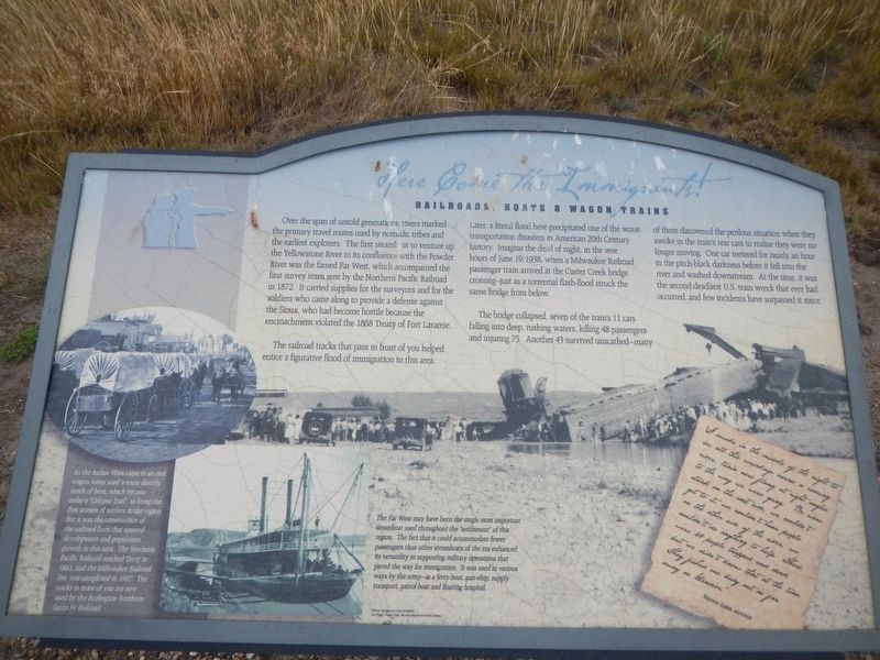
Captions: (lower left) As the Indian Wars came to an end, wagon trains used a route directly north of here, which became today's "Calypso Trail." to bring the first stream of settlers to the region. But it was the construction of the railroad lines that spurred development and population growth in this area. The Northern Pacific Railroad reached Terry in 1881, and the Milwaukee Railroad line was completed in 1907. The tracks in front of you are now used by the Burlington Northern Santa Fe Railroad.; (bottom center) The Far West may have been the single most important steamboat used throughout the 'settlement' of this region. The fact that it could accommodate fewer passengers than other steamboats of the era enhanced its versatility in supporting military operations that paved the way for immigration. It was used in various ways by the army-as a ferry-boat, gun-ship, supply transport, patrol boat and floating hospital.
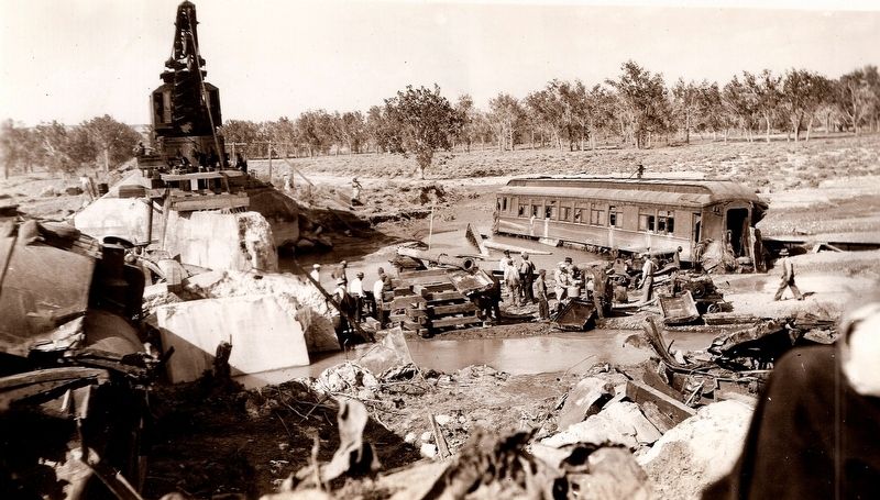
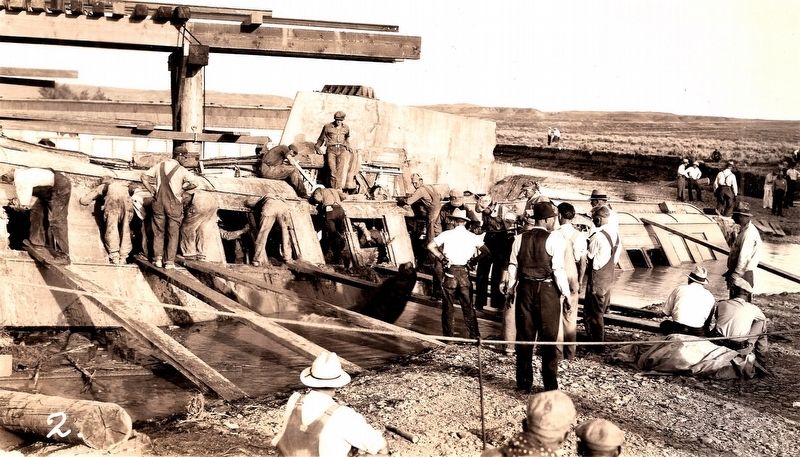
The railroad tracks that passed in front of you helped entice a figurative flood of immigration to this area. Later, a literal flood here precipitated one of the worst transportation disasters in American 20th Century history. Imagine the dead of night, in the wee hours of June 19, 1938, when a Milwaukee Railroad passenger train arrived at the Custer Creek Bridge crossing- just as a torrential flash-flood struck the same bridge from below.
The bridge collapsed, seven of the train's 11 cars falling into deep, rushing waters, killing 48 passengers and injuring 75. Another 43 survived unscathed-many
this page online
script letter at the bottom center:
"I awoke in the middle of the night to see all this wreckage across a roaring river, train cars flung at right angles to the way we were going. We were stuck on the east side, we couldn't get to it, we couldn't hear people on the other side of the river, we couldn't do anything to help. There were 48 people trapped and dead but we didn't know that at the time. They fished one body out as far away as Gelendive." Warren Jones, survivor
Erected by Undaunted Stewardship.
Topics. This historical marker is listed in these topic lists: Bridges & Viaducts • Disasters • Railroads & Streetcars • Waterways & Vessels. A significant historical date for this entry is June 19, 1938.
Location. 46° 43.836′ N, 105° 26.109′ W. Marker is in Terry,
Photographed by Barry Swackhamer, February 5, 2011
2. Here Come the Immigrants! Marker
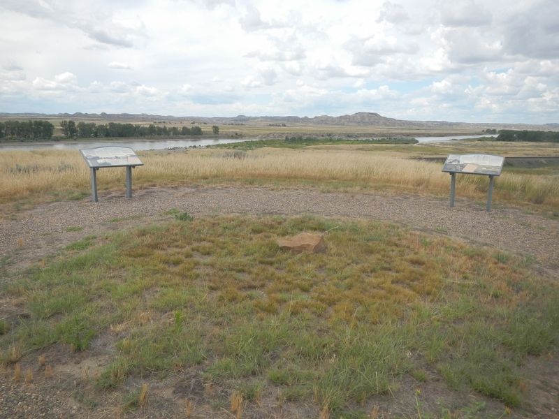
The marker is on the left.

Regionally, this marker is in andspecifically outheast Montana in Custer Country. It is also in the American Mountain West, in the Lewis & Clark Corridor, on the prairies, on the Great Plains, and specifically on the Northern Plains. Globally, it is in North America, the Western Hemisphere, the Western World, and the Anglosphere. Historically, it finds itself in what was once Rupert’s Land and also the Louisiana Purchase.
Other nearby markers. At least 8 other markers are within 8 miles of this marker, measured as the crow flies: Military Camp (here, next to this marker); Welcome to Prairie County (within shouting distance of this marker); Buffalo Hunters (within shouting distance of this marker); Father DeSmet - Sitting Bull Council (within shouting distance of this marker); The Powder River (approx. ¾ mile away); Milwaukee Railroad (approx. 5 miles away); C. W. "Prof" Grandey School
Milwaukee Railroad Archives, March 13, 2011
3. The Custer Creek Train Wreak
Milwaukee Railroad Archives, March 13, 2011
4. Custer Creek Train Wreak
Credits. This page was last revised on August 9, 2024. It was originally submitted on August 9, 2024, by Barry Swackhamer of Brentwood, California. This page has been viewed 176 times since then and 25 times this year. Photos: 1, 2, 3, 4. submitted on August 9, 2024, by Barry Swackhamer of Brentwood, California.
