Mechums West in Ivy in Albemarle County, Virginia — The American South (Mid-Atlantic)
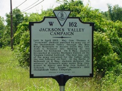
Jackson’s Valley Campaign
Photographed by J. J. Prats, July 1, 2007
1. Jackson’s Valley Campaign Marker
Erected 2002 by Department of Historic Resources. (Marker Number W-162.)
Topics and series. This historical marker is listed in these topic lists: Railroads & Streetcars • War, US Civil. In addition, it is included in the Virginia Department of Historic Resources (DHR) series list. A significant historical date for this entry is May 3, 1862.
Location. This marker has been replaced by another marker nearby. It was located near 38° 3.716′ N, 78° 38.714′ W. Marker was in Ivy, Virginia, in Albemarle County. It was in Mechums
this page online

Regionally, this marker was in the Piedmont and in Central Virginia. It was also in the American South and specifically in the Upper South. Globally, it was in North America, the Western Hemisphere, the Western World, and the Anglosphere. Historically, it found itself in what was once the territory of the Mississippian Culture, one of the original Thirteen Colonies, one of the Confederate States of America, and the Antebellum South.
Other nearby markers. At least 8 other markers are within 7 miles of this location, measured as the crow flies: A different marker also named Jackson's Valley Campaign (here, next to this marker); Birthplace of Meriwether Lewis (approx. 2.6 miles away); Crozet (approx. 3.1 miles away); The Rothwell Family ... / Elisha Wm. Robertson ... (approx. 3½ miles away); Miller School (approx. 4.7 miles away); “The Albemarle 26” (approx. 6 miles away); Staunton and James River Turnpike (approx. 6.2 miles
Photographed by J. J. Prats, July 1, 2007
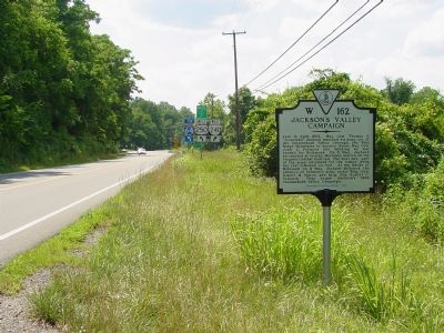
2. Jackson’s Valley Campaign Marker
Related marker. Click here for another marker that is related to this marker. New Marker At This Location also titled "Jackson's Valley Campaign".
Also see . . . The Virginia Central Railroad. “During the Civil War the Virginia Central was one of the Confederacy’s most important lines, carrying food from the Shenandoah region to Richmond, and ferrying troops and supplies back and forth as the campaigns surrounded its tracks frequently. On more than one occasion it was used in actual tactical operations, transporting troops directly to the battlefield. The Blue Ridge Tunnels and the Virginia Central were key tools in the fast mobilization of Confederate General Stonewall Jackson’s famous ‘foot cavalry.’ But, it was a prime target for Federal armies, and by the end of the war had only about five miles of track still in operation, and $40 in gold in its treasury. After the War, Collis P. Huntington reorganized the Virginia Central and its affiliates into his new Chesapeake and Ohio Railway ... ”
Photographed by J. J. Prats, July 1, 2007
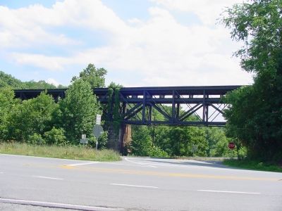
3. Railroad Bridge over Highway and Mechum’s River
Present railroad bridge at Mechum’s River. Depot was to the right beyond bridge.
Photographed by Paul Crumlish, September 5, 2009
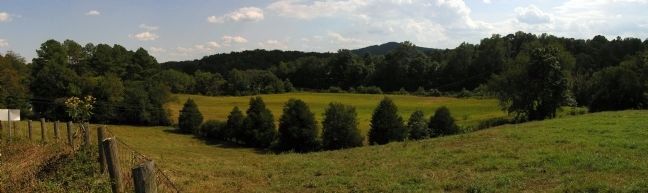
4. Present Day View of Mechum’s Station
Looking southeast from Brown's Gap Turnpike to the site of Mechum’s Station. The present day C&O railroad runs from left to right through the middle treeline beyond the field and road.
Credits. This page was last revised on August 11, 2024. It was originally submitted on July 21, 2007, by J. J. Prats of Springfield, Virginia. This page has been viewed 3,929 times since then and 529 times this year. Last updated on August 11, 2024, by Carl Gordon Moore Jr. of North East, Maryland. Photos: 1, 2. submitted on July 21, 2007, by J. J. Prats of Springfield, Virginia. 3. submitted on July 22, 2007, by J. J. Prats of Powell, Ohio. 4. submitted on September 5, 2009, by PaulwC3 of Northern, Virginia. • Bernard Fisher was the editor who published this page.
