
Brooklyn Heights in Kings County, New York — The American Northeast (Mid-Atlantic)
Fort Stirling Park
0.214 acre
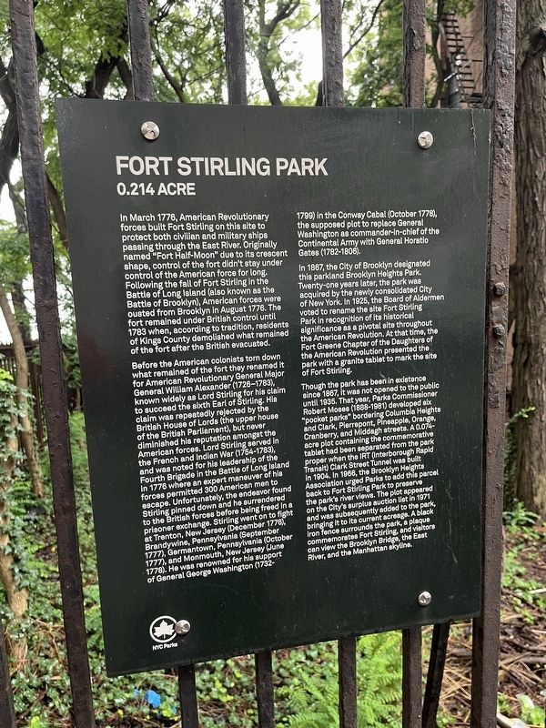
In March 1776, American Revolutionary forces built Fort Stirling on this site to protect both civilian and military ships passing through the East River. Originally named "Fort Half-Moon" due to its crescent shape, control of the fort didn't stay under control of the American force for long. Following the fall of Fort Stirling in the Battle of Long Island (also known as the Battle of Brooklyn), American forces were ousted from Brooklyn in August 1776. The fort remained under British control until 1783 when, according to tradition, residents of Kings County demolished what remained of the fort after the British evacuated.
Before the American colonists torn down what remained of the fort they renamed it for American Revolutionary General Major General William Alexander (1726-1783), known widely as Lord Stirling for his claim to succeed the sixth Earl of Stirling. His claim was repeatedly rejected by the British House of Lords (the upper house of the British Parliament), but never diminished his reputation amongst the American forces. Lord Stirling served in the French and Indian War (1754-1763), and was noted for his leadership of the Fourth Brigade in the Battle of Long Island in 1776 where an expert maneuver of his forces permitted 300 men to escape. Unfortunately, the endeavor found Stirling pinned down and he surrendered to the British forces before being freed in a prisoner exchange. Stirling went on to fight at Trenton, New Jersey (December 1776), Brandywine, Pennsylvania (September 1777), Germantown, Pennsylvania (October 1777), and Monmouth, New Jersey (June 1778). He was renowned for his support of General George Washington (1732-1799) in the Conway Cabal (October 1778), the supposed plot to replace George Washington as commander-in-chief of the Continental Army with General Horatio Gates (1782-1808).
In 1867, the City of Brooklyn designated this parkland Brooklyn Heights Park. Twenty-one years later, the park was acquired by the newly consolidated City of New York. In 1925, the Board of Aldermen voted to rename the site Fort Stirling Park in recognition of its historical significance as a pivotal site throughout the American Revolution. At that time, the Fort Greene Chapter of the Daughters of the American Revolution presented the park with a granite tablet to mark the site of Fort Stirling.
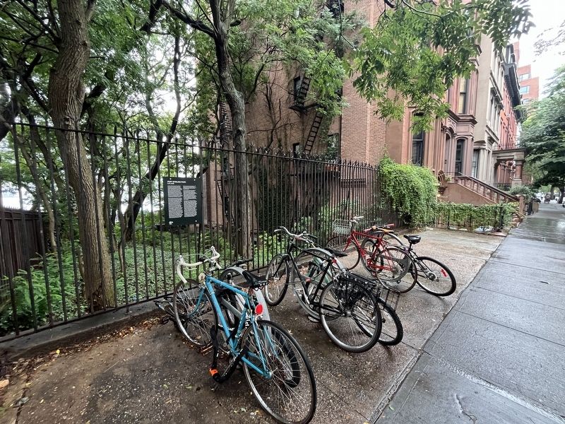
Though the park has been in existence since 1867, it was not opened to the public until 1935. That year, Parks Commissioner Robert Moses (1888-1981) developed six "pocket parks" bordering Columbia Heights and Clark, Pierrepont, Pineapple, Orange, Cranberry, and Middagh streets. A 0.074-acre plot containing the commemorative tablet had been separated from the park proper when the IRT (Interborough Rapid Transit) Clark Street Tunnel was built in 1904. In 1966, the Brooklyn Heights Association urged Parks to add this parcel back to Fort Stirling Park to preserve the park's river views. The plot appeared on the city's surplus auction list in 1971 and was subsequently added to the park, bringing it to its current acreage. A black iron fence surrounds the park, a plaque commemorates Fort Stirling, and visitors can view the Brooklyn Bridge, the East River, and the Manhattan skyline.
Erected by NYC
this page online
Topics. This historical marker is listed in these topic lists: Forts and Castles • Parks & Recreational Areas • War, US Revolutionary. A significant historical month for this entry is March 1776.
Location. 40° 41.903′ N, 73° 59.782′ W. Marker is in Brooklyn, New York, in Kings County. It is in Brooklyn Heights. It is at the intersection of Columbia Heights and Clark Street, on the left when traveling north on Columbia Heights. Touch for map. Marker is at or near this postal address: 154 Columbia Heights, Brooklyn NY 11201, United States of America. Touch for directions.

Regionally, this marker is in New York City. It is also in the American Northeast and on the Eastern Seaboard. Globally, it is in North America and the Western World. Historically, it finds itself in what was once one of the original Thirteen Colonies.
Other nearby markers. At least 8 other markers are within walking distance of this marker: Fort Stirling (a few steps from this marker); Brooklyn Heights Historic District (about 500 feet away, measured in a direct line); Robert White House (about 600 feet away); Dawn Redwood (about 600 feet away); 155 - 157 - 159 Willow Street
Credits. This page was last revised on September 29, 2025. It was originally submitted on August 11, 2024, by Devry Becker Jones of Washington, District of Columbia. This page has been viewed 330 times since then and 58 times this year. Photos: 1, 2. submitted on August 11, 2024, by Devry Becker Jones of Washington, District of Columbia.
