South Milwaukee in Milwaukee County, Wisconsin — The American Midwest (Great Lakes)
The Panama Canal
Photographed by J.T. Lambrou, August 3, 2024
1. The Panama Canal Marker
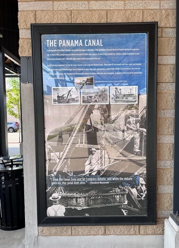
A photograph of President Theodore Roosevelt was taken in November 1906 operating a Bucyrus shovel in Panama during his inspection trip. In March 1910, a single Bucyrus shovel excavated 70,000 cubic yards in 25 days at the Culebra cut, setting a canal construction record. Each shovel averaged over 1,000,000 cubic yards of earth excavated at the cut.
In 1904 Bucyrus supplied 77 of the 102 steam shovels used to dig the Panama Canal. These were 95 ton models with five-cubic-yard buckets could move approximately eight tons of material at once. They were operated by a crew of four. Similar to a locomotive, the crew was headed by an engineer, and included two firemen who stoked the boiler with coal, and a craneman A support crew of six on the ground laid rails on which the shovel moved.
"I took the Canal Zone and let Congress debate; and while the debate goes on, the canal does also." -Theodore Roosevelt
Topics and series. This historical marker is listed in these topic lists: Industry & Commerce • Waterways & Vessels. In addition, it is included in the Former U.S. Presidents: #26 Theodore Roosevelt series list. A significant historical year for this entry is 1904.
Location. 42° 54.607′ N,
this page online

Regionally, this marker is in Southeast Wisconsin and in Greater Milwaukee. It is also in the American Midwest and in the Corn Belt. Globally, it is in North America, on the Great Lakes, in the Western Hemisphere, in the Western World, and in the Anglosphere. Historically, it finds itself in what was once the territory of the Mississippian Culture and also the Northwest Territory.
Other nearby markers. At least 8 other markers are within 5 miles of this marker, measured as the crow flies: Bucyrus Foundry and Manufacturing Company (a few steps from this marker); Chicago & Northwestern Railroad Depot (about 300 feet away, measured in a direct line); Schooner Lumberman (approx. 3.2 miles away); General Mitchell Field (approx. 3.7 miles away); Lake Protestant Cemetery (approx.
Photographed by J.T. Lambrou, August 3, 2024
2. The Panama Canal Marker
Another marker is no longer nearby. Lawson Airplane Company (was approx. 0.4 miles away but has been confirmed missing).
Public Domain - Unknown (Zenodot Verlagsgesellschaft mbH), 1904
3. The Panama Canal
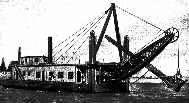
A Bucyrus steam shovel working in the Panama Canal.
Credits. This page was last revised on August 13, 2024. It was originally submitted on August 12, 2024, by J.T. Lambrou of New Boston, Michigan. This page has been viewed 409 times since then and 59 times this year. Photos: 1, 2, 3. submitted on August 12, 2024, by J.T. Lambrou of New Boston, Michigan. • J. Makali Bruton was the editor who published this page.
