Near Browning in Glacier County, Montana — The American West (Mountains)
The Blackfeet Nation
Photographed by Barry Swackhamer, July 1, 2024
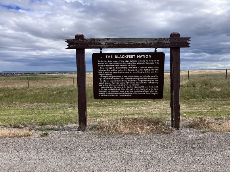
1. The Blackfeet Nation Marker
The Blackfeet Nation consists of three tribes, the Pikunis or Piegans, the Bloods and the Blackfoot. Each tribe is divided into clans marking blood relationships. The majority of Indians on the Blackfeet Indian Reservation are Piegans.
Many years ago, the Blackfeet ranged from north of Edmonton, Alberta to the Yellowstone River and into southwestern Montana and western Wyoming. The were quick to resent and avenge insult or wrong, but powerful loyal allies when their friendship was won.
The Piegans were greatly feared by early American trappers and settlers because of the vigor with which they defended their hereditary hunting grounds from encroachment.
No tribe ever exceeded them in bravery. Proud of their lineage and history, they have jealously preserved their tribal customs and traditions. The Piegans have produced many great orators, artists, warriors, educators, and statesmen.
Browning has been the agency for the Blackfeet tribe since 1895 when it was moved to this place from Badger Creek, fifteen miles south of here. One the site of Joe Kipp's trading post, the community is named for one-time Commissioner
this page online
Erected by Montana Department of Transportation.
Topics. This historical marker is listed in these topic lists: Indigenous Peoples and Communities • Settlements & Settlers. A significant historical year for this entry is 1895.
Location. 48° 32.436′ N, 113° 0.079′ W. Marker is near Browning, Montana, in Glacier County. It is on U.S. 89 at milepost 222 near Heart Butte Road, on the left when traveling east. Touch for map. Marker is in this post office area: Browning MT 59417, United States of America. Touch for directions.

Regionally, this marker is in Montana’s Blackfeet Nation, in Western Montana, and in Glacier Country. It is also in the American Mountain West and in the Lewis & Clark Corridor. Globally, it is in North America, the Rocky Mountains, the Western Hemisphere, the Western World, and the Anglosphere. Historically, it finds itself in what was once Rupert’s Land and also the Louisiana Purchase.
Other nearby markers. At least one other marker is within 11 miles of this marker, measured as the crow flies: Camp Disappointment (approx. 10.1 miles away).
Another marker is no longer nearby. The Blackfeet Nation (was a few steps from this marker but has been permanently removed).
Also see . . . Blackfeet Nation -- Wikipedia. Pressure exerted by British traders at James Bay in present-day Canada on the Algonquin-speaking tribes in the area drove the Blackfeet out onto the Northern Plains. They eventually acquired firearms and horses, and the acquisition of these two pieces of technology allowed them to become a formidable example of the classic Plains Indian culture. (Submitted on August 12, 2024, by Barry Swackhamer of Brentwood, California.)
Credits. This page was last revised on December 27, 2024. It was originally submitted on August 12, 2024, by Barry Swackhamer of Brentwood, California. This page has been viewed 673 times since then and 158 times this year. Photo 1. submitted on August 12, 2024, by Barry Swackhamer of Brentwood, California.
