Near Appomattox in Appomattox County, Virginia — The American South (Mid-Atlantic)
The Kelley Family
Appomattox Court House National Historical Park
Photographed by Bradley Owen, August 13, 2024
1. The Kelley Family Marker
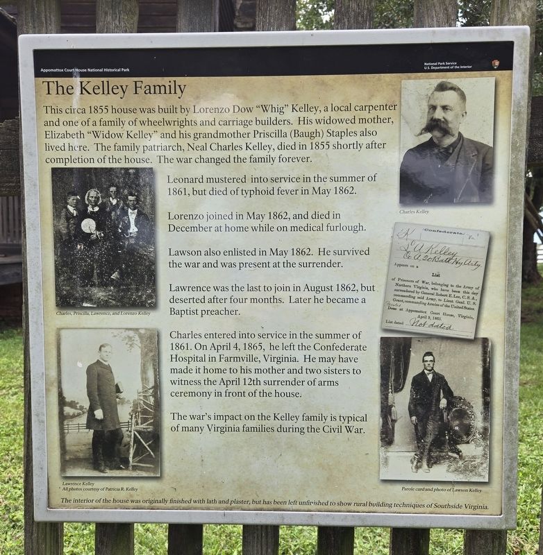
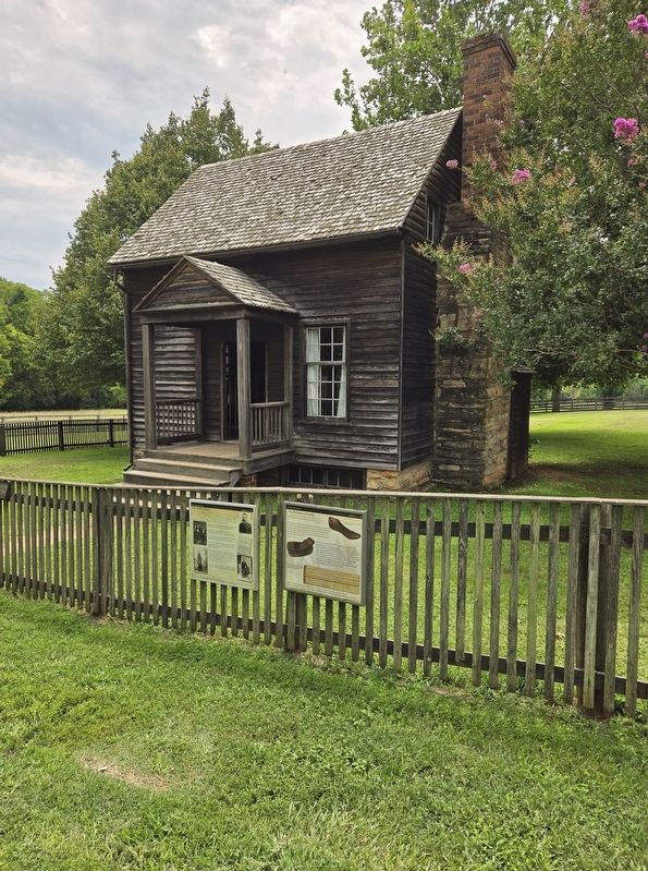
This circa 1855 house was built by Lorenzo Dow "Whig" Kelley, a local carpenter and one of a family of wheelwrights and carriage builders. His widowed mother, Elizabeth "Widow Kelley" and his grandmother Priscilla (Baugh) Staples also lived here. The family patriarch, Neal Charles Kelley, died in 1855 shortly after completion of the house. The war changed the family forever.
Leonard mustered into service in the summer of 1861, but died of typhoid fever in May 1862.
Lorenzo joined in May 1862, and died in December at home while on medical furlough.
Lawson also enlisted in May 1862. He survived the war and was present at the surrender.
Lawrence was the last to join in August 1862, but deserted after four months. Later he became a Baptist preacher.
Charles entered into service in the summer of 1861. On April 4, 1865, he left the Confederate Hospital in Farmville, Virginia. He may have made it home to his mother and two sisters to witness the April 12th surrender of arms ceremony in front of the house.
The war's impact on the Kelley family is typical of many Virginia families during the Civil War.
The interior of the house was originally finished with lath and plaster, but has been left unfinished to show rural building techniques of Southside Virginia.
(Captions):
Charles, Priscilla, Lawrence, and Lorenzo Kelley
Lawrence Kelley
All photos courtesy of Patricia R. Kelley
Charles Kelley
Parole card and photo of Lawson Kelley
Erected by National
this page online
Topics. This historical marker is listed in these topic lists: Industry & Commerce • War, US Civil. A significant historical date for this entry is April 4, 1865.
Location. 37° 22.651′ N, 78° 47.615′ W. Marker is near Appomattox, Virginia, in Appomattox County. It can be reached from National Park Drive north of Old Courthouse Road (Virginia Route 24), on the right when traveling north. Marker is attached to the fence on the north side of the Kelley/Robinson House on the grounds of Appomattox Court House National Historical Park. Touch for map. Marker is at or near this postal address: 111 National Park Drive, Appomattox VA 24522, United States of America. Touch for directions.

Regionally, this marker is in the Piedmont and in Central Virginia. It is also in the American South and specifically in the Upper South. Globally, it is in North America, the Western Hemisphere, the Western World, and the Anglosphere. Historically, it finds itself in what was once the territory of the Mississippian Culture, one of the original Thirteen Colonies, one of the Confederate States of America, and
Photographed by Bradley Owen, August 13, 2024
2. The Kelley Family Marker
Marker is on the left.
Other nearby markers. At least 8 other markers are within walking distance of this marker: The Robinson Family (here, next to this marker); The Surrender Ceremony (within shouting distance of this marker); Final Combat (within shouting distance of this marker); Last Artillery Shots (within shouting distance of this marker); The Isbell House (about 500 feet away, measured in a direct line); Lee and Grant Meet (about 600 feet away); “Salute of Arms” (about 600 feet away); Grant and Lee Meeting (about 600 feet away). Touch for a list and map of all markers in Appomattox.
Another marker is no longer nearby. County Jail (was about 500 feet away but has been confirmed missing).

Photographed by Bradley Owen, August 13, 2024
3. The Kelley/Robinson House

Photographed by Tom Bosse, July 4, 2026
4. The Kelley Family Marker
Marker is on the left.

Photographed by Tom Bosse, July 4, 2026
5. The Kelley Family Home (Back)
Credits. This page was last revised on August 4, 2026. It was originally submitted on August 13, 2024, by Bradley Owen of Morgantown, West Virginia. This page has been viewed 319 times since then and 49 times this year. Photos: 1, 2, 3. submitted on August 13, 2024, by Bradley Owen of Morgantown, West Virginia. 4, 5. submitted on July 27, 2026, by Tom Bosse of Jefferson City, Tennessee.
