Near Royston in Franklin County, Georgia — The American South (South Atlantic)
Cromer's Mill Covered Bridge
Photographed by David Seibert, March 15, 2001
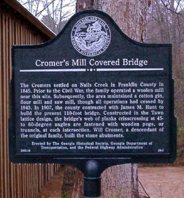
1. Cromer's Mill Covered Bridge Marker
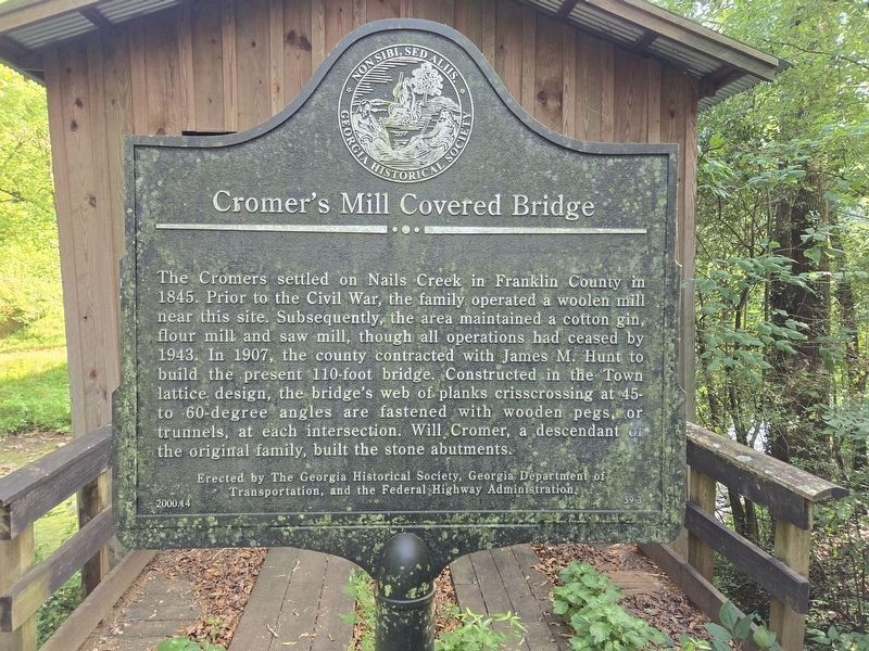
The Cromers settled on Nails Creek in Franklin County in 1845. Prior to the Civil War, the family operated a woolen mill near this site. Subsequently, the area maintained a cotton gin, flour mill and saw mill, though all operations had ceased by 1943. In 1907, the county contracted with James M. Hunt to build the present 110-foot bridge. Constructed in the Town lattice design, the bridge's web of planks crisscrossing at 45-to 60-degree angles are fastened with wooden pegs, or trunnels, at each intersection. Will Cromer, a descendant of the original family, built the stone abutments.
Erected 2000 by The Georgia Historical Society, Georgia Department of Transportation, and the Federal Highway Administration. (Marker Number 59-3.)
Topics and series. This historical marker is listed in these topic lists: Bridges & Viaducts • Waterways & Vessels. In addition, it is included in the Covered Bridges, and the Georgia Historical Society series lists. A significant historical year for this entry is 1907.
Location. 34° 16.517′ N, 83° 15.949′ W. Marker is near Royston, Georgia, in Franklin County. It can be reached from Baker
this page online

Regionally, this marker is in the Mountains. It is also in the American South and specifically in the Deep South. Globally, it is in North America, the Western Hemisphere, the Western World, and the Anglosphere. Historically, it finds itself in what was once the territory of the Mississippian Culture, one of the original Thirteen Colonies, one of the Confederate States of America, and the Antebellum South.
Other nearby markers. At least 8 other markers are within 7 miles of this marker, measured as the crow flies: Old Federal Road Historic District (approx. 5½ miles away); Hebron Presbyterian Church (approx. 6½ miles away); Carroll's Methodist Church (approx. 6.7 miles away); Franklin County (approx. 6.8 miles away); Franklin County Confederate Monument (approx. 6.8 miles away); Franklin County Veterans Memorial (approx. 6.8 miles away); Historical Franklin Springs
Photographed by David Seibert, March 15, 2001
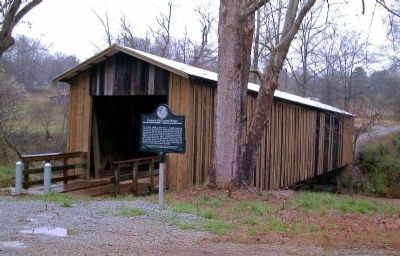
2. Cromer's Mill Covered Bridge and Marker
More about this marker. The marker was originally located on the south end of the bridge which is no longer accessible by vehicle or foot.
Photographed by David Seibert, March 15, 2001
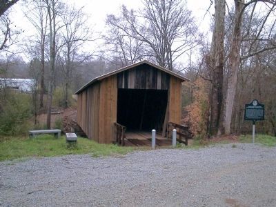
3. Cromer's Mill Covered Bridge and Marker
Photographed by A. Chester Ong, 2011
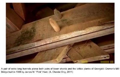
4. Cromer's Mill Bridge planks
A pair of extra long trunnels pierce both pairs of lower chords and the lattice planks of Georgia's Cromer's Mill Bridge built in 1906 by James M. "Pink" Hunt (America's Covered Bridges: Practical Crossings - Nostalgic Icons by Miller and Knapp).
Photographed by Mark Parker, August 14, 2024
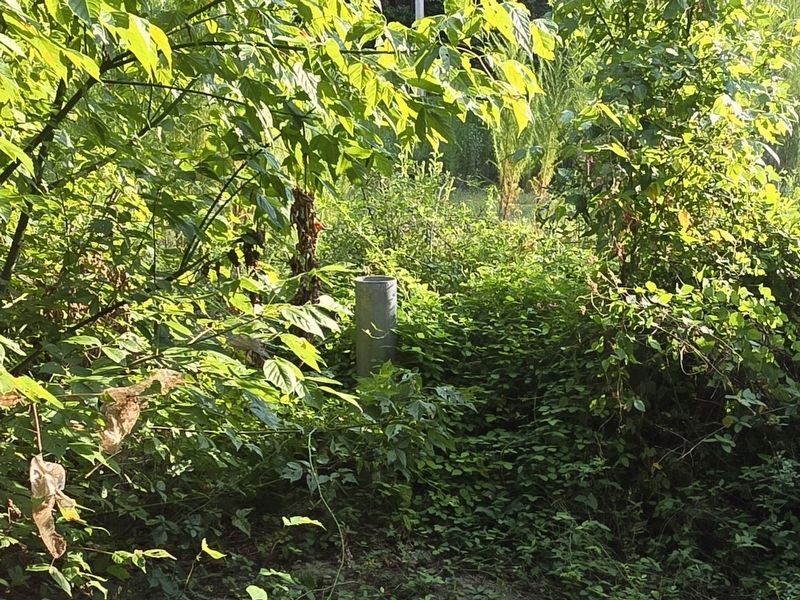
5. Former location of Cromer's Mill Covered Bridge Marker on south side of the bridge.
Not longer accessible by vehicle or foot
Photographed by Mark Parker, August 14, 2024
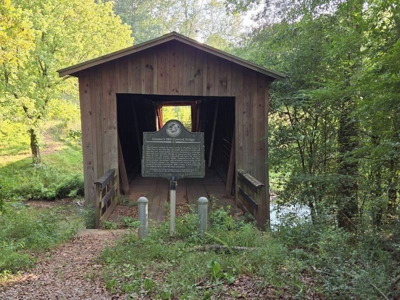
6. Cromer's Mill Covered Bridge Marker
Location at the entrance to the north side of the bridge. Path is unsigned (shown as Baker Road in Google Maps). Accessible by vehicle approximately 300 feet South of Cromer's Bridge Road.
Photographed by Mark Parker, August 14, 2024
7. Closeup of Cromer's Mill Covered Bridge Marker at North entrance
Credits. This page was last revised on August 15, 2024. It was originally submitted on January 1, 2009, by David Seibert of Sandy Springs, Georgia. This page has been viewed 5,357 times since then and 181 times this year. Last updated on August 14, 2024, by Mark Parker of Hickory, North Carolina. Photos: 1, 2, 3. submitted on January 1, 2009, by David Seibert of Sandy Springs, Georgia. 4. submitted on February 12, 2015, by J. Makali Bruton of Washington, District of Columbia. 5, 6, 7. submitted on August 14, 2024, by Mark Parker of Hickory, North Carolina. • Bernard Fisher was the editor who published this page.
